RSS
 

Posts Tagged ‘Maps’

Find the Perfect Photography Location Using Google Maps

25 May

No matter if you’re planning your next photo road trip or you’re scouring the city streets looking for the perfect viewpoint, Google Maps and Google Earth are the most valuable tools to add to your arsenal for finding the perfect photography location.
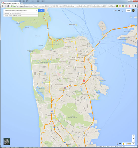
Planning to Shoot

I usually travel for work, or with family, so I don’t have the luxury of as much time as I might want to search for the perfect vantage point in person. Nor to scout an area to compare locations that I want to dedicate to the one sunset that I’ll have time to shoot. Google Maps to the rescue!

While planning a trip from home, you have much more time to explore the area in a virtual capacity instead of being out there with boots on the ground. Nothing can compare with actually being there, but the tools available to you are getting better every day and the ability to nearly frame your shot is a realistic time saver. Time to turn the volume on your pre-visualization up to 11.

If I’m planning a trip or have an idea for a shot, I’ll start with Google Maps and zero in on the area that I want to shoot. You probably already do this, too, but let’s just take it a step further. Click the icon in the lower left corner labeled “Earth” to start the Google Earth browser plugin. This has replaced the satellite or aerial view for much of the world’s map, but instead of only offering a flat, two dimensional view of the map directly overhead, you can now tilt the map and see an approximation of topography, texture, and elevation.
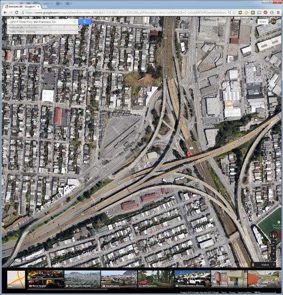
Default Earth View

Normal mouse controls on the map let you pan in all directions, and zoom in or out with the mouse wheel. In order to adjust to a view that will help you get a better idea of the terrain, hold down the shift key, click and drag upward. That will rotate your point of view (POV) so that you now have an aerial view looking toward the horizon instead of straight down. Dragging left or right while holding shift will rotate your point of view instead of panning.
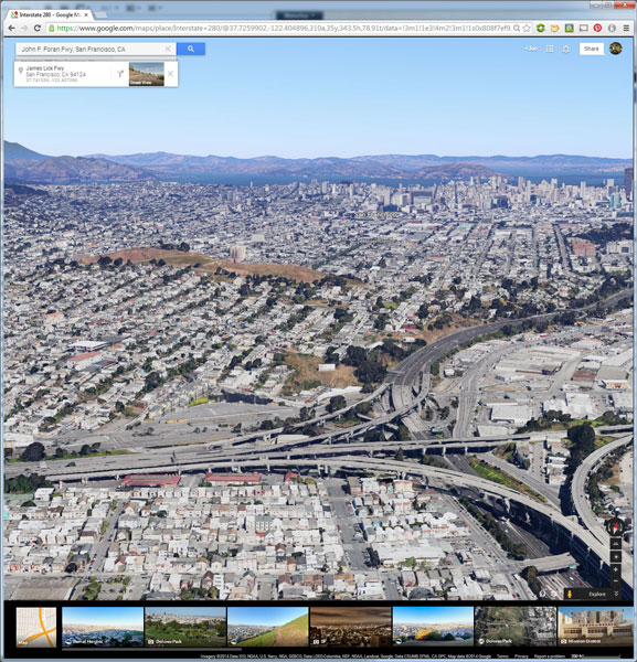
Rotated Earth View

But, you don’t have to be tied down to your desk to do this. Just two weeks ago, I was out with a friend exploring San Francisco and searching for a specific vantage point of the 101/280 freeway interchange. We knew the general area that we wanted to shoot from, but with so many streets winding around, using Google Earth on my mobile phone helped to eliminate some of the trial and error of driving around without a clue how to find what we wanted.
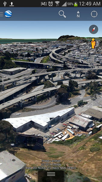
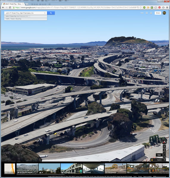
101 280 Framing the Shot Mobile

101 280 Framing the Shot

Desktop interface Google Earth view looking south

Joe Ercoli Land of Confusion 600

Finished image from location scouted using Google Maps/Earth

The example images from this article show the area that we shot in, including a screenshot taken from the mobile interface, and the completed image. Of course the view that you can get from the map interface is never as good as what you’ll see in person, but it’s an excellent way to help you hit the ground running when you get on-site with your camera in hand.

NOTE: The camera is facing South in the final composition, not North as in the initial Google Earth Point of View.

Have you used Google Maps to find any cool locations? What other tips or tricks have you tried? Please share in the comments below.

The post Find the Perfect Photography Location Using Google Maps by Joe Ercoli appeared first on Digital Photography School.

Digital Photography School

 
Comments Off on Find the Perfect Photography Location Using Google Maps

Posted in Photography


Google Gmail – Show Maps Automatically in Emails Instead of Copying and Pasting

16 Apr

If you often receive addresses via Google Gmail, why copy and paste them into a Google Maps window?

Depending on your electronic mail habits, you may have contacts that often need to send addresses to your Gmail account. When you get these addresses and need to view them on a map, would you rather A) copy and paste the addresses into a new browser tab running Google Maps, or B) have Gmail show the maps automatically inside the e-mail messages?

If your answer is “B”, there is a Google Labs extension that will do just that, and it’s easy to set up:…

Read more at MalekTips.
New Computer and Technology Help and Tips – MalekTips.Com

 
Comments Off on Google Gmail – Show Maps Automatically in Emails Instead of Copying and Pasting

Posted in Technology


Virtual LEGO Blocks: Build with Chrome, Set on Google Maps

05 Feb

[ By WebUrbanist in Gaming & Computing & Technology. ]

build with chrome page

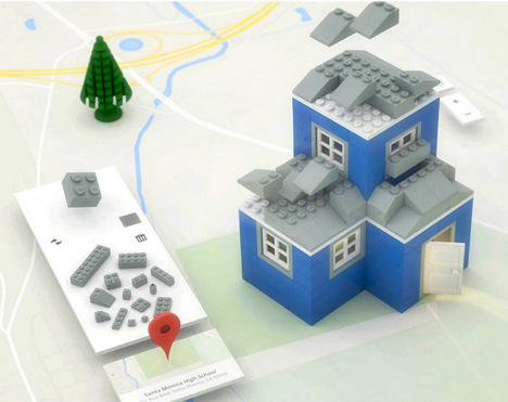
Build with Chrome is the new, fast and simple model-maker in town, and this one lets you create structures faster than digital SketchUp or physical LEGOs ever could.

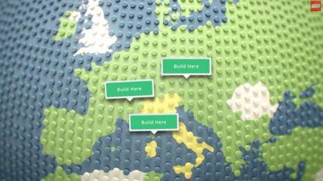
build lego google maps

Of course, this Chrome Experiment project would not be complete without Google Maps integration, allowing you to deploy your creations around the world and interact with others.

build lego online browser

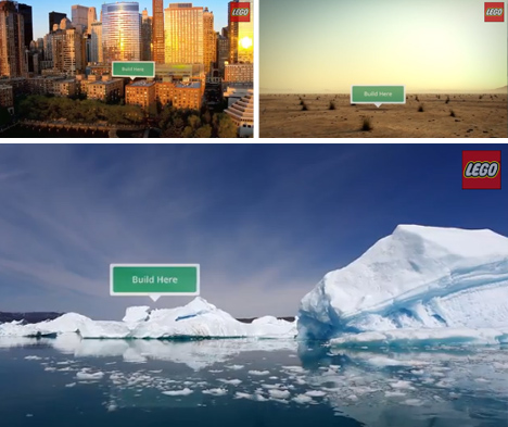
Architecture seems the most obvious, but infrastructure, ships and other complex shapes are all ultimately possibilities as well.
build lego pirate ships

Like SketchUp (previously owned by Google), the tool set is relatively simple, except in this case the learning curve is even faster, making it possible for anyone to participate with ease.
build lego house architecture

Users can select blocks, change colors, rotate with a key click, drop them into place then keep on stacking, then save or reset at any time. From private estates to pirate ships, anything is possible.

Share on Facebook


[ By WebUrbanist in Gaming & Computing & Technology. ]

[ WebUrbanist | Archives | Galleries | Privacy | TOS ]


WebUrbanist

 
Comments Off on Virtual LEGO Blocks: Build with Chrome, Set on Google Maps

Posted in Creativity


Extreme Street View: Google Employee Maps Deserted Island

31 Jan

[ By WebUrbanist in Global & Urbex & Parkour. ]

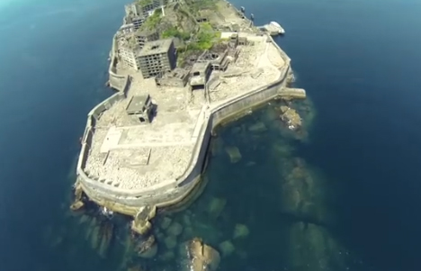
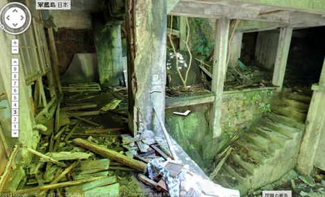
street view battleship island

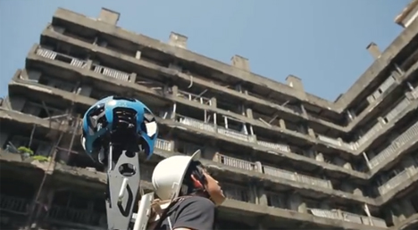
Street View has mapped much more than roads in its, but sending a lone urban explorer through the haunting multistory ruins of a remote island may be one of their riskiest geographic ventures yet.

street view abandoned island

street view japanese employee

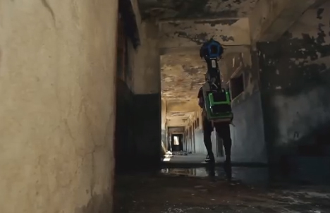
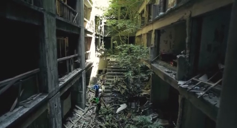
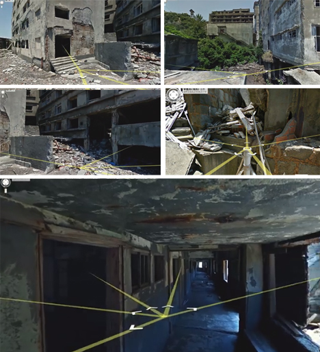
Strapped with panoramic photography equipment, this video shows a lone Google employee crawling through rubble, scaling partially caved-in abandonments and standing on precarious roofs, all to document one of the most unique deserted cities on the globe.

street view urban exploration

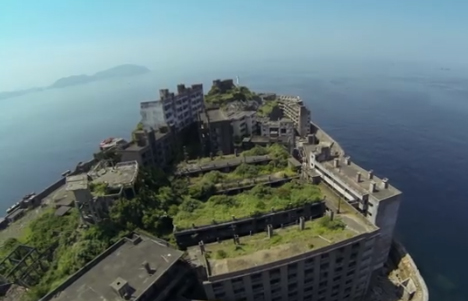
Occupied for over a century, and briefly the world’s most densely-populated island, Gunkanjima, Japan (aka Hashima) is now one of the loneliest places on the planet.

street view overview aerial

street view island rooftop

A giant concrete wall surrounds the ship-shaped Battleship Island, giving it its nickname. At one point it was packed with an average of 1.4 residents per square meter of space, almost like an overcrowded sea vessel.

street view inside walking

street view building infiltration

Parts of the deserted island have since been reopened to the public, but Google secured special permission to go off the beaten path and pass through long-abandoned buildings that only intrepid infiltrators have seen in recent decades past.

street view ruin interior

street view routes paths

Thanks to their carefully mapping, virtual visitors (web viewers) can now tour the corroded corridors, crumbling stairs and uncertain roofs from a much safer distance, almost look a choose-your-own-adventure for urban explorers.

Share on Facebook


[ By WebUrbanist in Global & Urbex & Parkour. ]

[ WebUrbanist | Archives | Galleries | Privacy | TOS ]


WebUrbanist

 
Comments Off on Extreme Street View: Google Employee Maps Deserted Island

Posted in Creativity


Ricoh and Google team up to get Theta spherical pictures on Google Maps

31 Jan

Screen_Shot_2014-01-29_at_3.10.28_PM.png

Ricoh has updated the suite of apps provided with the Theta spherical image camera, to allow users to post images from the Theta to Google Maps and Google+. According to Ricoh, these new abilities are a result of collaboration with Google to make the Theta’s images compatible with Photo Sphere XMP, Google’s standard for panoramic images. Click through for more details. 

News: Digital Photography Review (dpreview.com)

 
Comments Off on Ricoh and Google team up to get Theta spherical pictures on Google Maps

Posted in Uncategorized


Urban Apps: 13 Interactive City Maps, Tools & Guides

15 Jul

[ By Steph in Gadgets & Geekery & Technology. ]

Urban Apps Main

Chances are, even if you’re a lifelong resident of a particular city, you don’t know every nook and cranny, every food truck location, or the lore of every interesting local building. Apps for smartphones, tablets and other gadgets are making big urban centers feel smaller than ever, making it easy to catch a ride, find cheap eats, check out street art and make new friends.

Eat Cheap – Roaming Hunger

Urban Apps Roaming Hunger

Find out where your next meal is parked with Roaming Hunger, an app that shows real-time food truck locations in your area. The app not only displays the trucks on a map, with their hours at that location, but also allows you to sort results by meal, and browse menus. Additional apps are city-specific, like Street Food App, which currently shows schedules for Boston, Calgary, Edmonton, Ottawa, Toronto and Vancouver.

Maps and Travel Guides – City Maps 2Go

Urban Apps City Maps 2Go

Want access to maps while traveling abroad, without gobbling up roaming data or lurking in a spot that offers wi-fi? City Maps 2Go downloads maps for the cities of your choice for offline use, including millions of POI (restaurants, bars, hotels etc.), 500,000 Wikipedia entries for sites and attractions, and travel guides. It’s avaiable for iPhone, iPod touch and iPad.

Connect – MeetMe

Urban Apps MeetMe

Among the most popular apps to show you who’s nearby and looking to meet new people, MeetMe gives both social butterflies and the shy an easy way to connect. You’ll probably find more people looking to date than to make new friends, and it might be easier to just walk up to someone and introduce yourself than spend your time scrolling through photos, but hey – whatever works.

Avoid Your Friends – Hell is Other People

Urban Apps Hell is Other People

Maybe, instead of making new friends, you want to avoid the ones you already have. There’s an app for that, too. Hell is Other People will show you where your friends are based on check-ins on Foursquare, Facebook, Instagram and other networks, and provide ‘safe zones’ where you can hang out without being recognized. Of course, it only works if your contacts are avid users of social media, and you might find yourself relegated to unexpected places in the city.

Find Street Art – 1AM Mobile

Urban Apps Street Art

This free photo app called 1AM Mobile lets users pinpoint, share and discover street art in their own communities before it’s gone, as it often is within days or weeks of completion. Shoot photos of street art and the app will map them, date them and credit you as the photographer before sharing them worldwide.

Next Page:
Urban Apps 13 Interactive City Maps Tools Guides

Share on Facebook


[ By Steph in Gadgets & Geekery & Technology. ]

[ WebUrbanist | Archives | Galleries | Privacy | TOS ]


WebUrbanist

 
Comments Off on Urban Apps: 13 Interactive City Maps, Tools & Guides

Posted in Creativity


Accidental Art: Apple Maps Glitches Create Surreal Scenes

27 Jun

[ By Steph in Art & Photography & Video. ]

Apple Maps Glitch Art 1

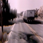
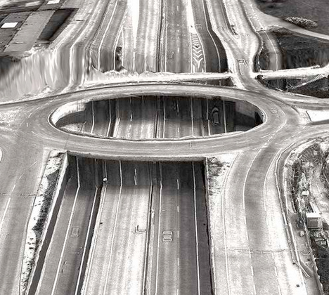
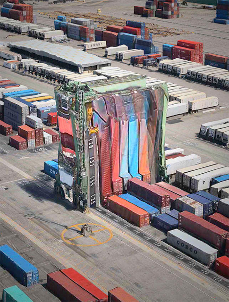
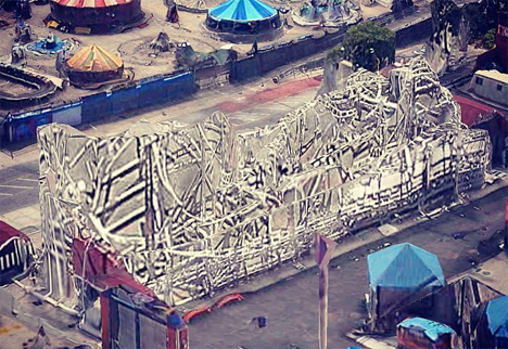
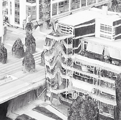
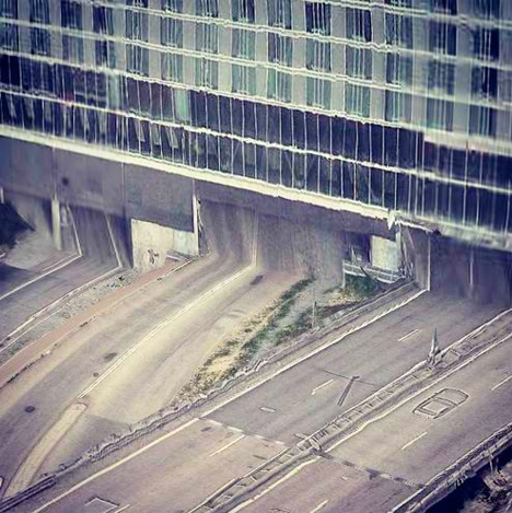
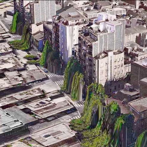
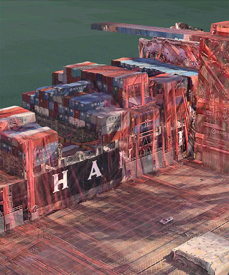
All of the notorious glitches on Apple’s Maps app make it incredibly frustrating to use for practical purposes, but it still has value – as accidental art. When two-dimensional images are incorrectly mapped onto three-dimensional topography, the results can be fascinating, creating landscapes and architecture that look alien and futuristic.

Apple Maps Glitch Art 2

Apple Maps Glitch Art 3

Peder Norrby, founder of graphics company Trapcode, has collected the many glitches on the Apple iOS Maps app into a trippy gallery on Flickr. Houses in Barcelona appear to be puking trees from their windows. A vortex has opened in the middle of a Stockholm highway. Skyscrapers and stacked shipping containers look like they’re melting.

Apple Maps Glitch Art 4

Apple Maps Glitch Art 5

In this parallel universe, the laws of physics have apparently been suspended. Norrby explains that some structures, like bridges, viaducts, tunnels and roller coasters, are too complex for the app’s algorithms to handle. While criticism of Apple’s Maps app has increased reliance on its competitors, Google Maps isn’t entire free of glitches, either.

Apple Maps Glitch Art 6

Apple Maps Glitch Art 7

The mesmerizing beauty of glitches has led to an entire genre of art revolving around reproducing their eerie effects on purpose. Glitch art creates digital or analog image errors by intentionally corrupting files, or mimicking their appearance in traditional artistic media like paintings and sculptures.

Share on Facebook


[ By Steph in Art & Photography & Video. ]

[ WebUrbanist | Archives | Galleries | Privacy | TOS ]


WebUrbanist

 
Comments Off on Accidental Art: Apple Maps Glitches Create Surreal Scenes

Posted in Creativity


Test Your Geography Skills with Google Maps Game

14 May

[ By Steph in Global & Travel & Places. ]

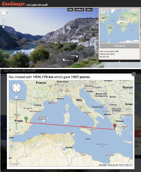
GeoGuessr Google Maps Game 1

Can you guess where in the world this unidentified Google Maps location is by landscape, road signs, architecture and cars? Test your geography skills with GeoGuessr, a site that drops you into a random Street View and challenges you to answer correctly five times in a row. Brilliantly simple, this virtual travel guessing game will stump you with featureless fields, and city scenes that seem to belong on entirely different continents.

GeoGuessr Google Maps Game 2

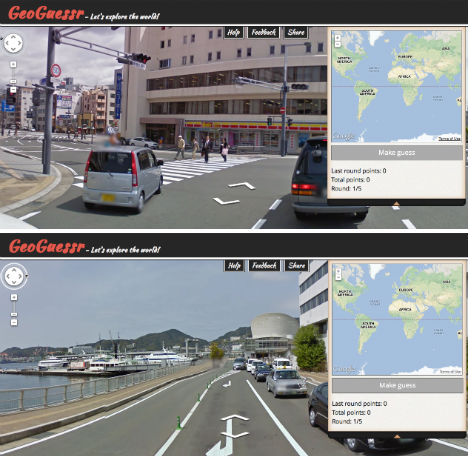
Once placed in a location, you can move up and down the streets and use the arrows to view it in 360 degrees, just like on Google Maps and Google Earth. Sometimes, you might get lucky, and see some kind of identifying signs. Sometimes, there’s nothing but farmland and trees.

GeoGeussr Google Maps Game 3

When you think you’ve determined the location, drop a pin on the world map on the right side of the screen and make your guess. You might be surprised how many times you’re about as off as you can possibly be. Some streets in Northern Canada look an awful lot like those in Argentina. Try it for yourself at GeoGuessr.com (via Laughing Squid).

Share on Facebook


[ By Steph in Global & Travel & Places. ]

[ WebUrbanist | Archives | Galleries | Privacy | TOS ]


WebUrbanist

 
Comments Off on Test Your Geography Skills with Google Maps Game

Posted in Creativity


Metropolitan Cityscapes: Maps Honor Favorite Places

30 Nov

[ By Steph in Art & Drawing & Digital. ]

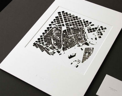
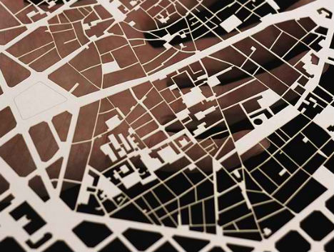
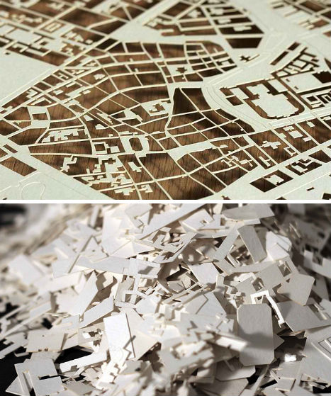
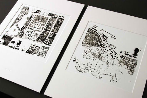
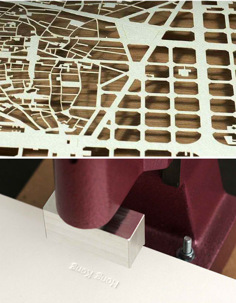
Each city is as different, and as beautiful, as we are. That’s the sentiment behind ‘Metropolitan Cityscapes‘, beautifully complex city maps with the negative space around the streets meticulously cut out, leaving delicate patterns behind.

Perhaps your tie to your favorite city is family history, or perhaps you walked down one of those unfamiliar streets as a visitor and have never forgotten the way it felt to take part in something entirely new. Designers Chauntelle Trinh and Eckard Buscher didn’t just arbitrarily choose the cities for their series of papercut maps, they explored them and set out to capture their essence.

Rather than simply modifying a city map and cutting it out, the designers undertook what they call ‘expeditions’ to gain an intimate understanding of metropolitan cities like Hong Kong, New York and San Francisco. Walking the streets to get a sense of the terrain, discovering the features that stood out to them, colored the way they designed each map.

“The centre of a city, its beating heart, is a palimpsest overflowing with imagery. Layers upon layers of stories have accumulated and disappeared through time. Behind each facade, each brick, each pathway, untold stories, memories and dreams are waiting to be narrated. Above all the noise, if you listen carefully, you can hear your own tale of the city.”

“To tell our stories of the city, we peeled away all the complex urban layers so that only the bare bones of place remains. Each line drawn and cut on every cityscape has a distinct story. Metropolitan Cityscapes are a new vision of the city as organism.”


Want More? Click for Great Related Content on WebUrbanist:

Wear You Live: T-Shirts and Totes Printed with City Maps

CityFabric creates t-shirts, totes and prints that are painstakingly hand-printed with maps of the city of your choice, including Raleigh, Brooklyn and Seattle.
2 Comments – Click Here to Read More »»


Creative Cartography: 15 Artists Transforming Maps

These 15 artists cut, sculpt and rearrange paper maps, create their own from unexpected materials like money or use them to illustrate interesting data.
10 Comments – Click Here to Read More »»


Share on Facebook


[ By Steph in Art & Drawing & Digital. ]

[ WebUrbanist | Archives | Galleries | Privacy | TOS ]


WebUrbanist

 
Comments Off on Metropolitan Cityscapes: Maps Honor Favorite Places

Posted in Creativity


[3DZ] Create Depth Maps – AfterEffects

22 Nov

This tutorial goes over how to use rotoscoping in Mocha, a very powerful roto tool that comes free with After Effects CS5, to create depth footage. The resulting footage can then be used to create stereo pairs from a single camera. The tutorial is quite long but goes over the entire process from start to finish and tries to explain aspects of Mocha and AfterEffects along the way.

 
Comments Off on [3DZ] Create Depth Maps – AfterEffects

Posted in 3D Videos