RSS
 

Posts Tagged ‘Aerial’

DJI reveals the winners of the 2017 SkyPixel aerial photography contest

03 Feb
“Above the polar bear” by Florian Ledoux — SkyPixel Photo Contest 2017 Grand Prize winner

Chinese drone-maker DJI and aerial photography website SkyPixel have announced the winners of the 2017 SkyPixel aerial photography contest, which was launched back in October. Winners span three categories—Landscape, Portrait, and Story—split between a “professional group” and “enthusiast group.”

The Grand Prize this year went to “Above the polar bear” captured with a DJI Phantom 4 Pro drone by Arctic and wildlife photographer Florian Ledoux.

As the Grand Prize winner, Ledoux will receive an impressive collection of gear valued at more than $ 15,000 USD, including a DJI Inspire 2 with a Zenmuse X7 and lens, iPhone X 256GB, Nikon D850 DSLR camera body, and more. The contest also awards thousands of dollars’ worth of gear to other contest winners.

A total of 18 other winning images were announced, three per group in both the professional and enthusiast categories. SkyPixel also revealed nine nominated images and 10 “Popular Prize” images. Overall, more than 40,000 people from 141 countries entered images in the contest.

You can check out all of the winners for yourself in the gallery and list below:

$ (document).ready(function() { SampleGalleryV2({“containerId”:”embeddedSampleGallery_3283891052″,”galleryId”:”3283891052″,”isEmbeddedWidget”:true,”selectedImageIndex”:0,”isMobile”:false}) });

Landscape – Professional Group

1st Prize: Sun’s Up, Nets Out by Zay Yar Lin
2nd Prize: Comet into Darkness by Drone Hikers
3rd Prize: Santa Maddalena village in front of the Geisler or Odle Yolo… by Valentin Valkov

Landscape – Enthusiast Group

1st Prize: Lobsters Farm by Trung
2nd Prize: GEOMETRY OF LIQUID GOLD by Javier del Cerro
3rd Prize: Raising Ducks by caokynhan

Portrait – Professional Group

1st Prize: Balmoral Ball by Petra Leary
2nd Prize: ???? by ??
3rd Prize: The Rebirth by andrea

Portrait – Enthusiast Group

1st Prize: Dancer by cocoanext
2nd Prize: Free Wheeling by nigelkwan
3rd Prize: ??? by ????

Story – Professional Group

1st Prize: ????”——??????? by ????????
2nd Prize: ??????? by ??
3rd Prize: ??? by lalienware

Story – Enthusiast Group

1st Prize: 1??????? by ???
2nd Prize: ???????? by ???
3rd Prize: The Long Ride by Jesper Guldbrand

Nominated Entries:

Landscape: The Path of Camels across the Sands by Abdullah Alnassar
Landscape: ELEMENTS by olivier…
Landscape: ??????? by LENG_VISION
Portrait: FANCY FINISH by Martin Sanchez @ zekedrone
Portrait: Lost in by Marc Lamey
Portrait: Untitled by Bobo
Portrait: ?? by ????
Story: Elemental by Max Foster
Story: ??????? by ???

Popular Prize – Top Ten

?????????? by ?????
????? by 7555486
???????? ????“??” by ???
????? Pointing to the light tower by henter liu
???? by Anter
?? by ?????
????????????–??? by ????????
Plane in the Forest by mark calayag
white wonderland by Eberhard Ehmke
Barcelona by David

Articles: Digital Photography Review (dpreview.com)

 
Comments Off on DJI reveals the winners of the 2017 SkyPixel aerial photography contest

Posted in Uncategorized


Tips for Aerial Photography from Small Planes and Drones

20 Nov

At its heart, good photography is about showing people views of the world they would not otherwise see. That might be; places your viewers have not visited, impossible ways of seeing to the human eye such as long exposures and night photography, but most often this novelty comes in the form of a different perspective. Even familiar scenes and objects can make compelling photographic subjects if we are willing to explore them from new angles.

Tips for Aerial Photography from Small Planes and Drones

Aerial photography is one of my favorite ways to provide that novel perspective. I’m fortunate to spend a lot of time in small planes. My life in Alaska is full of flights in bush planes to remote places in the state. While only occasionally do I fly specifically to make aerial images, I find simply going to and from different locations provides ample opportunity.

The second way I frequently use to access an aerial perspective is by flying drones. While both techniques get me the elevation I want, the photographic experience is very, very different. The two methods, planes and drones, require very different ways of thinking about image-making.

Tips for Aerial Photography from Small Planes and Drones

Here are a few tips to improve your aerial photography images, whether you are shooting from a plane or using a remote drone.

Airplanes

While big passenger jets are great for getting us from one place to another quickly, they are lousy photography platforms. Sure, I’ve made some images from jet windows, but they inevitably follow the same formula. There’s an airplane wing in the foreground with some sunset or mountain beyond. It gets old. Plus the perpetually fogged or scratched windows will destroy your image quality. Except for the occasional phone snap, I rarely bother with it anymore.

Small, single-engine planes, however, are a different story and can be an amazing platform for creative aerial photography.

Tips for Aerial Photography from Small Planes and Drones

Sharpness

Attaining a sharp image is a major challenge because airplanes are vibration-filled nightmares. Here are four things to help you improve sharpness:

  1. Use a fast shutter speed. I like anything over 1/1000th of a second.
  2. Don’t brace your lens or arms on the plane. Hold your camera and elbows free of the window. If you touch the plane, the vibrations will be transmitted straight into your camera. I tuck my arms against my sides and hold the lens an inch or so away from the window glass.
  3. Focus at infinity. I often shoot manual focus from the air and pre-set my focus point to infinity. Everything you are seeing from the air will be in focus when the lens is set to infinity, so don’t even bother with autofocus.
  4. Shoot wide open. The depth of field is not a problem from a 1000 or meters from your subject. So a take advantage of the extra shutter speed provided by your fastest f-stop.

Lens Choices

Tips for Aerial Photography from Small Planes and Drones

When flying 100+ mph at low altitude, the landscape passes very quickly. If you don’t act quickly, you’ll miss the shot. That’s why I like zoom lenses for aerial photography. I can quickly compose with different focal lengths, without having to change lenses or cameras. I favor a wide to moderate zoom. A 24-105mm or similar lens is about right.

Communication

Usually, in a small plane, you’ll be in direct communication with your pilot, who might be willing to help you out with your photography. When I’m flying over something interesting, but a wing or strut is in the way, I’ll often simply ask the pilot to tip a wing one way or another. Pilots are often happy to accommodate you.

Tips for Aerial Photography from Small Planes and Drones

You can also ask them to make slight turns, or even circle if there is something particularly compelling. If you’ve chartered a flight for photographic purposes, feel free to ask for what you want.

I recommend talking to your pilot ahead of your trip to discuss what kind of images you want, and how he or she might be able to help you. If it is a photography-specific flight, you may even be able to remove windows or doors from the plane.

Tips for Aerial Photography from Small Planes and Drones

Remember your pilot is the final judge of what is acceptable in terms of safety and time. If they say they can’t do something, they can’t. Don’t push them into something with which they aren’t comfortable.

Composition

There are almost as many ways to shoot from an airplane as there are from the ground so any discussion of composition runs the risk of leading us deep into the photographic weeds. However, the general rules of landscape photography still apply. Remember depth, foregrounds, and the way lines connect the image.

Tips for Aerial Photography from Small Planes and Drones

Some shots from the air could be details of the landscape below, but more often they will be sweeping landscapes. I like to place elements in the frame that guide the eye through; a river, a mountain valley, or a highlight like a lake or patch of colorful ground.

The altitude at which you are flying will also dictate your options. When making aerial images of mountain environments (my usual subject) I prefer the plane to be below the level of the surrounding peaks. This perspective still provides a sense of grandeur, while maintaining the unique aerial perspective. Ask your pilot if you can fly lower or higher, and they may be able to help you out if conditions are safe.

Tips for Aerial Photography from Small Planes and Drones

Drones

Flying a remote copter or drone is a very different experience from being up high yourself. There are advantages, but also some drawbacks.

First the drawbacks. Most consumer grade drones limit you to one focal length. Without the ability to zoom or change lenses, most drone shots tend to have the same wide-angle look. To change the scene, you’ve got to move the drone. Drones also have limited ranges, elevation capabilities, and at times, limiting regulations.

Tips for Aerial Photography from Small Planes and Drones

Some locations, like national parks in the United States (and many other countries) are off-limits for drones. Range limitations also mean that you have to get yourself close to your desired subject. So if you want to make images of some remote, or difficult to access location, you’ll still have to do it on the ground.

The advantages, however, are many. Cost is a big one. For the price of a couple hours charter of a small plane, you can buy a decent drone, literally. Flexibility is another. If you want to go make some aerial photos, you simply do it, no waiting around for a pilot or plane charter. If the light is right, you just go fly.

The biggest advantage for me, though, is composition flexibility. You can create an image from a few meters off the ground, to a couple hundred. You can also spend the time necessary to get the composition right. The drone sits still when you want it to, or you can adjust to your heart’s desire.

Composition

I like to fly my drone fairly low. I find the combination of altitude and wide angle lenses make everything look less dramatic and smaller if I’m flying too high. 20-30 meters off the ground is probably my favorite height, but of course, it varies on where I’m flying and the image I’m creating.

Remember to take advantage of the many camera angles drones allow. Shooting straight down is almost impossible from a plane. But with a drone, it’s as easy as angling your camera.

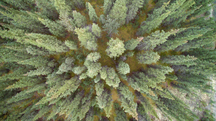
Playing with lines and patterns is a drone specialty, so take advantage of the way the world looks from above. Play with dividing your images into parts using the natural variations in the landscape. Trees from above, for example, create a starburst pattern, not a typical way humans see a forest!
Tips for Aerial Photography from Small Planes and Drones

The flexibility provided by drones is extraordinary. Don’t be afraid to experiment with aerial images of places a plane could never fly.

Drone Warning

Follow the rules! Flying a drone in a dangerous area like around airports, or at the scene of an emergency is not only irresponsible it can be life-threatening. Be aware of the laws surrounding drones, and fly only in areas where it is allowed, and at permitted elevations.

Lastly, be respectful of others. Don’t fly over private property if you don’t have permission, and be aware of how your flight is impacting the experience of others. Simply put, don’t be a jerk.

Tips for Aerial Photography from Small Planes and Drones

Conclusion

Aerial photography is a gateway to new ways of seeing. Whether you are shooting from the passenger seat of a Cessna or from your phone screen using a drone, there are abundant opportunities to make new and exciting images. Explore it and share with me what you make!

The post Tips for Aerial Photography from Small Planes and Drones by David Shaw appeared first on Digital Photography School.


Digital Photography School

 
Comments Off on Tips for Aerial Photography from Small Planes and Drones

Posted in Photography


DJI will let you rent a Mavic Pro for free so you can enter Nat Geo’s aerial photography contest

09 Sep

NatGeo and DJI have teamed up to offer Mavic Pro drone rentals to photographers who want to enter National Geographic’s #MyMavicContest, an aerial photography contest for photos taken with the Chinese company’s drone. Not everyone who signs up for the drone rental will be awarded one, but those who are chosen to receive the Mavic Pro will get to use the drone for two weeks.

National Geographic has detailed the rentals on its new contest page, explaining that anyone can sign up to get the Mavic Pro loaner device. For its part, DJI explains that it will randomly select people from the application pool for whom the drones will be provided; there are ‘hundreds’ of drones available, though an exact number wasn’t provided. Recipients will have to pick up the rental from their local DJI Store, as well.
When signing up for the rentals, applicants must provide information that includes name and email, photography interests, pickup city, and can optionally provide an Instagram ID and National Geographic Your Shot ID. The rental period is running from September 5 to October 31, though recipients will only get the drone for two weeks during that period.

Photographers who already own the Mavic Pro can enter their photos into the contest by posting them on Instagram with the hashtags #NatGeoTravel and #MyMavicContest. Five winners will be selected in November to received a Mavic Pro of their own.

Via: The Drive

Articles: Digital Photography Review (dpreview.com)

 
Comments Off on DJI will let you rent a Mavic Pro for free so you can enter Nat Geo’s aerial photography contest

Posted in Uncategorized


NASA ortbiter snaps aerial photo of lonesome Mars Curiosity rover

23 Jun
The bright blue dot at the center of this photo by NASA’s Mars Reconnaissance Orbiter is actually NASA’s Curiosity Mars rover, going about its lonely mission on the Red Planet. © Photo courtesy of NASA/JPL-Caltech/Univ. of Arizona

No human photographer could capture this aerial photograph. That’s because this image is literally out of this world – it was captured by NASA’s Mars Reconnaissance Orbiter on June 5th, and shows the Mars Curiosity Rover as it traverses the red planet, approximately 241,500,000 miles away from where I sit typing this right now.

It’s hard to spot, and you have to look really closely, but there’s a small blue dot in the very middle of the photograph above. This closer crop might help:

There, amid the Martian landscape, you can actually see the Curiosity rover as it trekked along the northwestern flank of Mount Sharp, on its way to ‘Vera Rubin Ridge.’

The photograph was taken by the NASA Lunar Reconnaissance Orbiter using its High Resolution Imaging Science Experiment (HiRISE) camera, which captures a red band, blue -green band, and an infrared band, combining these together to form an RGB image. Because of this, the photograph is not a so-called ‘true color’ image, and the orbiter appears bluer than it actually is.

Oh, and if you’re curious, you can actually see what Curiosity was seeing when this photo was captured. The rover was using its Mast Camera to shoot these photographs of the Martian landscape while its picture was taken.

Articles: Digital Photography Review (dpreview.com)

 
Comments Off on NASA ortbiter snaps aerial photo of lonesome Mars Curiosity rover

Posted in Uncategorized


The good, the bad and the ugly of aerial photography part 5: examples and comparison

17 Jun
The Holuhraun eruption in Iceland, taken from a helicopter. This remains one of my most rewarding photographic experiences.

So far in this series I have talked about the advantages of aerial photography and about shooting from a helicopter as opposed to shooting from a light plane. I have also talked about the right equipment for this kind of shoot, and about technique and parameter selection. In this final article in the series I want to discuss my experiences from 4 aerial photography sessions, compare them and analyze what I learned from them.

I won’t be presenting any new info, but I think it’s important to do a comparison since I learned a lot from these short sessions, and if you can learn from my experience and mainly from my mistakes, I will have done what I set out to do with this series of articles.

My first ‘serious’ photography flight was in Namibia, in March of 2014. I flew over Sossusvlei to capture the dunes of the Namib Desert in morning light. It was in a Robinson R44, mentioned earlier as a great helicopter for photography flights, and both doors were taken off. I flew around for 1:15 hours and the hourly rate was about $ 850, which is quite good. I took one Canon EOS 5D Mark III with a Tamron 24-70mm F2.8 stabilized lens on it, plus a 70-300mm which I never actually used. This was the flight on which I understood the need for 2 bodies, but I really did fine with the 24-70mm as most of the beauty was in the larger-scaled structures, mainly the shapes of the dunes.

About half an hour into the flight the pilot noticed mist between the dunes ahead, and it was an easy decision to carry on flying and shoot the dunes shrouded in mist. Overall the flight was a huge success, and it triggered my love for aerial photography. I highly recommend flying in Sossusvlei. The fact that the pilot was flexible and had enough insight to suggest flying further above the dunes made a huge difference. Where possible, you should always opt for a pilot with experience of photographers, and make sure you listen to their suggestions.

The second flight was during a very special event: the Holuhraun volcanic eruption in Iceland. I had come back to the hostel after shooting the eruption from the land three days before the flight, and I encountered several days of harsh winds and sand storms. Then finally the weather improved and I secured my spot on a sunset flight. We had an unbelievable flight over the volcano with a pink sunset in the background, and even today, that flight ranks among my favorite photography experiences

I took two bodies, a Canon EOS 5D Mark II and a 5D Mark III, with 24-70mm and 70-300mm zoom lenses. I used the telephoto lens quite a bit to shoot the details of the eruption, and in this case it was a good decision to opt for a telephoto instead of an ultra wide.

The flight was very costly. For 1:45 hours I paid 2600 Euros, at a rate of almost 1500 Euros an hour. Ouch. Helicopter flights in Iceland are more expensive than in other countries, so make sure it’s really worth it if you intend to fly there. These are some of my favorite shots from this flight. You can decide for yourself if it was worth it or not, but note that unique images such as these are the key to getting noticed: thanks to this shoot alone, I sealed an ongoing postcard deal in Iceland (which alone paid back for the trip), an interview with Iceland’s largest news website, several new private clients and a share by National Geographic on Facebook, hitting over 124,000 likes.

My third photography flight was in Disko Bay, Greenland. Unfortunately, this was also my most disappointing experience. I flew in a small airplane with a tiny hatch to shoot from, which both made it very hard to achieve a decent composition, and caused the lens to vibrate violently, rendering many of my shots blurry.

On top of that, communication with the pilot wasn’t good enough, and he didn’t understand that I needed more room on my right to shoot from. I paid way too much, over a thousand Euros for a flight I could have definitely done without. It was a bad experience, but at least I learned a great deal about what not to do.

My fourth and most recent photography flight was above the Lofoten Islands in Arctic Norway. It was an amazing flight, and it reinforced my belief in light planes. The pilot was highly experienced and understood exactly what I needed, even without words. It comes to show how important a good pilot who understand photography actually is. The flight was affordable at about $ 300 per hour, and the conditions were excellent.

Due to their relatively small size, the Lofoten Islands are a perfect place for photography flights. You can get from place to place very quickly, and the mountainous landscape is incredible from above. The famous shooting spots are easily recognizable, too, which is a wonderful bonus.

Aerial photography is amazing. I doubt that anyone who tries it will not like it, but it comes at a cost. I hope this series has helped you understand the benefits of shooting from the air, the different options and the importance of being prepared. Enjoy your flight!


Erez Marom is a professional nature photographer, photography guide and traveler based in Israel. You can follow Erez’s work on Instagram, Facebook and 500px, and subscribe to his mailing list for updates.

If you’d like to experience and shoot some of the most fascinating landscapes on earth with Erez as your guide, you’re welcome to take a look at his unique photography workshops around the world:

Land of Ice – Southern Iceland
Winter Paradise – Northern Iceland
Northern Spirits – The Lofoten Islands
Giants of the Andes and Fitz Roy Hiking Annex – Patagonia
Tales of Arctic Nights – Greenland
Saga of the Seas and The Far Reaches Annex – The Faroe Islands
Desert Storm – Namibia

More in This Series:

  • The good, the bad and the ugly of aerial photography – Part 1: Why shoot aerials?
  • The good, the bad and the ugly of aerial photography – Part 2: Aircraft
  • The good, the bad and the ugly of aerial photography – Part 3: Equipment
  • The good, the bad and the ugly of aerial photography – Part 4: Technique

Selected Articles by Erez Marom:

  • Parallelism in Landscape Photography
  • Behind the Shot: Dark Matter
  • Mountain Magic: Shooting in the Lofoten Islands
  • Behind the Shot: Nautilus
  • Behind the Shot: Lost in Space
  • Behind the Shot: Spot the Shark
  • Quick Look: The Art of the Unforeground
  • Whatever it Doesn’t Take
  • Winds of Change: Shooting changing landscapes
  • On the Importance of Naming Images
  • On Causality in Landscape Photography

Articles: Digital Photography Review (dpreview.com)

 
Comments Off on The good, the bad and the ugly of aerial photography part 5: examples and comparison

Posted in Uncategorized


SkyPixel and DJI now accepting entries to 2017 Aerial Video Contest

03 Jun

DJI and SkyPixel have opened up their latest competition for entries. The 2017 SkyPixel Video Contest accepts video clips from 30 seconds up to 5 minutes in length. Videos can be created by any aerial platform, so if you don’t own a DJI drone, fear not – you’re still in the running. Prize packages include DJI drones, Nikon DSLRs and some slick-looking (?) Oakley sunglasses.

Entries must be submitted to one of three categories: City, Nature and Sports. The deadline for submissions in August 2nd, 2017. Find out more at the contest website.

Articles: Digital Photography Review (dpreview.com)

 
Comments Off on SkyPixel and DJI now accepting entries to 2017 Aerial Video Contest

Posted in Uncategorized


Industrial Scars: Aerial Photos of Humankind’s Harrowing Impact on Earth

30 May

[ By SA Rogers in Art & Photography & Video. ]

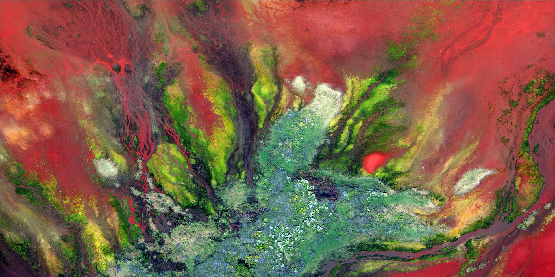
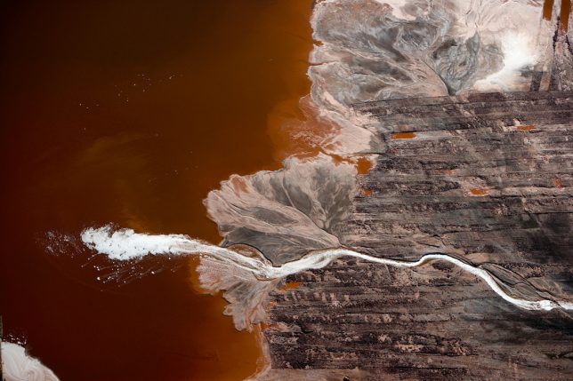
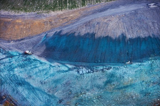
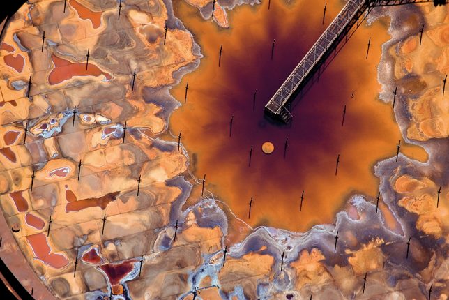
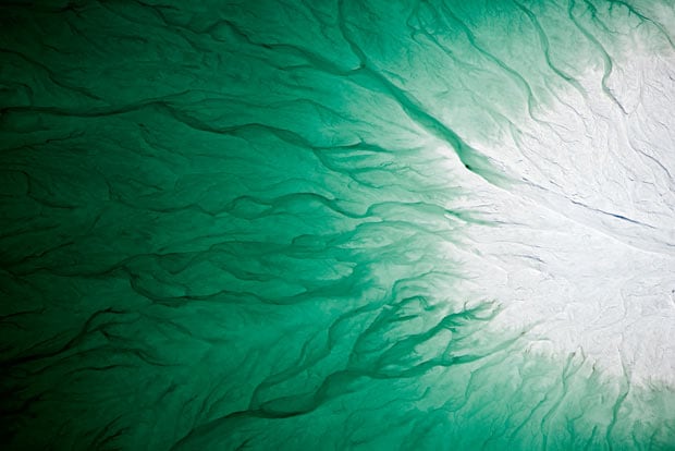
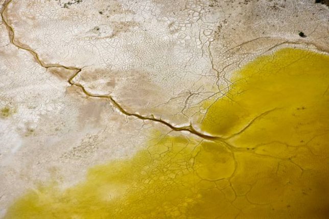
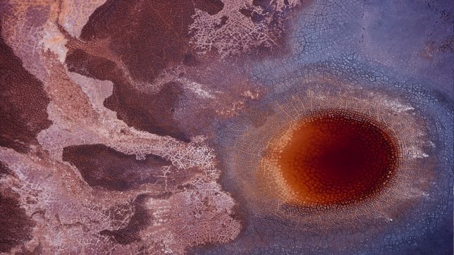
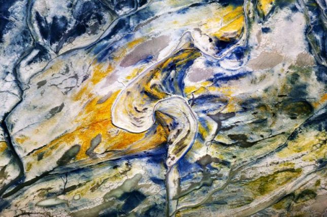
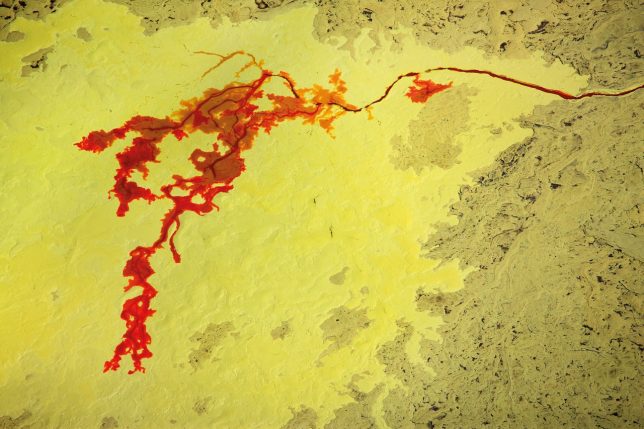
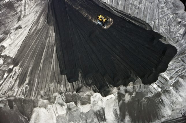
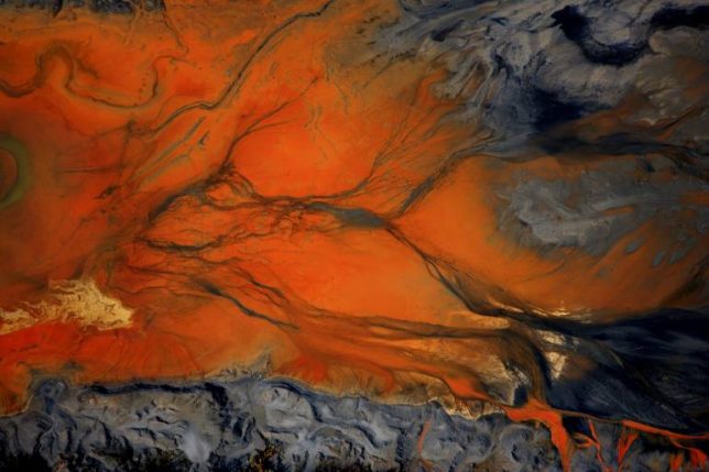
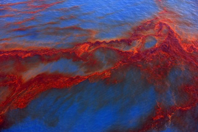
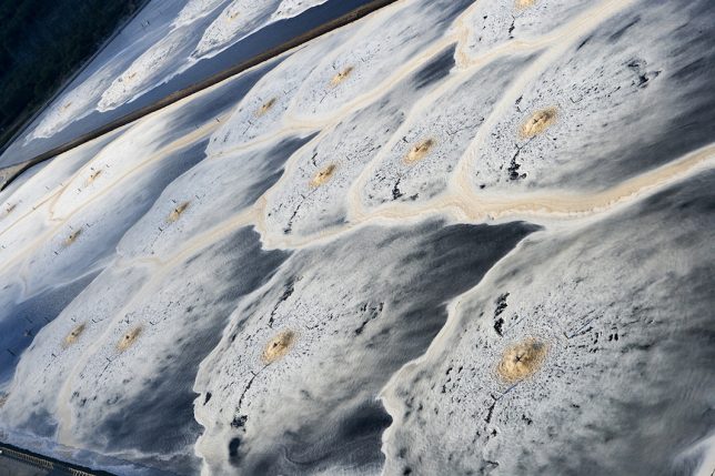
In strikingly well-composed, vividly colored scenes resembling abstract paintings, J. Henry Fair’s aerial photographs of toxic waste and industrial activity on Earth give us an uncomfortable look at the cost of human progress. In fact, the images seem unreal: how could the damage caused by industrial pollution be so strangely beautiful? Tar sands, mountaintop removal mining, fertilizer runoff, coal ash, factory farming and devastating oil spills aren’t exactly the stuff that stunning art is usually made of, but Fair is no ordinary artist, forcing us to face the duality of what we’ve created.

Shooting these scenes from the air gives us a perspective we don’t normally have, as if we’re flying over them in person, reckoning with the damage that comes with our consumption of fossil fuels, large-scale farmed meat, chemicals and other commodities that do significant harm to the environment in their sourcing and manufacturing.

Coal combustion waste may not be pretty, but its splashes of rust and bronze against its black and white surroundings are undeniably striking. Some heavy metals, like ‘red mud’ bauxite waste from aluminum production, are almost floral in their contrast to green.  Oil from the BP Deepwater Horizon spill is mesmerizing in its flowing red ribbons against the cobalt blue of the Gulf of Mexico waters. Phospho-gypsum fertilizer waste is a brilliant blue-green, like a gemstone; it contains both uranium and radium, piled dangerously close to drinking water aquifers.

“What interests me about this series is its essential irony and hope,” he says. “The thinking person participating in the modern world understands that all of us are living unsustainably, the impending consequences on our economy are real and significant. But in fact, with a little effort and luck, these limitations could be overcome, ensuring a secure future. And so we must hope, as we are all invested. My goal is to produce beautiful images that stimulate an aesthetic response, and thus dialog. If the pictures are not beautiful, the viewer will not stop to consider them.”

These images and many more are available in the form of a hardcover book set to be released on July 6th, ‘Industrial Scars: The Hidden Costs of Consumption.’

Share on Facebook


[ By SA Rogers in Art & Photography & Video. ]

[ WebUrbanist | Archives | Galleries | Privacy | TOS ]


WebUrbanist

 
Comments Off on Industrial Scars: Aerial Photos of Humankind’s Harrowing Impact on Earth

Posted in Creativity


Hasselblad launches A6D 100MP aerial camera

18 May

Hasselblad has updated its aerial camera offering with a new model that features a 100MP sensor. The A6D appears to have replaced the A5D series, which had a number of sensor options, with a single body using the company’s highest resolution back. The new model has many features similar to the previous incarnation and allows synchronization of up to eight cable-connected bodies with a delay of just 20 microseconds.

The use of the 100MP sensor increases the system’s dynamic range from a maximum of 14 to 15 stops, and the company has installed a slot for CFast 2.0 memory media.

Hasselblad has nine H lenses that have been adapted especially for aerial use. With focal lengths from 24mm to 300mm the system offers angles of view of 96-10.2° and a new top shutter speed of 1/4000sec. Hasselblad says that because its lenses use leaf shutters they are less exposed to issues of the plane’s movements than focal plane shutter systems that can only compensate for motion in a single direction – usually forward.

The A6D will be available with or without an infrared cut filter so it can be used with sensitivity to extended wave lengths of 750-1000nm. For more information see the Hasselblad website.

Warning: sample image is 68MB

Press release

Hasselblad Introduces a 100 Megapixel Aerial Camera System

Aerial photography delivers better results today than ever before and Hasselblad continues to grow its presence in the market, introducing more advanced products and applications for the aerial photographic industry. This is reflected in the Hasselblad A6D-100c, the latest evolution of Hasselblad aerial cameras.

Hasselblad cameras are developed by building on the shoulders of the previous generation of models which enables all of the prior advancements and branch-demanding features to be automatically included. This process allows Hasselblad to continually enhance and develop models. The A6D heralds a technological improvement that is noticeably greater than earlier generations.

The A6D Aerial camera includes a feature that allows up to eight cameras to be synchronized within 20 ?s. A simple bus-type cable connection is required between all cameras in the set-up. This feature completely eliminates any issues in post-production caused by un-synchronized exposures.

Product Manager Bjarne Hjörlund commented, “Available in 100 megapixel resolutions, the A6D camera combines the world’s best optics and sensors with a modern, compact design, resulting in a system that will ensure you attain the highest possible image quality. Hasselblad aerial cameras provide a range of important features that help deliver your imaging requirements”.

Nine H System lenses are available in aerial versions with secure locking mounts to minimize vibration and flexing which guarantees the image plane and sensor stay parallel at all times. These units ship with their focus precisely adjusted and fixed at infinity. The focal length range from 24 to 300mm of these lenses results in a horizontal AFOV of 96° to 10.2° covering most applications. The new generation of leaf shutters for the H lenses has an extended lifetime, which ensures reliability during flight.

In addition, the exposure time for the aerial lenses has been improved up to 1/4000 of a second, for sharp and crisp images. Traditionally, FMC systems typically only compensate for movement in a single direction, but the fast leaf shutter-based exposure time can both compensate for ground speed and the roll and pitch of the plane.

Near Infra-Red Photography
The A6D camera is available with or without Infra-Red filter for infra-red captures from 750nm to 1000nm to serve the needs of aerial analysis, such as environment surveying and crop management. NDVI, CIR and NIR imaging is possible with third party software.

Phocus SDK by Hasselblad
To facilitate the development of user specific software, Hasselblad offers a complete Software Developers Kit (SDK) which allows full control of camera and image processing from the user’s own software. To quickly get started using the A6D aerial cameras for photography, Hasselblad has created a simple but effective PC sample application which can capture and store RAW files coming from the camera. All source code for this application is supplied to allow the user to adapt to special individual requirements.
Technical Data Sheet:
Key Features

  • Medium format 100 Megapixel resolution
  • The A6D Aerial includes a feature that allows up to 8 cameras to be synchronized within 20 microseconds.
  • 9 of the H System lenses are available in aerial versions
  • The exposure time for the aerial lenses is increased up to 1/4000 of a second
  • The A6D camera is available with or without Infra-Red filter to allow infra-red captures from 750nm to 1000nm

Additional Features

  • Reduced foot print designed to fit existing POD mountings
  • Up to 15 stops Dynamic
  • Improved external connectivity via stable LEMO connections
  • Fits plane power with a power requirement of 12 – 24 volt DC
  • FMS and multiple camera synchronization
  • Secure camera mounting via 4 x M4 screws
  • Lens locking mechanism with additional lens protector
  • Onboard fast 500+ Mbytes/sec CFast2.0 storage with a capacity of up to 512 GByte
  • External storage interface via locked USB3.0 type C-connection
  • Fully mechanically fixed system to minimize effects of vibrations

Articles: Digital Photography Review (dpreview.com)

 
Comments Off on Hasselblad launches A6D 100MP aerial camera

Posted in Uncategorized


The Human Footprint: Aerial Photos Show How Industry Changes the Land

06 May

[ By SA Rogers in Art & Photography & Video. ]

The toll exacted from the earth for human progress is rarely more dramatically visible than from overhead, looking down onto the mines, oil fields, salt flats, recycling yards and other artificial landscapes we’ve created to maintain a population that has exploded since the 1950s. Photographer Edward Burtynsky, who has been flying all over the world capturing aerial images of these scenes since long before the arrival of Google Earth, now sees human activity as expanding “like a rogue species… stretching the boundaries and limits of what we can do in nature.”

How have we changed the shape of the Earth since the dawn of the industrial age? The human population on Earth has expanded by nearly a billion every decade, and in our constant quest for lives of comfort and plenty, we ravenously consume natural resources and radically alter the landscapes we depend on for our own survival. Burtynsky has produced a series of photo collections in 11 categories like water, oil, mines, ship breaking, tailings and quarries to show that our appetites have put our own future in jeopardy.

Accepting his 2005 TED Prize for his stunning work, Burtynsky said he hopes that these images will help persuade millions of people around the world to join a global conversation on sustainability.

“These images are meant as metaphors to the dilemma of our modern existence; they search for a dialogue between attraction and repulsion, seduction and fear. We are drawn by desire – a chance at good living, yet we are consciously or unconsciously aware that the world is suffering for our success. Our dependence on nature to provide the materials for our consumption and our concern for the health of our planet sets us into an uneasy contradiction. For me, these images function as reflecting pools of our times.”

Share on Facebook


[ By SA Rogers in Art & Photography & Video. ]

[ WebUrbanist | Archives | Galleries | Privacy | TOS ]


WebUrbanist

 
Comments Off on The Human Footprint: Aerial Photos Show How Industry Changes the Land

Posted in Creativity


SkyPixel, DJI and Tourism Australia team up to launch aerial photography contest

04 Mar
Image: SkyPixel / Piotr Parzybok

Aerial photography community SkyPixel is launching an aerial photography contest in cooperation with DJI and Tourism Australia to showcase the natural beauty of the Land Down Under. The Australia From Above contest’s aim is to inspire aerial photographers from around the world to experience and share new photographic perspectives of Australia. The contest is open from March 3 to May 2 to both professionals and enthusiasts. 

“Drone photography is gaining huge popularity in Australia, with the country home to a rising number of very talented aerial photographers,” said Lisa Ronson, Chief Marketing Officer, Tourism Australia. “Advances in technology are enabling us to tell Australia’s story in ways previously not possible, and the levels of engagement we get when we share some of these amazing drone clips on our social channels is just extraordinary. It’s really exciting to be part of a competition which provides such a great platform for this new generation of content creators to capture the rich colours, patterns and textures of Australia’s diverse landscape and share this with the rest of the world.”

The winner of the contest’s Grand Prize will receive a DJI Inspire 2 Premium Combo drone package and go on a three-day journey to Lord Howe island for two as well as a three-day trip to Kangaroo island for two. Additional prizes include a DJI Phantom 4 Pro drone, a Mavic Pro drone and one of 10 Osmo Mobile handheld smartphone stabilized gimbals. Winning images will also be showcased on the SkyPixel website and on DJI’s social media platforms. More information on the competition can be found on the Skypixel competition page. If you’d like to participate but lack inspiration, you should have a look at the winning images from SkyPixel’s 2016 competition to get the creative juices flowing.

SkyPixel Launches ‘Australia from Above’ Aerial Photography Contest

DJI and Tourism Australia Partner for Country’s First Large-scale Aerial Photo Contest

SYDNEY, March 3, 2017 /PRNewswire/ — SkyPixel, the world’s most popular aerial photography community run in cooperation with DJI, on Friday launches its first national aerial photography contest to showcase the stunning natural beauty of Australia as seen from drones and other aerial equipment.

The Australia From Above contest, sponsored by DJI and Tourism Australia, aims to inspire aerial photographers from around the world to share, enjoy and experience new creative perspectives of Australia. The contest is open from March 3 to May 2 and welcomes professionals and enthusiasts alike to share their visions of the country. Please find a link to the competition here: https://www.skypixel.com/events/australia

Australia is a stunning, diverse country, from the inspiring expanse of its pristine white beaches to the raw power of its rich, red outback,” said Danny Zheng, DJI Vice President of Marketing. “Capturing these landscapes from above empowers photographers to see Australia’s extraordinary beauty in an entirely new way, and we can’t wait to see the amazing images from inspired aerial creators.”

“Drone photography is gaining huge popularity in Australia, with the country home to a rising number of very talented aerial photographers,” said Lisa Ronson, Chief Marketing Officer, Tourism Australia. “Advances in technology are enabling us to tell Australia’s story in ways previously not possible, and the levels of engagement we get when we share some of these amazing drone clips on our social channels is just extraordinary. It’s really exciting to be part of a competition which provides such a great platform for this new generation of content creators to capture the rich colours, patterns and textures of Australia’s diverse landscape and share this with the rest of the world.”

The Australia from Above Grand Prize consists of a DJI Inspire 2 Premium Combo drone package, a three-day journey to Lord Howe island for two and a three-day journey to Kangaroo island for two. Runners-up have a chance to win a DJI Phantom 4 Pro drone, a Mavic Pro drone and one of 10 Osmo Mobile handheld smartphone stabilized gimbals. Winning entries will also be showcased on the SkyPixel website as well as to DJI’s millions of fans and followers across its social media platforms. Australia From Above is generously supported by media partners Australian Photography, Drone Magazine and Capture as well as other product sponsors.

To learn more about the contest and submit entries, please visit www.skypixel.com/events/australia.

The judging panel includes a select jury of renowned photographers and influencers.

  • Kirk Hille, Australian photographer and winner of SkyPixel’s 2015 global photography contest
  • Mike O’Connor, Editor of Australian Photography
  • Lisa Ronson, Chief Marketing Officer, Tourism Australia
  • Tom Rex Jessett, professional photographer travelling the world and capturing its beauty

“I’m looking forward to seeing what fellow SkyPixel community members will share over the coming months,” said Hille, who won the grand prize in SkyPixel’s first annual worldwide contest with an image of a lone swimmer off the coast of Lucky Bay in western Australia. “As an Australian, I treasure the beauty of my home country and I was happy to learn it’s the country of choice for SkyPixel’s first national contest.”

Articles: Digital Photography Review (dpreview.com)

 
Comments Off on SkyPixel, DJI and Tourism Australia team up to launch aerial photography contest

Posted in Uncategorized