RSS
 

Posts Tagged ‘Wayfinding’

Wayfinding in Subways: 3D Blueprints Show NYC Tunnel Systems

27 Sep

[ By WebUrbanist in Architecture & Cities & Urbanism. ]
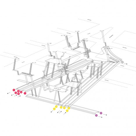
nyc underground blueprint render

Inspired by detailed three-dimensional maps of Hong Kong subway stations, a New York artist has painstakingly documented and rendered a gorgeous series of helpful underground diagrams.
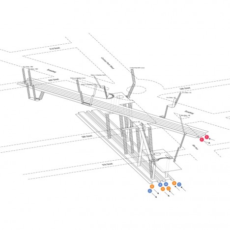
nyc subway 3d maps

Exiting a subway network can be a disorienting experience. While stair signage and sidewalk compasses can help, anyone navigating based on landmarks or other surface features is lost. Project Subway NYC by Candy Chan is a step in the right direction. Using pen, paper and a camera, she meticulously recorded directions and relative positions of tracks and lines, referring to Google and MTA resources as a baseline.
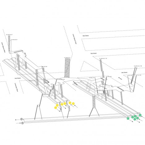
nyc complex subway navigation

She then took the results into AutoCAD, verified those drawings in person, and proceeded to model and render the results using Rhino, Adobe Illustrator and Photoshop to produce 3D maps. Her explorations have helped her identify pain points for navigating these multilevel stations.
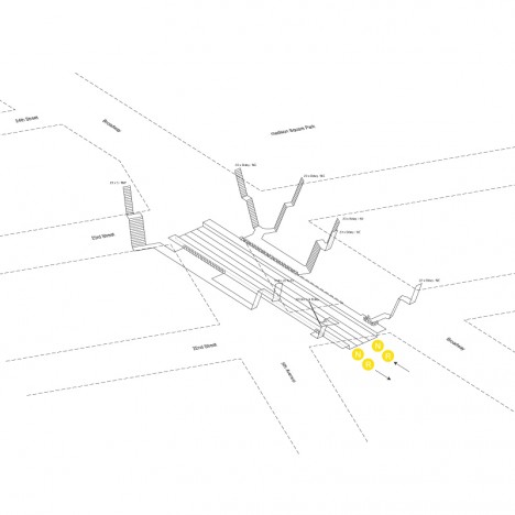
nyc subway station map

From CityLab: “The first batch includes five stops along Broadway: Columbus Circle, Times Square, Herald Square, Madison Square, and Union Square. But Chan hopes to do more, in Manhattan as well as in the outer boroughs. Since the project just launched two weeks ago, she’s gauging people’s reactions to decide which stations to explore next.”
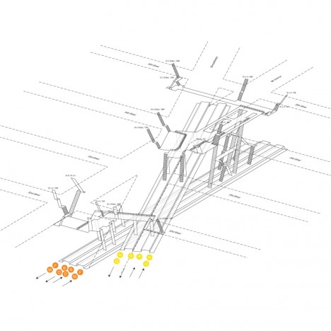
nyc track paths stairs

Still, 3D maps may not in themselves be a solution – murals, screens, signage or other indicators tied to visual landmarks from the world above would be a welcome addition for those who cannot read English or simply navigate using different means and methods.

Share on Facebook


[ By WebUrbanist in Architecture & Cities & Urbanism. ]

[ WebUrbanist | Archives | Galleries | Privacy | TOS ]


WebUrbanist

 
Comments Off on Wayfinding in Subways: 3D Blueprints Show NYC Tunnel Systems

Posted in Creativity


Future of Wayfinding: Augmented Reality for Urban Bicyclists

13 Jun

[ By WebUrbanist in Conceptual & Futuristic & Technology. ]

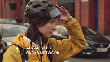
1augmented

Using augmented reality highlights, hints and cues to guide bikers through complex city paths and streets, this conceptual system addresses issues of wayfinding and safety, speculatively asking: “Could a cycle path be created, or at least augmented, using connected technologies?”

augmented urban path highlight

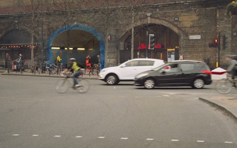
Five initial functions are proposed by the Connected Cyclists project for this wearable prototype, all around themes of navigation in London, a place notorious for the variety of its path types and unexpected route shifts. With so many transitions between street paths, parks and alleyways, it can be hard for bikers new to the city to know where to go – subtle highlights of next steps could solve that problem.

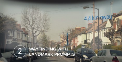
2wayfind

“We see that cyclists often take bearings when paused at traffic lights—this interface could essentially simply provide the next direction, reinforcing the journey. We also feel that the visual nudge implied here, using the fabric of the city itself, is more akin to how cyclists move and navigate—a more fluid movement through and sometimes across the streetscape, as opposed to the very directed navigation delivered for drivers.”

3pollution-1

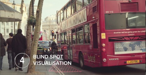
Blind spot visualization assists travelers as they pass in the shadows of cars, buses and trucks, while an overall approach promoting backstreet network paths helps avoid traffic and poor air quality in the first place. Monuments, icons and landmarks displayed subtly in the background can also give clues to riders about where they are in the city.

4Blind-1

Already there are many programs like CityMapper built on OpenStreetMaps that contain the necessary information about routes and paths but using those on the go via a typical mobile device means either unsafe cycling practices or frequent stops, hence the augmented heads-up display. “If these displays talked to the city around them—if they knew where the cyclist was and what they were looking at—they could give much more subtle spatial and contextual information that builds on the surroundings of the cyclist.”

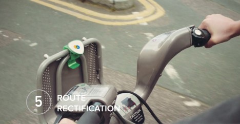
5route

The key is making such technology accessible and seamless, a distraction-free overlay to other visual information being taken in by those on bikes moving through the urban environment.

augmented reality headset

“Many cities are spending serious money, time and attention on improving the ‘hard infrastructure’ of cities to make cycling safer, more convenient, more attractive,” but “there is potential of a ‘soft infrastructure’ which can be overlaid on existing urban fabric to further support cycling, which takes advantage of contemporary technologies such as wearables, the internet of things, real-time sensor data, and so on.”

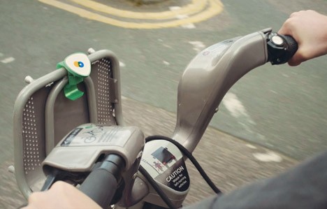
augmented city bike device

While none of this is a reality quite yet, “‘Design stories’ allow you to try on a future for size, and to imagine how a prototype might fit into its urban context. With prototypes to point at, critique and discuss we can begin to imagine other externalities or knock-on effects and build up both understanding and language to discuss what can otherwise be fairly abstract and technical ideas.”

Share on Facebook


[ By WebUrbanist in Conceptual & Futuristic & Technology. ]

[ WebUrbanist | Archives | Galleries | Privacy | TOS ]


WebUrbanist

 
Comments Off on Future of Wayfinding: Augmented Reality for Urban Bicyclists

Posted in Creativity


Guerrilla Wayfinding: User-Powered Signs Aid Exploration

01 Oct

[ By Steph in Gaming & Computing & Technology. ]

Walk Your City 1

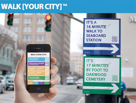
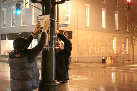
What are you missing out on in your own city by sticking to your established routes each day, or driving instead of walking? Sometimes it’s easy to forget how close any number of interesting locations are to the places you visit on a regular basis, even by foot – and walking can be the best way to truly experience any given city. Walk [Your City] aims to encourage that kind of exploration with a combination of user-powered custom street signs and online tools.

Walk Your City 2

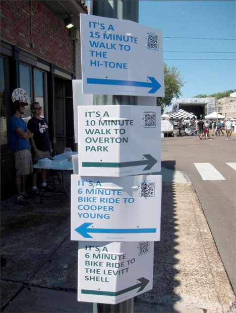
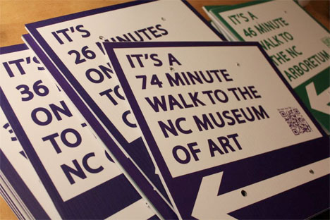
The signs tell pedestrians how close certain attractions are by foot. Scan the QR code, and you’ll get an entire walking route that gives you the walk or cycle minutes to points of interest along your path. You can join in the process by ordering your own custom-made sign and putting it up yourself.

Walk Your City 4

The project started in North Carolina with Walk Raleigh, a guerrilla wayfinding operation that posted 27 signs at three major intersections throughout the city in January 2012. The signs weren’t legally sanctioned by the city, so they were taken down – but the project caught the attention of officials, who are now making Walk Raleigh a permanent feature.

Walk Your City 3

New York City has gotten behind the project officially, too. WalkNYC kicked off in June 2013 and aims to be “the citywide standard for pedestrian wayfinding.” Other cities around the nation and in Canada are following suit. If you’re interested in implementing Walk [Your City] in  your own community, you can simply go ahead and make your own signs at WalkYourCity.org.

Share on Facebook


[ By Steph in Gaming & Computing & Technology. ]

[ WebUrbanist | Archives | Galleries | Privacy | TOS ]



WebUrbanist

 
Comments Off on Guerrilla Wayfinding: User-Powered Signs Aid Exploration

Posted in Creativity