RSS
 

Posts Tagged ‘Travelogue’

Canadian Travelogue – Nova Scotia – Brier Island

12 Aug

Long Island and Brier Island, along with several much smaller uninhabited islands, form the archipelago that lies right at the tip of Digby Neck, a peninsula that juts into the Bay of Fundy. With a population hovering around 300 residents, Westport, Brier Island’s only village, cannot help but be relaxing. Consequently I recommend the village of Westport as one of the most relaxing three-day summer holiday destinations in Nova Scotia. There is only one access route to Brier Island: drive west on Highway 217 from Digby for about an hour, and two small ferry crossings.

Brier Island, the outer-most island along Digby Neck, is essentially a comprised of lava-flow-formed basalt rock. While making a beauthiful coastline to photography, it is also brutal on scrapped knees.

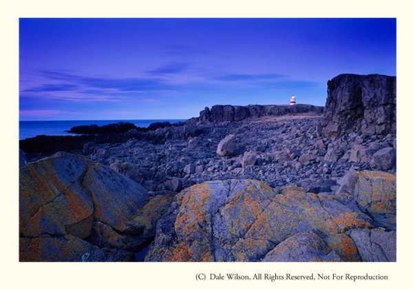
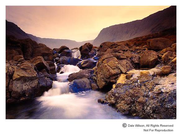
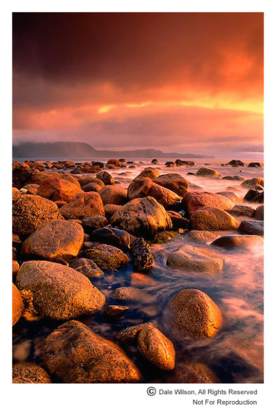
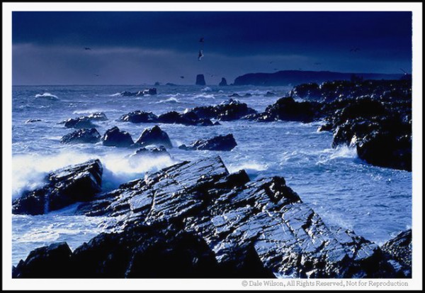
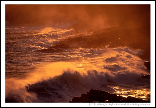
Brier Island, the outer-most island along Digby Neck, is essentially comprised of lava-flow-formed basalt rock. While making a beauthiful coastline to photograph and enjoy, it is also brutal on scrapped knees.

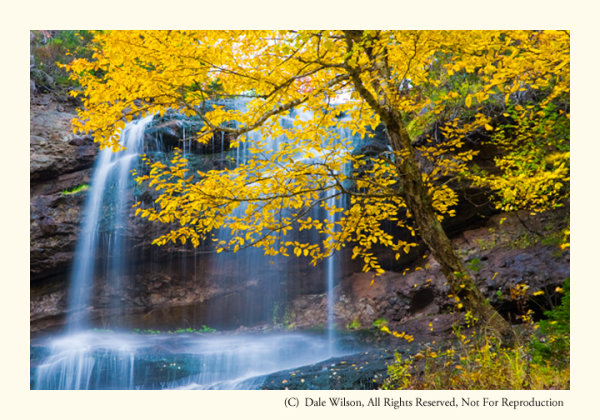
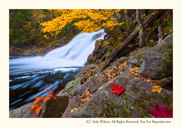
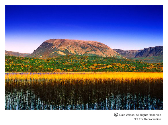
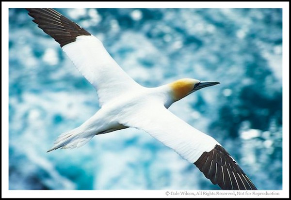
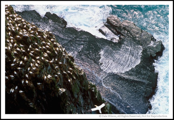
There are countless photo opportunities, including rare flora, numerous shore and seabird species (Brier Island is located on the Atlantic Flyway, and autumn is the best season for bird-watching) and spectacular seascape opportunities wherever you choose to “drop” your tripod.  Brier Island juts into the lower Bay of Fundy, and the waters surrounding it are the summer home of the nearly extinct Atlantic Right Whale. Endangered humpback whales are also regularly seen in these waters, as are finback and Minke whales and the Atlantic white-sided dolphin.

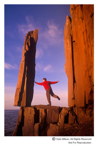
One of my favourite locations on Brier Island is a stretch of basalt columnar formations along the east and south-east shorelines. Simply park your car at the lot at the end of the road and walk south toward the small monument that profiles the seafaring heroics of Joshua Slocum, the first sailor to circumnavigate the world solo. Really good hiking books are essential here as you will be scampering along a fairly rugged shoreline. Be careful of the slippery seaweed and the tide: you will have great difficulty out-running the rising water if you’re caught where you shouldn’t be.

One of the quirkiest sights in all of Nova Scotia is the “Balancing Rock.”  Near the village of Tiverton on Long Island, this precariously perched piece of basalt stands nearly seven metres high and looks as a good wind would blow it off its precarious perch.  Not so. It’s easy to find, just look for the roadside sign several kilometres west of the Tiverton or ask any local resident.

I first discovered the Balancing Rock in 1991 when working on an editorial assignment and immediately saw its photographic potential. Getting close to it then was quite a chore, but I am pleased to report that a boardwalk now makes crossing the bogs and fens much easier and a really convenient stairway with an observation deck has replaced the knotted hawser once tangling over the cliff edge.  It is about a 30-minute trek from Highway 217 and is most definitely a sunrise location.

Precariously perched on a ledge above St. Mary's Bay, local folklore indicates three lobster boats once tried to pull over this rock in unison - unsuccessfully, apparently.  The Balancing Rock can now only be photographed from a viewing platform, so it is highly unlikely you will find any fairies testing their strength.

Precariously perched on a ledge above St. Mary’s Bay, local folklore indicates three lobster boats once tried to pull over this rock in unison – unsuccessfully, apparently. The Balancing Rock can now only be photographed from a viewing platform, so it is highly unlikely you will find any fairies testing their strength.

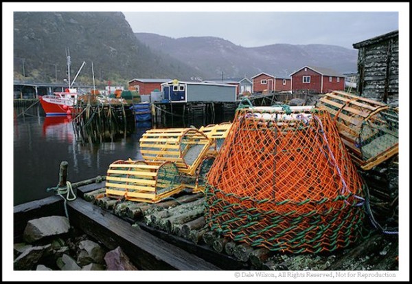
Welcome to this great little archipelago jutting like a finger into the Bay of Fundy and be prepared for many great days of therapeutic relaxing while gulls screech in this working harbour and the smell of salt wafts through the air.  Your watch won’t be wound quite so tight when you leave – I guarantee it.

Post originally from: Digital Photography Tips.

Check out our more Photography Tips at Photography Tips for Beginners, Portrait Photography Tips and Wedding Photography Tips.

Canadian Travelogue – Nova Scotia – Brier Island


Digital Photography School

 
Comments Off on Canadian Travelogue – Nova Scotia – Brier Island

Posted in Photography


Canadian Travelogue – Nova Scotia – Peggy’s Cove

07 Aug

No location in Canada’s Ocean Playground is more quintessentially Nova Scotian than Peggy’s Cove. It’s all there: a lighthouse, pounding surf on large granite outcroppings and a tranquil working fishing community. And it’s only 50 kilometres from Halifax, the largest city in Atlantic Canada.

Early spring is a great time to photograph one of the most photographed lighthouses in the world, should you want images without people in the picture

Early spring is a great time to photograph one of the most photographed lighthouses in the world, should you want images without people in the picture

The only land route to Peggy’s Cove is Highway 333, starting at Armdale, and then routes along to coast and eventually joins Highway 103 at Upper Tantallon to the west. You then turn right onto Highway 103 and drive east back to the western reaches of Halifax at Bayers Lake. The coastal drive from Armdale to Peggy’s Cove along Route 333 is by far the most scenic and interesting, offering may little side trips to the not too distant shoreline and coastal communities.  You will have no difficulty locating Peggy’s Cove itself: it’s one of the top tourist destinations in all of Canada, so road signage is abundant.

Photographers who desire images of the lighthouse without people milling about will have their patience taxed to the limit. The task will be almost impossible in the peak tourist season of July and August, and just plain difficult at any other time of the year … except maybe the coldest days of winter. I find April is a good time as most of the snow will have melted and it is still too early for people to be thinking about visiting this Atlantic sentinel. Additionally, what little foliage there is will still be brown and this is typically a good month for storm clouds that create interesting and supportive notions of why a lighthouse is there in the first place.

The best approach to photograph the village and the lighthouse is to arrive in early morning and “play tourist,” making pictures as you meander around the harbour. You can easily spend several hours just following your nose, and there is a large restaurant on site for that moment when the light gets too harsh. Make sure to re-visit in the evening –after a noon-day nap, of course—and leave yourself lots of time to find the perfect location to get the classic lighthouse-against-the-sunset photograph.  Should you stake out a vantage point on the south side of the lighthouse there is a better chance you will be able to eliminate people from the image with creative camera positioning and sight angles. From a low elevation the camera’s line of sight will be just over the heads of the tourists who sit on the rocks enjoying the last rays of the day.  The other classic view is from the water’s edge just to the north of the little cove in front of the lighthouse itself, immediately below the restaurant. Be aware, from here you will almost be guaranteed there will be people in your picture.

By staying to the south of the light, it is possible to keep the camera low and avoid people from creeping into the frame. Challenge yourself to look for creative images as well as portaits of the light.

By staying to the south of the light, it is possible to keep the camera low and avoid people from creeping into the frame. Challenge yourself to look for creative images as well as portaits of the light.

When travelling along the shoreline anywhere in Atlantic Canada, but especially so in Peggy’s Cove, be astutely aware of your surroundings, rogue waves are common and have called unwary visitors to the depths to dwell with King Neptune. So, please, be careful and mindful of the signage; if those rocks are black or wet you are too close to the water’s edge. The Atlantic Ocean is huge and powerful, and its combers deserve, and demand, your respect.

Now get out there and enjoy one of the most photogenic places in all of Nova Scotia, and Canada. You won’t be disappointed.

Post originally from: Digital Photography Tips.

Check out our more Photography Tips at Photography Tips for Beginners, Portrait Photography Tips and Wedding Photography Tips.

Canadian Travelogue – Nova Scotia – Peggy’s Cove


Digital Photography School

 
Comments Off on Canadian Travelogue – Nova Scotia – Peggy’s Cove

Posted in Photography


Canadian Travelogue: Nova Scotia – Cape Breton Highlands National Park

21 Jul

The autumn foliage of Cape Breton Highlands National Park offers a more exciting colour palette than anywhere else in Canada, and quite possibly in North America.

The best time to visit is immediately after Thanksgiving weekend in October. The holiday weekend itself can be nightmarish, with hordes of people and endless lines of tour buses. Restaurants are filled to capacity and accommodations are hard to find unless you have made reservations well in advance. On the Monday immediately following the holiday weekend, you will pretty much have the entire Highlands region and the National Park to yourself.

Beulach Ban Falls in the 2nd week of October.

Beulach Ban Falls in the 2nd week of October.

The park is enclosed by the northern section of the famed 300Km long Cabot Trail, a loop of highway that starts and ends at Baddeck. I prefer to enter the Park at the western terminus, near the Acadian village of Cheticamp, and tour the park in a by driving in a clockwise direction along the Cabot Trail.

For those who enjoy American history, the original residents of Cheticamp are repatriated families who had previously been extradited to the United States during the Great Expulsion (Le Grand Dérangement) of 1755.  The word Cajun, which is a common term used to identify the French residents of Louisiana, for example, is actually an anglicized mispronunciation of the French word Acadien. This is a topic for another day, but Cheticamp is a fabulous place to base a few days and listen to the residents speak a very unique and distinct dialect of French and English languages.

One cannot leave the Cape Breton without the classic Cabot Trail photo, and the opportunity comes early in the trip. Park your car at the Cap Rouge pull-off and look southwest back toward the village of Cheticamp – you will instantly recognize the view and potential for a great post card picture. This is an afternoon shot, unless you are looking for a photographic challenge. A sunset photo from this location can be breathtaking, but it can also be difficult to pull-off. The sun will be slight to the right-centre of the frame so you will most likely have to contend with lens flare, and make your images thinking of a final HDR treatment.

Two particular locations in the park that call me back each year are Mary Ann Falls and Beulach Ban Falls. Beulach Ban Falls is at the eastern base of North Mountain, near the most northerly point on the Cabot Trail. It is reached by way of a gravel laneway that passes a warden’s cabin, on the opposite side of the road from the Big Intervale Campground. About 2 kilometres on this gravel laneway will get you to a small picnic park, and to the base of the falls. You should hear the falls from the parking lot. As with any waterfall, the option to include the entire waterfall, or selective portions, is an entirely personal choice – let the muses direct your creativity.

Mary Ann Falls in 2nd week of October. Yes, I placed the leaves; however, I later heard a photographer swear up and down that those leaves in his picture were exactly as he found them!

Mary Ann Falls in 2nd week of October. Yes, I placed the leaves; however, I later heard a photographer swear up and down that those leaves in his picture were exactly as he found them!

On the Park’s eastern limits, and about a 5 kilometre drive west from the town of Ingonish, you will come to a gravel road leading inland to the Marrach Group Campground. Continue along this road, following the signs to Mary Ann Falls, for about 7 kilometres until you come to a gated wooden bridge – Mary Ann Falls is immediately to your right, or downstream.

Successful images can be made at several vantage points, but the weather will often decide your ideal location along this relatively small but photogenic waterfall. Like most watercourses, the ideal time to make photographs at either Mary Ann Falls or Beulach Ban Falls is during a light drizzle or with overcast skies, thus lowering the overall contrast. Shutter speeds below 1/15th of a second should produce the often sought after “bridal veil” effect, suggesting water movement.

There are many other locations in Cape Breton Highlands National Park that deserve your attention: there is a fantastic panoramic image looking up MacKenzie River from a pull-off near the top of MacKenzie Mountain, the Coastal Trail offers some really unique Jack Pine stands (an uncommon tree in Cape Breton) as well as several vantage points for great views along the Gulf of St. Lawrence shoreline, and a really easy hike among the hardwoods of the Lone Shieling Trail.

As with most national parks, there is much to offer and explore. You simply have to allow yourself the time and flexibility to maximize your efforts in this park due to its maritime environment – if you don’t like the weather, wait an hour.

The Highlands of Cape Breton, in autumn, is a world-class destination. Plan to spend at least four days to appreciate its splendour.

Post originally from: Digital Photography Tips.

Check out our more Photography Tips at Photography Tips for Beginners, Portrait Photography Tips and Wedding Photography Tips.

Canadian Travelogue: Nova Scotia – Cape Breton Highlands National Park


Digital Photography School

 
Comments Off on Canadian Travelogue: Nova Scotia – Cape Breton Highlands National Park

Posted in Photography


Canadian Travelogue -Newfoundland- Gros Morne National Park

14 Jul

Gros Morne National Park is to Atlantic Canada what Banff is to Alberta: a treasure trove of photographic opportunities. One major difference between the two National Parks is that Gros Morne receives only about 120,000 visitors per year, while Banff gets four million.

Gros Morne Mountain as seen from Rocky Harbour Pond. Filters used: Cokin 173 Blue/Yellow Colour Polarizing, Cokin 2-stop blue soft edge graduated and Singh-Ray Colour Intensifying

Gros Morne Mountain as seen from Rocky Harbour Pond. Filters used: Cokin 173 Blue/Yellow Colour Polarizing, Cokin 2-stop blue soft edge graduated and Singh-Ray Colour Intensifying


Designated a UNESCO World Heritage Site, Gros Morne is best photographed by concentrating on a given topic or subject matter, be it wildlife, flora, seascapes or landscapes. Each geographical region in the park offers its own rewards and anyone planning to explore and photograph Eastern Canada’s premium photo destination should schedule a minimum of four days.

While each month offers its own special attractions and challenges, I prefer to photograph Gros Morne in September when the air is usually clear of atmospheric haze and there are few tourists. Late in September many of the animals –moose in particular—become more active as they enter the rutting season. July is prone to a lot of atmospheric haze and August is the warmest month, averaging around 20 degrees Celsius and rarely going above 25 degrees.

Even during the summer months snow can be found at higher elevations in the cirques and shadows zones of north facing mountains, and evening can be quite cool. In addition to foul-weather gear, warm clothing and wind breakers are a must for personal comfort. Even during the summer months finger-less are invaluable for handling the cold legs of a tripod and providing some shelter against chilly winds.

Access is gained by driving along route 430 (the Viking Trail) from Deer Lake to the park’s epicentre at Rocky Harbour, about 71 kilometres. Or, turn off route 430 onto route 431 at Wiltondale to access the south side of the park, where you will drive past the Tablelands mountains and eventually arrive at the fishing hamlet of Trout River.

Often overlooked, the Tablelands mountain range is one of the most unusual geological formations in the world. The yellowish-brown rock known as peridotite was thrown heavenward by the continual bump-and-grind of plate tectonics. Exposed from the earth’s mantle, this rock is devoid of plant supporting nutrients, and consequently the Tablelands Range hosts only a few varieties of flora, with most to be found along the banks of Winterhouse Brook.

Winterhouse Brook in the Tablelands.  Filters used: Cokin 173 Blue/Yellow Colour Polarizing and Cokin 2-stop Grey soft edge graduated

Winterhouse Brook in the Tablelands. Filters used: Cokin 173 Blue/Yellow Colour Polarizing and Cokin 2-stop grey soft edge graduated


Photographically, the Tablelands is a challenge that demands the photographer’s full attention to make creative images. The light is unique due to the topography; both morning and evening is in shadow and light only makes its way into this valley during high noon. However, if you must make a choice, opt for evening when you can drive along route 431 and view the mountain range to the south. On those few occasions when the evening light bathes this unique landscape the colour of the rocks will be sublime and unparalleled in eastern Canada.

One of the most exciting areas to photograph seascapes is the north side of Bonne Bay, just a few kilometres past Lobster Cove Head lighthouse. Green Point, on the Gulf of St. Lawrence, provides an ideal vantage point as the large rocks turn a lovely shade of orange in the sweet light of sunrise and sunset – and you can photograph both from this location.  The best access is via a single lane gravel driveway on your left about 500 metres beyond the Green Point Campground. You will recognize the spot when you find fishermen’s seasonal cabins along the shoreline. As this is a working area for the fisherfolk, it is courteous to park at the top of the bank and walk over the hill to the shoreline. There are no tips with respect to how best create images from this location, simply walk along the shoreline and change lenses as your creative vision dictates.


Green Point at dusk in pending storm light. Filters used: Cokin 173 Blue/Yellow Colour Polarizing, Singh Ray Colour Intensifying and Cokin 2-stop grey soft edge graduated

Green Point at dusk in pending storm light. Filters used: Cokin 173 Blue/Yellow Colour Polarizing, Singh Ray Colour Intensifying and Cokin 2-stop grey soft edge graduated


Other attractions not to be missed in Gros Morne National Park are Western Brook Pond and the boat tour of this land-locked fiord. Secure your reservations at least a day in advance from the tour office located in the Ocean View Hotel in Rocky Harbour.  As awe-inspiring as this trip down the fiord is, it is incredibly difficult to capture creative images as you are restricted by the movement of the boat and the lack of light reaching the 675 metre high south wall. Given the choice, opt for the last run of the day for best light.

As mentioned above, bring warm clothes, sturdy footwear, lots of media cards and allow at least four days and you will be rewarded with the most exciting, photographic diversity and easily accessable region in Atlantic Canada.

Post originally from: Digital Photography Tips.

Check out our more Photography Tips at Photography Tips for Beginners, Portrait Photography Tips and Wedding Photography Tips.

Canadian Travelogue -Newfoundland- Gros Morne National Park


Digital Photography School

 
Comments Off on Canadian Travelogue -Newfoundland- Gros Morne National Park

Posted in Photography


Canadian Travelogue – Newfoundland – Spillars Cove

06 Jun

Spillars Cove lies at the tip of Cape Bonavista, with Bonavista Bay behind you and Trinity Bay ahead as you face east awaiting sunrise. For most of my many visits there the weather has been unbelievable: hurricane force-winds, driving rain and sleet — did I mention wind? Only a handful of times have I been blessed with a calm day, with bright sunny skies and temperatures hovering around 20 degrees; you know, the kind of day that is great for mosquitoes. I’ll take the wind, thank you very much.

In fact, the stronger the winds the better. This mean and rugged coastline lies generally northwest to southeast —perfect for photographs of the sunrise—and strong winds only add to the beauty. Use from two to four stops of graduated filter of various colours to add even more drama to the sky, or, alternatively, underexpose your bracketed frames in full-stop increments for masking via several post production techniques.  This incredible shoreline is typically far enough distant to permit lens apertures of f/5.6, to give shutter speeds high enough to keep the crashing waves from blurring while maintaining an acceptable depth of field.

When the light or weather is not cooperating you have to dig deep into that bag of tricks. In this case I have used a tungsten colour correcting filter (80A) to add some colour to an otherwise grey day.

When the light or weather is not cooperating you have to dig deep into that bag of tricks. In this case I have used a tungsten colour correcting filter (80A) to add some colour to an otherwise grey day.

There are several access roads leaving the Trans-Canada Highway between Clarenville and Port Blandford that meander toward Cape Bonavista, and if time is not a concern you should explore the bi-ways that will usually always lead to salt water and a tranquil and quaint fishing village. Once you reach the township of Bonavista be prepared to get lost, planned urban development and ease of transport were unheard of in the 17th century – streets simply followed the coastline and houses were built … wherever. But this is a part of the charm of rural Newfoundland. If you follow your nose and a few scattered signs you should easily find the lighthouse. A few hundred metres before the ocean sentinel there is the gravel Lance Cove Road to your right that leads to “The Dungeon,” a provincial natural attraction. Take this road and drive south east for about two kilometres along the coast and you will see the Spillars Cove shoreline, as seen above, unfold in the distance.

Should the wind be blowing hard—and it often is—keep your tripod as close to the ground as you can, to minimize camera movement. Once you have composed the image in your viewfinder you can use your body as a wind shield during the exposure. Should the wind be particularly aggressive, the coastline here is firm enough that you can drive your vehicle close to the edge and position it as a wind block to ensure the tripod mounted camera is rock steady. Back absolutely certain the marsh is dry enough to support your car first, and stay safely back from the edge of the cliff however by walking it first.

Another great nearby location for incredible seacoast images is Cable John Cove. From the Dungeon continue driving the gravel road south for another ¾ kilometre until you reach the paved Highway 235 (Bonavista Bay Hwy), and turn left, heading east. Simply drive this road for about one kilometre until the road ends, at which time you can walk the additional 200 metres to the shoreline. Once at the water’s edge simply continue walking the coastline to your left and once atop the little knoll you will see a large and impressive sea stack that begs to be photographed. Be careful when walking along this shoreline – the moss and rocks can get slippery if wet, and the fall to the depths below will be unforgiving.

Certainly not an award winning image, but a snapshot to show what can potentially await the adventuring photographer as seen from atop the highlands of Cable John Cove.

Certainly not an award winning image, but a snapshot to show what can potentially await the adventuring photographer.  As seen from atop the highlands of Cable John Cove.

Another great side trip should be to nearby Elliston. Once in the community ask anyone for directions to the puffin site at Elliston Point. There are about 300 nesting pair of Atlantic puffin at this site and if the wind is blowing in the right direction you should easily be able to striking portraits with a 200mm lens.

If you happen to really lucky and are in this area in early summer ask the locals if they know of any icebergs in the area. You shouldn’t be surprised if there are a couple hidden in some cove; you are, after all, on the banks of Iceberg Alley.

Post originally from: Digital Photography Tips.

Check out our more Photography Tips at Photography Tips for Beginners, Portrait Photography Tips and Wedding Photography Tips.

Canadian Travelogue – Newfoundland – Spillars Cove


Digital Photography School

 
Comments Off on Canadian Travelogue – Newfoundland – Spillars Cove

Posted in Photography


Canadian Travelogue – Newfoundland – Cape St. Mary’s

22 May

Cape St. Mary’s Ecological Reserve is about a one hour drive south on Highway 100 from the Marine Atlantic ferry terminus of Argentia. The drive to the reserve itself is fascinating and provides many opportunities for images of the rugged maritime coastline, particularly around Ship Cove and Gooseberry Cove. Should your departure point be the international airport at St. John’s, the drive will take about three hours as you travel inland via Salmonier Line, and south across the Avalon Peninsula to St. Bride’s.  Should you want the most scenic drive from St. John’s, take the 350Km coastal drive along what is known locally as the “Irish Loop.”  Be forewarned, however, you will want to stop continuously and can easily spend a couple of days playing tourist before you arrive at the Placentia Bay community of St. Brides.

Once at the reserve your best vantage point will be mere metres from the large precipitous pinnacle known as Bird Rock, which is a 30-minute walk from the Visitation Centre. You will be welcomed to Bird Rock by a chorus originating from the third largest nesting colony of Northern gannets in North America. In addition there is a large rookery of common murre (known locally as turres), black-legged kittiwake, thick-billed murre, razorbill, black guillemont, double-crested and great cormorant as well as Northern fulmar all nesting at the site.  By far the most spectacular of these Pelagic species that nest here each summer is the golden headed avian dive bombing gannet.

You will also want to be vigilant as there is a strong possibility you will see the resident red fox scampering along the headlines in search of a poultry lunch.

Cape St. Mary's is one of the best locations in eastern Canada to make portraits of the sleek Northern Gannet.

Cape St. Mary’s is one of the best locations in eastern Canada to make portraits of the sleek Northern Gannet.

Images can be made here even during the harsh light of high-noon. For unique pictures mount your camera on a tripod and extend the legs as far as possible. You can safely lie on the cliff edge and then extend the tripod mounted camera out over the edge of the cliff face, and point the camera straight down yielding what will look like an aerial shot. You should be able to program your camera to take a series of images with a time lapse between frames and thereby increase the probability of getting a good frame.  When you think you have finished the sequence —I would recommend starting with a five image sequence— simply retrieve the camera back to terra firma and see if you have captured a “keeper.”  The nice thing about this location is that if you aren’t happy with your results the first time, try again – the birds and rocks aren’t going anywhere soon.

This is also a great location to practise panning technique. If you just sit and watch the birds for awhile, notice how the gannet when fishing dive bomb from great heights and plunge into the water at speed upwards of 100 km/h (60 mph).  The distance and the speed will probably make panning shots of a diving bird near impossible; however, if you observe the birds as they take off and land on Bird Rock you should notice several things: they will almost hover as they come in to land and they will usually always land facing into the wind (as do all birds).  It won’t take long until you learn the habits of the gannets, and why I think they are the most beautiful of all sea birds.

With 20,000 nesting pairs of gannets, Cape St. Mary's is the second largest rookery in Canada. Quebec's Bonaventure Island is the largest with around 50,000 pair.

With 20,000 nesting pairs of gannets, Cape St. Mary’s is the second largest rookery in Canada.  Quebec’s Bonaventure Island is the largest with around 50,000 pair.

Most of your image making will be done facing a southerly direction with an unobstructed field of view to both the east and west.  Pre-dawn is my preferred time, which means leaving the Interpretation Centre about an hour before sunrise. Simply do a web search or check the St. John’s newspaper, the Evening Telegram, for sunrise times. You should also be aware that this area annually receives around 200 days of fog per year, so you will want to dress warmly with a rain shell.

Extreme caution must be exercised as this is a natural area with no retaining or safety fences to keep an errant foot from going over a cliff edge. An inattentive moment could result in a fall that would surely be fatal, as the drop to the ocean is about 100 metres.

Ensure you have lots of fresh batteries and more than enough media. I know from experience you are going to shoot like crazy at this most incredible seabird sanctuary.

Post originally from: Digital Photography Tips.

Check out our more Photography Tips at Photography Tips for Beginners, Portrait Photography Tips and Wedding Photography Tips.

Canadian Travelogue – Newfoundland – Cape St. Mary’s


Digital Photography School

 
Comments Off on Canadian Travelogue – Newfoundland – Cape St. Mary’s

Posted in Photography


Canadian Travelogue – Newfoundland – Cape Spear

06 May


Cape Spear is the most easterly point of land in North America, so you may have the distinction of photographing sunrise here before anyone else on the continent.

 the Cape Spear shoreline is one of the most easily accessible and perectly orientated for early morning shoots. Yet, it still warrants extreme safety.

The Cape Spear shoreline is one of the most easily accessible and perectly orientated for early morning shoots. Yet, it still warrants extreme safety.

Tourists usually take the 15 minute drive along Highway 11 from downtown St. John’s to the Cape Spear National Historic Site to see Newfoundland’s oldest lighthouse, constructed in 1835, and of course to view the sunrise. But even at such early hours, photographers wishing to make images of a natural seascape with the presence of “humanoids” will face challenges.

Non-photographers have every bit as much right to be here as photographers, so the easiest solution is to side-step the challenge. As you top the hill and for the first time see the two lighthouses, you’ll notice a small parking lot to your immediate left that overlooks a small cove. Although you could go the extra distance of about 200 metres to the literal easternmost point if land on the continent, you might do better to stay here and make wonderful pictures of crashing surf without unwanted people interrupting the picture-making process.

I have found that an ebb tide, nearest its lowest point, along with relatively high winds, is ideal conditions for capturing the eastward looking seascape.  As the waves crash against the reefs we need only use an 80-200mm zoom lens to compose striking images. June may offer an added bonus of icebergs, if the weather and winds are right. Typically along the eastern Canadian coast, September and October usually brings stronger winds, and indeed hurricanes, which means even bigger waves.

Study your viewfinder image carefully, as there is a small outbuilding with a power line at the extreme north tip of land that has the uncanny ability to find its way into your picture. With careful in-camera cropping this landscape image eyesore can be eliminated.

There are two lighthouses at Cape Spear, this is the new working light. The historic light is just a stones throw away.

There are two lighthouses at Cape Spear, this is the new working light. The historic light is just a stones throw away.


I know you’ll enjoy one of my favourite locations in eastern Canada to photography the seascape. Before you leave, though, walk out to the lighthouses. After all, you’ll want to say that you were to the easternmost point of land in North America.

On your drive back to St. John’s, you deserve to take a slight detour.  As you return via the Blackhead road drive about 7 kilometres until you see another road to your left; the sign should say Maddox Cove – Petty Harbour.  You will want to drive to Petty Harbour, which is approximately 11 kilometres from the Cape Spear National Historic Site.

Petty Harbour is the quintessential Newfoundland fishing village.  The smells and sounds are reminiscent of days past, and few locations along the eastern coast of this province offer such easy and exquisite photo opportunities. Be prepared for fog and wet weather, but in my opinion this just adds to the mystique of the place.

The quintessential hishing village of Petty Harbour. Just park your car and have fun walking around the small harbour.

Parking your car will be challenging – there were no cars and urban planning was not a consideration when the first settlers planted roots here in 1598. The village is small so it is possible to park in a designated spot, or the church parking area and walk back to the wharf area. As with most areas in eastern Canada, you should be safe if you don’t block a driveway to either home, pasture or outbuildings.

Whereas Cape Spear is going to provide great seascapes, Petty Harbour is going to provide incredible fishing village scenes.   The producers of the 1977 film Orca also thought so when they brought Bo Derek, Richard Harris, Charlotte Rampling and supporting cast here to shoot this feature film.

Once finished shooting and enjoying Petty Harbour, you have the option of backtracking to St. John’s or continue west on the only road leaving town (Long Run Road) until you come to the Bay Bulls Road, where you will make a right hand turn and then continue to St. John’s.

-DW

Postscript: All images were shot on Fuji Velvia film with Nikon cameras, colour enhancing, colour polarizing and split-graduated filters. There has been no digital enhancing of saturation or contrast. 

Post originally from: Digital Photography Tips.

Check out our more Photography Tips at Photography Tips for Beginners, Portrait Photography Tips and Wedding Photography Tips.

Canadian Travelogue – Newfoundland – Cape Spear


Digital Photography School

 
Comments Off on Canadian Travelogue – Newfoundland – Cape Spear

Posted in Photography


Canadian Travelogue – Introduction

28 Apr

PREFACE:

In 2000, as a millennium project, my good friend and noted landscape photographer Daryl Benson, and I joined forces and produced a book called “A Guide to Photographing the Canadian Landscape.”  In this tome we presented our favourite places to photograph across Canada, how to get there and showed images of what to expect once the reader arrived at that destination.  We called the book our “armchair trek” across this vast landscape.

It wasn’t long after I started contributing to Digital Photography School that personal messages started arriving from folks living in Europe (primarily) asking questions about where they should go in Canada to get good pictures.  My answer has remained steadfast over the years: The best photos are where you happen to be at that point in time.  Successful photography really is a combination of research, skill and mindset; with the later being the most important in my opinion.  However, this did not satisfy those enquiring, and follow up questions continued.

From both an aesthetic and technical perspective, much has changed since we produced that 152 page book. Daryl and I were heavy users of filters – Photoshop wasn’t yet a viable option for landscape photographers as it was still in its infancy as a software, as well as snails-pace computer hardware meant excruciatingly long wait times for various functions to complete. As you can imagine, overt filter use has gone out of favour as have many trends (sorry to say that to all us HDR proponents).  Our film cameras have essentially become antique and valueless – a Pentax 67 looks at me as I write this duly retired to its role as a bookend. And books are now delivered to the offset press as PDF files as opposed to huge CMYK sheets of film.

With all these considerations taken into account, it simply is not worthy of consideration to re-print the original book verbatim. Therefore, what I will do over the next few months is re-write the text, insert new photos, and generally re-work this book to bring it up to day’s styles and standards. The content will be posted in a systematic fashion, starting where the sun first reaches the North American coast and then eventually sets on the Pacific coast. We will take this journey from coast-to-coast-to coast (yes, I am fortunate to say I have literally dipped my toes in the Atlantic, Pacific and Arctic Oceans).

I have two requests from dPs readers:  1. Accept the fact that those initial entries in the original book written by Daryl, will be annotated in these entries as “DB” and the entries originally penned by myself will be signified with a “DW”; and 2. Let me know as we get going on this journey if you would like to see it produced as an e-book.

Other than that, I hope you enjoy this journey across what I consider the greatest country on the planet – my home, Canada.


Bordered on three sides by salt water in a northern climate, ice is never far away. As the Canadian comedian Pete Soucey, aka Snook" says: We ahve nine months of winter and three to get ready for it. It's not all ice, there are also deserts and temperate rain forests. This image was made in mid-May at L'Anse aux Meadows, Newfoundland and Labrador; Canada's easternmost province.

Bordered on three sides by salt water in a northern climate, ice is never far away. As the Canadian comedian Pete Soucey, aka Snook,” says: We have nine months of winter and three to get ready for it. It’s not all ice, there are also deserts and temperate rain forests as well. This image was made in mid-May at L’Anse aux Meadows, Newfoundland and Labrador; Canada’s easternmost province.


INTRODUCTION:

“An incomplete Guide to Photographing the Canadian Landscape” was the original title for this book, but very early in the project our ace marketing, research and development team told us that no one would buy a guide book that admitted to being anything less than comprehensive. Bowing to wisdom, we re-named the book, but deep down we know that really it is incomplete.

Why so?

Well, Canada covers 9,970,610 square kilometres (second largest in the world behind Russia) and has 243,000 kilometres of shoreline (the most of any country in the world). If you could walk 20 kilometres per day, and followed the shoreline, it would take you 33 years to complete the trek. It is simply impossible to cover the vastness, the diversity and the natural beauty of Canada in any finite work.  Consequently, we know our book will forever be incomplete despite what that crack team of marketing people suggest.

A Guide to Photographing the Canadian Landscape has been created to make it easier for you to “hit the ice with sharp skates, so to speak; this is a Canadian metaphor that means, roughly, to arrive prepared. Interestingly enough, in the Russian language the same metaphor appears as “punch some vodka with a shaving device,” which is a good suggestion should your vodka be old and growing fur.

This guaranteed hair-free and clean shaven series is not intended to be a definitive photographic guide to areas that will be profiled –each one of them is worth a book itself- but merely a starting point at the head of the trail.

You are strongly encouraged to hike and explore further on your own, using the following words and information as a key to open the front door; what lies beyond is infinite.


The majestic Mount Cephren rises 3,307 metres (10,850 feet) from the Mistaya River Valley at Banff National Park in Alberta. The north-south running mountain range that is also a border between Alberta and British Columbia, is a continuation of the Rocky Mountain range which originates far to the south in New Mexico.

The majestic Mount Cephren rises 3,307 metres (10,850 feet) from the Mistaya River Valley in Banff National Park, Alberta. The north-south running mountain range  is also a physical border between Alberta and British Columbia, and is a continuation of the Rocky Mountain range which originates farther to the south in New Mexico.

Post originally from: Digital Photography Tips.

Check out our more Photography Tips at Photography Tips for Beginners, Portrait Photography Tips and Wedding Photography Tips.

Canadian Travelogue – Introduction


Digital Photography School

 
Comments Off on Canadian Travelogue – Introduction

Posted in Photography