RSS
 

Posts Tagged ‘Subways’

Monsters of New York: Creepy Critters Cuddle Strangers on City Subways

04 Nov

[ By WebUrbanist in Art & Drawing & Digital. ]

subway-snuggle-monster

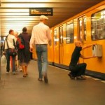
NYC subways are strange, dark and oft-overcrowded places where many people retreat into themselves and avoiding engagement, at least until these unusual (and invisible) creatures come along.

monsters-of-nyc

happy-snuggler

Artist Ben Rubin uses candid everyday photos of passengers as a canvass for an exotic cast of fictional characters that seem right at home in the public transit system of America’s largest city. His work is complex and detailed, but all rendered on a portable iPad device using the Procreate app.

creepy-subway-clown

sideways-glance

One could easily imagine that the off-putting noises and smells found on subway trains would be tied to such a strange set of monsters and aliens.

sitting-and-waiting

alien-maps

In some cases, they seem to intrude on those seated next to them. In others, they unobtrusively wait in stations for a ride or look at maps, apparently puzzled about getting from Manhattan to Brooklyn.

subway-tablet-game-player

too-big-for-transit

For the artist, these works started as a way to pass the time on the commute but have become a method of engaging and layering ideas onto photographs outside of the subway as well.

lonely-monster

spooky-eye

face-melting

creeper

Passengers engrossed in a book, listening to a podcast or zoned into a mobile phone game may not notice them, but these Subway Doodle creatures are there, at least in one man’s imagination. One has to wonder: if any of these really appeared, would the zombie humans around them even notice?

Share on Facebook


[ By WebUrbanist in Art & Drawing & Digital. ]

[ WebUrbanist | Archives | Galleries | Privacy | TOS ]


WebUrbanist

 
Comments Off on Monsters of New York: Creepy Critters Cuddle Strangers on City Subways

Posted in Creativity


Wayfinding in Subways: 3D Blueprints Show NYC Tunnel Systems

27 Sep

[ By WebUrbanist in Architecture & Cities & Urbanism. ]

nyc underground blueprint render

Inspired by detailed three-dimensional maps of Hong Kong subway stations, a New York artist has painstakingly documented and rendered a gorgeous series of helpful underground diagrams.

nyc subway 3d maps

Exiting a subway network can be a disorienting experience. While stair signage and sidewalk compasses can help, anyone navigating based on landmarks or other surface features is lost. Project Subway NYC by Candy Chan is a step in the right direction. Using pen, paper and a camera, she meticulously recorded directions and relative positions of tracks and lines, referring to Google and MTA resources as a baseline.

nyc complex subway navigation

She then took the results into AutoCAD, verified those drawings in person, and proceeded to model and render the results using Rhino, Adobe Illustrator and Photoshop to produce 3D maps. Her explorations have helped her identify pain points for navigating these multilevel stations.

nyc subway station map

From CityLab: “The first batch includes five stops along Broadway: Columbus Circle, Times Square, Herald Square, Madison Square, and Union Square. But Chan hopes to do more, in Manhattan as well as in the outer boroughs. Since the project just launched two weeks ago, she’s gauging people’s reactions to decide which stations to explore next.”

nyc track paths stairs

Still, 3D maps may not in themselves be a solution – murals, screens, signage or other indicators tied to visual landmarks from the world above would be a welcome addition for those who cannot read English or simply navigate using different means and methods.

Share on Facebook


[ By WebUrbanist in Architecture & Cities & Urbanism. ]

[ WebUrbanist | Archives | Galleries | Privacy | TOS ]


WebUrbanist

 
Comments Off on Wayfinding in Subways: 3D Blueprints Show NYC Tunnel Systems

Posted in Creativity


Stealth Style: Navigate Subways with a Map-Backed Necktie

31 Jan

[ By WebUrbanist in Design & Products & Packaging. ]

neck tie subway map

Putting loose ends to good use, this clever piece of street-smart apparel takes advantage of the usually-hidden flip side of your standard-shaped men’s tie.

necktie subway map japan

Savvy travelers know that there is no better way to look like a tourist than to pull out a map from your pocket or stare too long into your smartphone, hence this subtle and neutrally stylish alternative.

necktie map close up

necktie secret hidden map

Designed and sold by Rakuten in Japan, current available cities include Tokyo, Osaka and Kyoto. The dotted and striped, variously-colored ties cost 6,000 yen (around $ 70 USD) – not bad for a 100% silk map that doubles as business attire.

Share on Facebook


[ By WebUrbanist in Design & Products & Packaging. ]

[ WebUrbanist | Archives | Galleries | Privacy | TOS ]


WebUrbanist

 
Comments Off on Stealth Style: Navigate Subways with a Map-Backed Necktie

Posted in Creativity