RSS
 

Posts Tagged ‘Scotia’

Canadian Travelogue – Nova Scotia – Brier Island

12 Aug

Long Island and Brier Island, along with several much smaller uninhabited islands, form the archipelago that lies right at the tip of Digby Neck, a peninsula that juts into the Bay of Fundy. With a population hovering around 300 residents, Westport, Brier Island’s only village, cannot help but be relaxing. Consequently I recommend the village of Westport as one of the most relaxing three-day summer holiday destinations in Nova Scotia. There is only one access route to Brier Island: drive west on Highway 217 from Digby for about an hour, and two small ferry crossings.
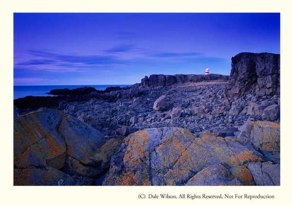
Brier Island, the outer-most island along Digby Neck, is essentially a comprised of lava-flow-formed basalt rock. While making a beauthiful coastline to photography, it is also brutal on scrapped knees.

Brier Island, the outer-most island along Digby Neck, is essentially comprised of lava-flow-formed basalt rock. While making a beauthiful coastline to photograph and enjoy, it is also brutal on scrapped knees.

There are countless photo opportunities, including rare flora, numerous shore and seabird species (Brier Island is located on the Atlantic Flyway, and autumn is the best season for bird-watching) and spectacular seascape opportunities wherever you choose to “drop” your tripod.  Brier Island juts into the lower Bay of Fundy, and the waters surrounding it are the summer home of the nearly extinct Atlantic Right Whale. Endangered humpback whales are also regularly seen in these waters, as are finback and Minke whales and the Atlantic white-sided dolphin.

One of my favourite locations on Brier Island is a stretch of basalt columnar formations along the east and south-east shorelines. Simply park your car at the lot at the end of the road and walk south toward the small monument that profiles the seafaring heroics of Joshua Slocum, the first sailor to circumnavigate the world solo. Really good hiking books are essential here as you will be scampering along a fairly rugged shoreline. Be careful of the slippery seaweed and the tide: you will have great difficulty out-running the rising water if you’re caught where you shouldn’t be.

One of the quirkiest sights in all of Nova Scotia is the “Balancing Rock.”  Near the village of Tiverton on Long Island, this precariously perched piece of basalt stands nearly seven metres high and looks as a good wind would blow it off its precarious perch.  Not so. It’s easy to find, just look for the roadside sign several kilometres west of the Tiverton or ask any local resident.

I first discovered the Balancing Rock in 1991 when working on an editorial assignment and immediately saw its photographic potential. Getting close to it then was quite a chore, but I am pleased to report that a boardwalk now makes crossing the bogs and fens much easier and a really convenient stairway with an observation deck has replaced the knotted hawser once tangling over the cliff edge.  It is about a 30-minute trek from Highway 217 and is most definitely a sunrise location.
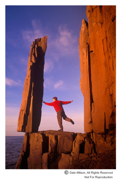
Precariously perched on a ledge above St. Mary's Bay, local folklore indicates three lobster boats once tried to pull over this rock in unison - unsuccessfully, apparently.  The Balancing Rock can now only be photographed from a viewing platform, so it is highly unlikely you will find any fairies testing their strength.

Precariously perched on a ledge above St. Mary’s Bay, local folklore indicates three lobster boats once tried to pull over this rock in unison – unsuccessfully, apparently. The Balancing Rock can now only be photographed from a viewing platform, so it is highly unlikely you will find any fairies testing their strength.

Welcome to this great little archipelago jutting like a finger into the Bay of Fundy and be prepared for many great days of therapeutic relaxing while gulls screech in this working harbour and the smell of salt wafts through the air.  Your watch won’t be wound quite so tight when you leave – I guarantee it.

Post originally from: Digital Photography Tips.

Check out our more Photography Tips at Photography Tips for Beginners, Portrait Photography Tips and Wedding Photography Tips.

Canadian Travelogue – Nova Scotia – Brier Island

Digital Photography School

 
Comments Off on Canadian Travelogue – Nova Scotia – Brier Island
Posted in Photography


Canadian Travelogue – Nova Scotia – Peggy’s Cove

07 Aug

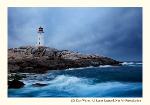
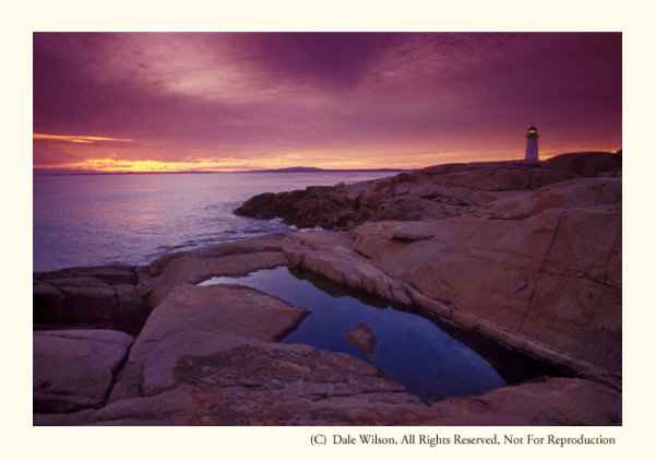
No location in Canada’s Ocean Playground is more quintessentially Nova Scotian than Peggy’s Cove. It’s all there: a lighthouse, pounding surf on large granite outcroppings and a tranquil working fishing community. And it’s only 50 kilometres from Halifax, the largest city in Atlantic Canada.

Early spring is a great time to photograph one of the most photographed lighthouses in the world, should you want images without people in the picture

Early spring is a great time to photograph one of the most photographed lighthouses in the world, should you want images without people in the picture

The only land route to Peggy’s Cove is Highway 333, starting at Armdale, and then routes along to coast and eventually joins Highway 103 at Upper Tantallon to the west. You then turn right onto Highway 103 and drive east back to the western reaches of Halifax at Bayers Lake. The coastal drive from Armdale to Peggy’s Cove along Route 333 is by far the most scenic and interesting, offering may little side trips to the not too distant shoreline and coastal communities.  You will have no difficulty locating Peggy’s Cove itself: it’s one of the top tourist destinations in all of Canada, so road signage is abundant.

Photographers who desire images of the lighthouse without people milling about will have their patience taxed to the limit. The task will be almost impossible in the peak tourist season of July and August, and just plain difficult at any other time of the year … except maybe the coldest days of winter. I find April is a good time as most of the snow will have melted and it is still too early for people to be thinking about visiting this Atlantic sentinel. Additionally, what little foliage there is will still be brown and this is typically a good month for storm clouds that create interesting and supportive notions of why a lighthouse is there in the first place.

The best approach to photograph the village and the lighthouse is to arrive in early morning and “play tourist,” making pictures as you meander around the harbour. You can easily spend several hours just following your nose, and there is a large restaurant on site for that moment when the light gets too harsh. Make sure to re-visit in the evening –after a noon-day nap, of course—and leave yourself lots of time to find the perfect location to get the classic lighthouse-against-the-sunset photograph.  Should you stake out a vantage point on the south side of the lighthouse there is a better chance you will be able to eliminate people from the image with creative camera positioning and sight angles. From a low elevation the camera’s line of sight will be just over the heads of the tourists who sit on the rocks enjoying the last rays of the day.  The other classic view is from the water’s edge just to the north of the little cove in front of the lighthouse itself, immediately below the restaurant. Be aware, from here you will almost be guaranteed there will be people in your picture.

By staying to the south of the light, it is possible to keep the camera low and avoid people from creeping into the frame. Challenge yourself to look for creative images as well as portaits of the light.

By staying to the south of the light, it is possible to keep the camera low and avoid people from creeping into the frame. Challenge yourself to look for creative images as well as portaits of the light.

When travelling along the shoreline anywhere in Atlantic Canada, but especially so in Peggy’s Cove, be astutely aware of your surroundings, rogue waves are common and have called unwary visitors to the depths to dwell with King Neptune. So, please, be careful and mindful of the signage; if those rocks are black or wet you are too close to the water’s edge. The Atlantic Ocean is huge and powerful, and its combers deserve, and demand, your respect.

Now get out there and enjoy one of the most photogenic places in all of Nova Scotia, and Canada. You won’t be disappointed.

Post originally from: Digital Photography Tips.

Check out our more Photography Tips at Photography Tips for Beginners, Portrait Photography Tips and Wedding Photography Tips.

Canadian Travelogue – Nova Scotia – Peggy’s Cove


Digital Photography School

 
Comments Off on Canadian Travelogue – Nova Scotia – Peggy’s Cove

Posted in Photography


Canadian Travelogue: Nova Scotia – Cape Breton Highlands National Park

21 Jul

The autumn foliage of Cape Breton Highlands National Park offers a more exciting colour palette than anywhere else in Canada, and quite possibly in North America.

The best time to visit is immediately after Thanksgiving weekend in October. The holiday weekend itself can be nightmarish, with hordes of people and endless lines of tour buses. Restaurants are filled to capacity and accommodations are hard to find unless you have made reservations well in advance. On the Monday immediately following the holiday weekend, you will pretty much have the entire Highlands region and the National Park to yourself.

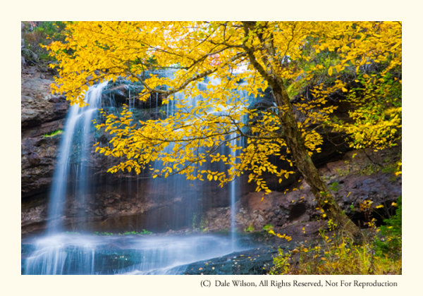
Beulach Ban Falls in the 2nd week of October.

Beulach Ban Falls in the 2nd week of October.

The park is enclosed by the northern section of the famed 300Km long Cabot Trail, a loop of highway that starts and ends at Baddeck. I prefer to enter the Park at the western terminus, near the Acadian village of Cheticamp, and tour the park in a by driving in a clockwise direction along the Cabot Trail.

For those who enjoy American history, the original residents of Cheticamp are repatriated families who had previously been extradited to the United States during the Great Expulsion (Le Grand Dérangement) of 1755.  The word Cajun, which is a common term used to identify the French residents of Louisiana, for example, is actually an anglicized mispronunciation of the French word Acadien. This is a topic for another day, but Cheticamp is a fabulous place to base a few days and listen to the residents speak a very unique and distinct dialect of French and English languages.

One cannot leave the Cape Breton without the classic Cabot Trail photo, and the opportunity comes early in the trip. Park your car at the Cap Rouge pull-off and look southwest back toward the village of Cheticamp – you will instantly recognize the view and potential for a great post card picture. This is an afternoon shot, unless you are looking for a photographic challenge. A sunset photo from this location can be breathtaking, but it can also be difficult to pull-off. The sun will be slight to the right-centre of the frame so you will most likely have to contend with lens flare, and make your images thinking of a final HDR treatment.

Two particular locations in the park that call me back each year are Mary Ann Falls and Beulach Ban Falls. Beulach Ban Falls is at the eastern base of North Mountain, near the most northerly point on the Cabot Trail. It is reached by way of a gravel laneway that passes a warden’s cabin, on the opposite side of the road from the Big Intervale Campground. About 2 kilometres on this gravel laneway will get you to a small picnic park, and to the base of the falls. You should hear the falls from the parking lot. As with any waterfall, the option to include the entire waterfall, or selective portions, is an entirely personal choice – let the muses direct your creativity.

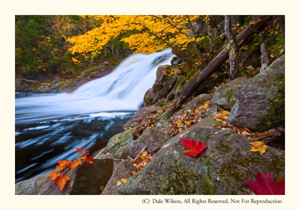
Mary Ann Falls in 2nd week of October. Yes, I placed the leaves; however, I later heard a photographer swear up and down that those leaves in his picture were exactly as he found them!

Mary Ann Falls in 2nd week of October. Yes, I placed the leaves; however, I later heard a photographer swear up and down that those leaves in his picture were exactly as he found them!

On the Park’s eastern limits, and about a 5 kilometre drive west from the town of Ingonish, you will come to a gravel road leading inland to the Marrach Group Campground. Continue along this road, following the signs to Mary Ann Falls, for about 7 kilometres until you come to a gated wooden bridge – Mary Ann Falls is immediately to your right, or downstream.

Successful images can be made at several vantage points, but the weather will often decide your ideal location along this relatively small but photogenic waterfall. Like most watercourses, the ideal time to make photographs at either Mary Ann Falls or Beulach Ban Falls is during a light drizzle or with overcast skies, thus lowering the overall contrast. Shutter speeds below 1/15th of a second should produce the often sought after “bridal veil” effect, suggesting water movement.

There are many other locations in Cape Breton Highlands National Park that deserve your attention: there is a fantastic panoramic image looking up MacKenzie River from a pull-off near the top of MacKenzie Mountain, the Coastal Trail offers some really unique Jack Pine stands (an uncommon tree in Cape Breton) as well as several vantage points for great views along the Gulf of St. Lawrence shoreline, and a really easy hike among the hardwoods of the Lone Shieling Trail.

As with most national parks, there is much to offer and explore. You simply have to allow yourself the time and flexibility to maximize your efforts in this park due to its maritime environment – if you don’t like the weather, wait an hour.

The Highlands of Cape Breton, in autumn, is a world-class destination. Plan to spend at least four days to appreciate its splendour.

Post originally from: Digital Photography Tips.

Check out our more Photography Tips at Photography Tips for Beginners, Portrait Photography Tips and Wedding Photography Tips.

Canadian Travelogue: Nova Scotia – Cape Breton Highlands National Park


Digital Photography School

 
Comments Off on Canadian Travelogue: Nova Scotia – Cape Breton Highlands National Park

Posted in Photography


Rock Crawling Nova Scotia Valley Crawl Part 3

23 Sep

The Valley Crawl is an annual event held on private land in the Annapolis Valley, Nova Scotia Canada.
Video Rating: 5 / 5

Vignettes are those fancy pants gradients around the edges of the frame in hipsters photographs. They make you look cool and like you know what you’re doing. So let’s fake that in post! There are 3 simple Vignette methods: 1. Using a solid layer and mask 2. Using a Shape layer and a fill 2.a. Calling someone else to do it for you 3. Using a solid layer and the circle effect I’m sure there are other less simple ways but I think you’ll like these ones. I know I sure do because I use them all the time. I hope you enjoy my terrible instructions on how to make these things happen and if you have any questions just leave them in the comments and I would love to help you out! Connect with me on the Internets? evanabrams.com http www.tumblr.com flickr.com plus.google.com