RSS
 

Posts Tagged ‘Rome’

LEGO at Large: Modern Block Vehicles Hit the Historic Streets of Rome

11 Nov

[ By WebUrbanist in Art & Photography & Video. ]

block-car

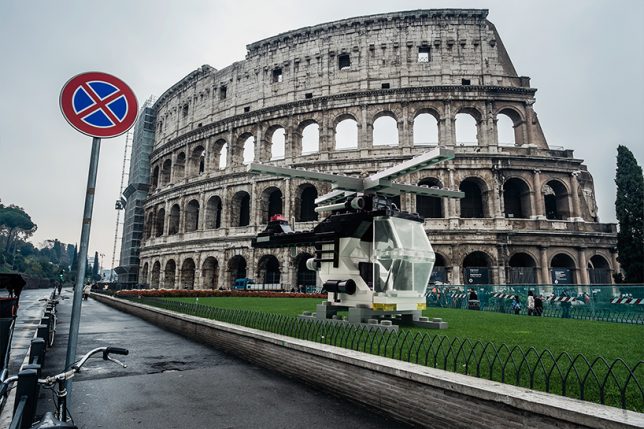
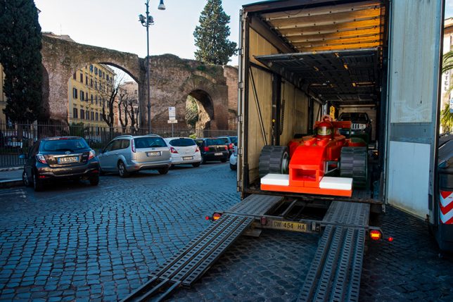
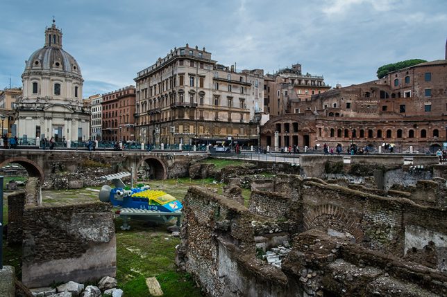
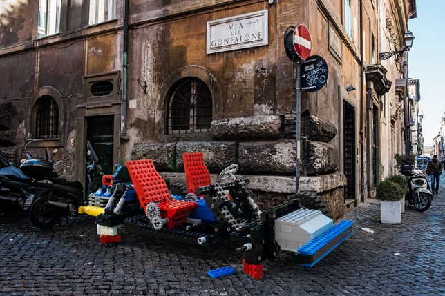
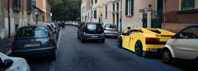
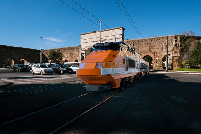
A sports car parked in a residential alley, train emerging from a tunnel and helicopter landing next to the Colosseum are all believable sights in Italy’s capital … except in this case they are constructed from LEGO.

lego-train-tracks-tunnel

lego-landing-helicopter

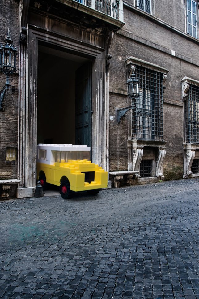
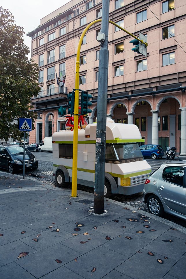
Italian photographer Domenico Franco imagines these block-built vehicles at human scale in his series LEGO Outside LEGOLAND, masterfully faked scenes of photo-realistic quality.

lego-race-car-unloading

lego-large-in-rome

In his series, normal conveyances are swapped with LEGO creations that stand out as simplified block forms against the rich historical fabric of Rome.

lego-parked-speeder

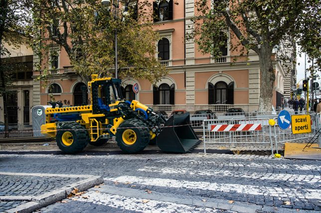
lego-construction-vehicle

While some are clearly toys writ large, others are more convincing: a passing glance at a tractor trailer doing road work might not immediately belie its fictional origins.

lego-car-tight

Landmark buildings and aged cobblestone roads come alive thanks to the contrast created by intervening toys. Ordinary gray-blue weather and aged architecture seems even more real than in a normal photograph.

lego-ambulance-parked

“The aim is to transform ordinary contexts in extraordinary ones,” says the artist, “thus compelling the toys to get out of the idyllic and politically correct landscapes belonging to their perfect and idealistic cities, with the result of instilling in them those vices, virtues and desires typical of human beings.”

Share on Facebook


[ By WebUrbanist in Art & Photography & Video. ]

[ WebUrbanist | Archives | Galleries | Privacy | TOS ]


WebUrbanist

 
Comments Off on LEGO at Large: Modern Block Vehicles Hit the Historic Streets of Rome

Posted in Creativity


Nolli App of Rome: Use a Classic Map as a Modern Travel Guide

29 Jun

[ By WebUrbanist in Destinations & Sights & Travel. ]
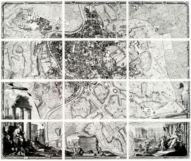
nolli map complete panels

The Nolli Map of Rome is one of history’s most famous works of cartography, and now a new iPhone and iPad app lets you use it to navigate in realtime, helping you both lose and find yourself in one of Europe’s most marvelous ancient cities.

nolli app of rome

Finished in 1748 after 12 years of research  by Italian architect and surveyor Giambattista Nolli, this innovative map represented a novel approach to figure-ground representation. Streets and open public spaces were, for instance, predictably depicted as voids against a backdrop of solid hashes, but so to were enclosed civic spaces like the Pantheon.
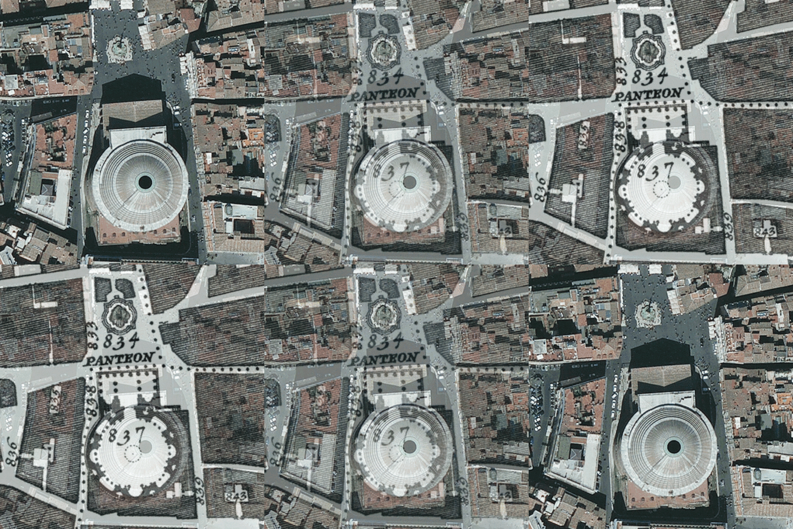
nollithennow

The original engraved city map consisted of 12 copper plates spanning 40 square feet, and, at the time, was the most accurate representation of the city to date. Honoring that tradition, this digital experience replicates many original features and details from the vintage original.
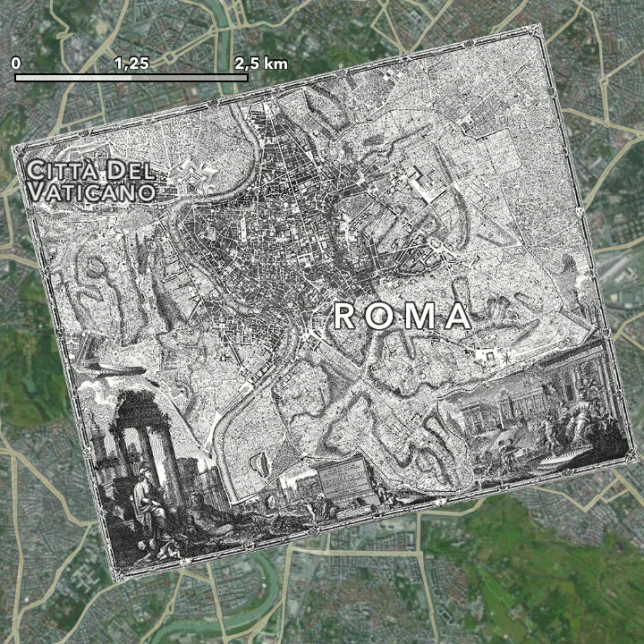
nolli versus modern rome

So why would you want to tour modern Rome with a centuries-old map? Its creator, Martin Koppenhöfer, explains that “despite its age, this map is still very valid for most parts of the Roman center.” He also notes that “it is quite entertaining to find your way with this app. Pedestrian navigation is very different … you don’t have to know every street or turn, just go into the right direction.”
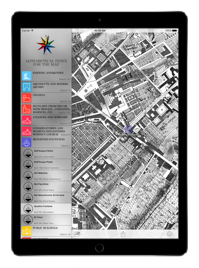
index of rome

Think of it as part walking tour, part adventure and part historical education. Using an old map to navigate a city lets you find things that might have otherwise escaped your attention. It also allows you to distinguish between more permanent fixtures of the historic built environment and more contemporary changes and additions. If you lack a compatible device for the app, you can also check out an online interactive (but less mobile) version of this iconic map.
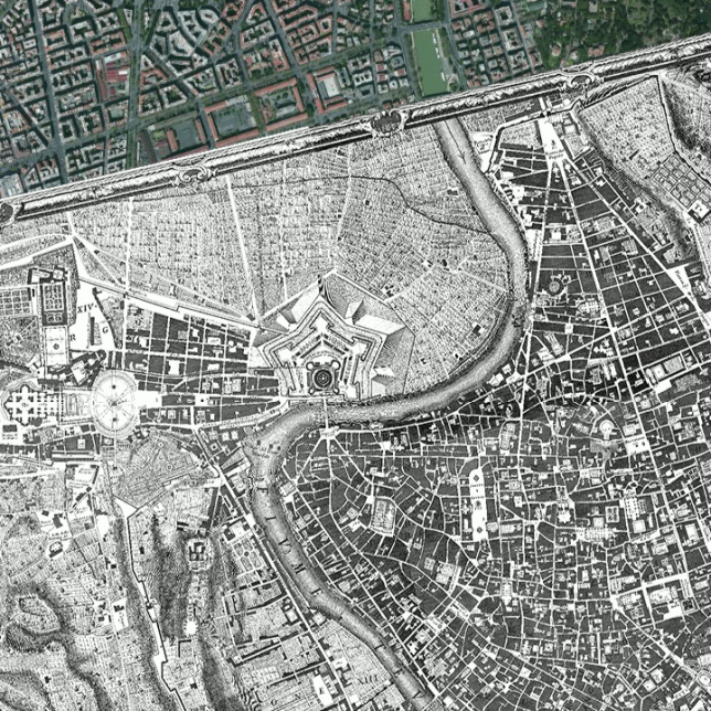
nolli zoomed overlay

“In designing the present edition,” Koppenhöfer elaborated in and interview with WebUrbanist, “we have spent great care with the aim to be as close to the original as possible regarding the labeling and the structure of the directories. Therefore the app reproduces in the indices on the left side of the map exactly those types in the exact order and (to the contemporary reader occasionally appearing outmoded) notation as provided by Giambattista Nolli in his indices. By selecting an entry you will be led to the corresponding location on the map. You can also browse by tapping on one of the numbers on the map to see what it is about.”
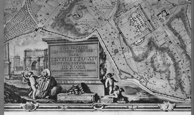
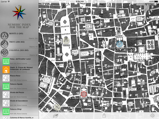
nolli map historical view

nolli indexed mpa closeup

The original version is meticulously adhered to, providing an updated digital experience while maintaining original notes and styles. “The explanations of the signatures and line styles,” says Koppenhöfer, and “hatches and selected abbreviations are reproduced in their original form (see “Legend”). You can access Nolli’s original spelling of the indices, legend, and other signs at the bottom of the English version in Italian language.”

Share on Facebook


[ By WebUrbanist in Destinations & Sights & Travel. ]

[ WebUrbanist | Archives | Galleries | Privacy | TOS ]


WebUrbanist
 
Comments Off on Nolli App of Rome: Use a Classic Map as a Modern Travel Guide

Posted in Creativity


All Roads Really Lead to Rome: City-Centric Arterial Renderings

06 Jan

[ By WebUrbanist in Art & Drawing & Digital. ]

all roads lead rome

During the lead up to the invasion of Iraq, a German newspaper published step-by-step driving directions from Berlin to Baghdad, highlighting the interconnectivity of contiguous European and Middle Eastern land masses.

roads to rome map

This series of maps from Moovel Lab highlights similar phenomena, starting with a map that shows the truth of an old aphorism about all roads leading to Rome. Ancient Romans created an estimated 50,000 miles of road across Europe, Asia and Africa, with their coastal Italian capital as the origin point.

all roads 10 cities

Next, they moved on to 10 major cities in the United States, analyzing how regional traffic flowed into each, before going through a full analysis of fastest routes to state capitals. The results were surprisingly varied: “Remarkable are the different road networks throughout the States. While the east coast seems to rely on roads parallel to the coast. The rockies and appalachian mountains reveal their topography with their curvy roads containing some blank spots not reached by any road. While the mid west of the USA show long straight road networks in rectangular alignment.”

roads us capitals map

Their process is relatively intuitive. The mapmakers overlaid a grid on existing open-source maps, then added a query: how would one get from here to Rome (or other cities)? The results have been turned into maps that look almost like a study of the human vascular system, with small veins feeding larger arteries along the path to the hub point. “The outcome of this project is somewhere between information visualisation and data art, unveiling mobility and a very large scale. View and interactively explore all roads to rome and other cities.”

Share on Facebook


[ By WebUrbanist in Art & Drawing & Digital. ]

[ WebUrbanist | Archives | Galleries | Privacy | TOS ]


WebUrbanist
 
Comments Off on All Roads Really Lead to Rome: City-Centric Arterial Renderings

Posted in Creativity


Swimwear by Rome Wilkerson Behind The Scenes

22 Sep

Houston professional photography a day at the studio testing for flawless entertainment’s 2010 calender

 
Comments Off on Swimwear by Rome Wilkerson Behind The Scenes

Posted in Nikon Videos