Confluence of two Grizzly Creeks 10 miles SW of Walden, CO – the beginning of the North Platte River
North Platte River is one of my favorite paddling destinations. Usually, I paddle various flatwater river sections in Wyoming above and below Saratoga. However, there is a 45 mile long river stretch in Colorado’s North Park before the North Platte enters the Northgate Canyon.
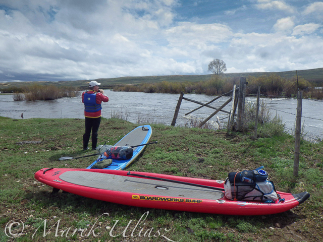
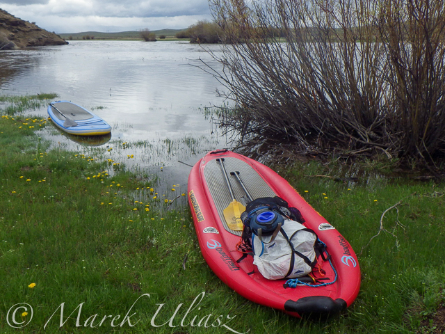
After some fall and winter scouting and a lot of time spent on Google maps, the exploration of the upper North Platte River finally took place during the Memorial Day weekend. Rob Bean joined me to paddle our inflatable Bordwarks SUPs: Shubu and Badfish.
Upper North Platte River on Google maps with some waypoints for access points and diversion dams.
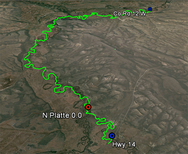
14 miles of the upper North Platte River near Walden with the river beginning
as a confluence of Grizzly Creek and Little Grizzly Creek
May 24, 2014
Put-in: Grizzly Creek at highway 14, 10 miles south of Walden (not much room for off road parking)
Take-off: Co road 12 W, 8 miles west of Walden (official fishing access, parking near bridge, another fishing access with parking ~0.5 mile below the bridge).
GPS milege: 13.8 miles, time: 2:50 hours.
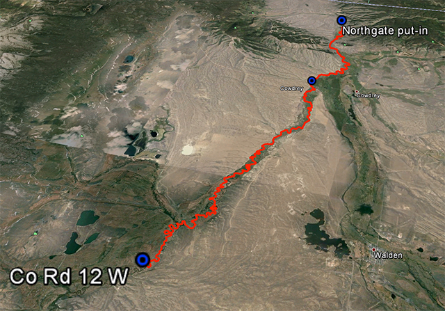
31 miles of the North Platte River from Walden to the Northgate Canyon put-in
May 25, 2014
Put-in: Co road 12 W
Take-off: put-in for the Northgate Canyon run, 9 miles north of Cowdrey
Alternative put-in for a short 6 miles run: Co Rd 6, 2 miles west of Cowdrey (that run is described in Paddling Colorado book by Dunbar Hardy).
GPS milege: 31 miles, time: 6:49 hours.
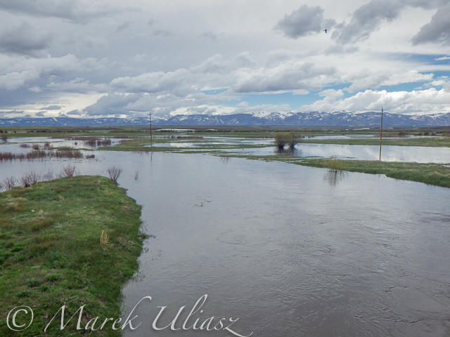
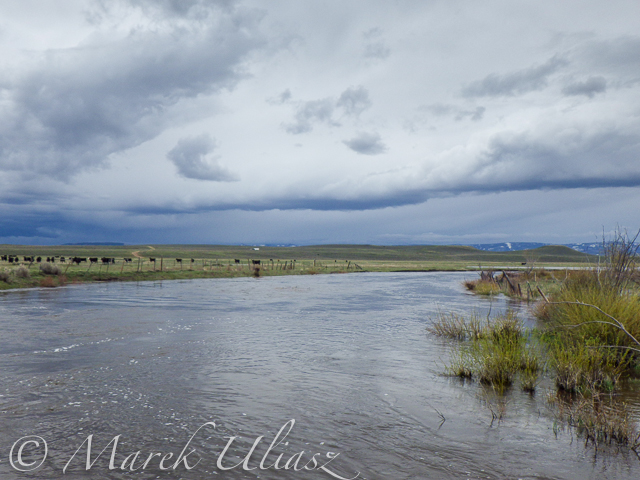
River flow was rising from 3000 to 4000 cfs at Northgate during our two days of paddling. A lot of meadows in the river valley were flooded. Paddling speed: up to 9 mph.
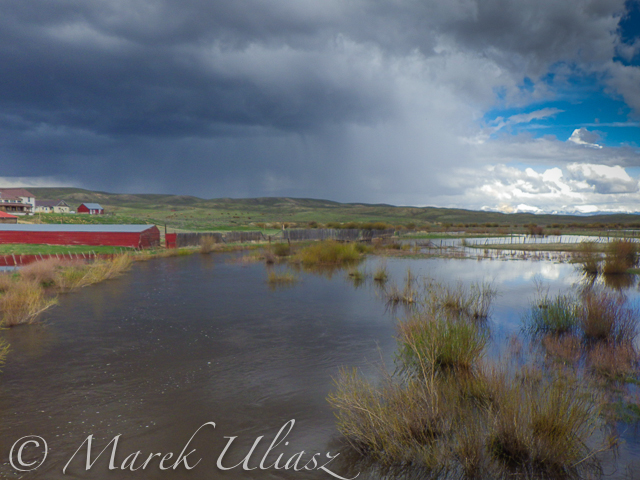
The weather was challenging. We had a lot of thunderstorms around us during the first day followed by ~8 hours of heavy rain. We were lucky to finished our paddling before the rain. A beautiful weather on second day lasted till noon, then we experienced a storm with a small hail followed by heavy rain for the rest of the day. Strong afternoon headwinds put us on our knees, especially, during the second day.
Obstacles: diversion dams, fences across the river, low bridges depending a water level. No trees. No rapids (except dams). The river is wide and open, so you can see or hear all incoming obstacles well in advance. We never run into any troubles.
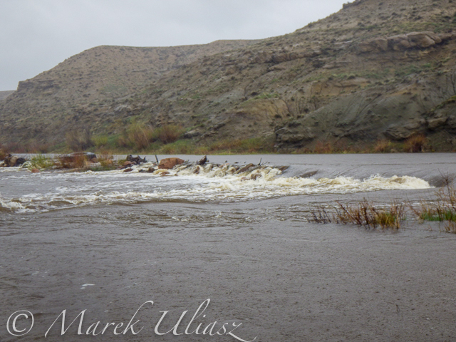
Most of the dams can be seen on satellite pictures. The dam a few miles below Co road 12 W is pretty big and always requires portaging (not comfortable on right). Other dams are primitive rock dams and often can be run. We portaged most of them to avoid big waves, but I would run more of them in a canoe. We managed to paddle around a few of them. It is easier to select a correct river arm on a map than in practice on the river.
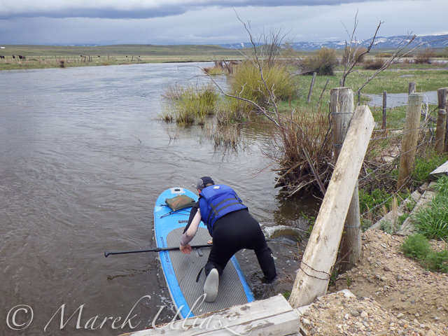
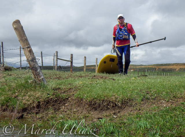
We had to portage numerous barbed wire fences crossing the river. Some were in water and could be safely run over in a canoe, but we played safe in out inflatable SUPs. A few fences had only a single wire across the river and was possible to paddle under them. Always watch for these fences! You can notice stronger and taller posts on the shores and, sometimes, stairs over them, before seeing the actual wires over the river.
One or two low farm bridges in the upper section required portaging. All bridges in the lower section have a high clearance.
Wildlife: moose, bighorn, deer, elk (a herd was swimming across the river several times just in front of us), bald and gold eagles, pelicans, geese and other waterfowl, numerous smaller birds, curious cows.
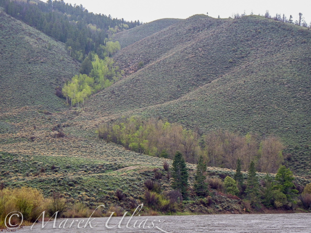
Scenery: a wide valley surrounded by snowy mountains, crazy river meanders in the upper section, cliffs and rock outcroppings, just a few trees (often with eagle nest), higher hills with some forest in the lower section, a lot of water flowing around and flooding meadows, but, usually, not difficult to find a dry place to land.
Grizzly Creek looking upstream from highway 14
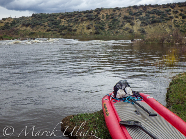
Grizzly Creek looking downstream from highway 14 – start of our adventure
North Platte River meandering near Walden
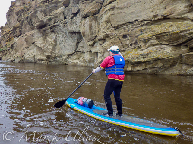
One of high cliffs
Going over a low farm bridge
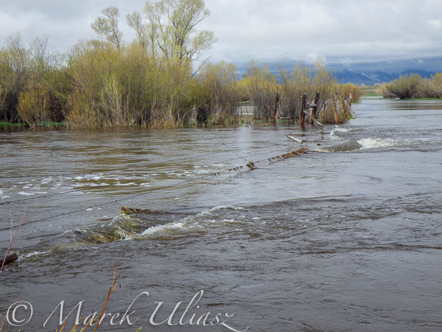
One of diversion dams
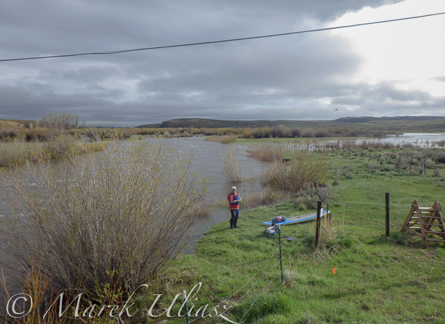
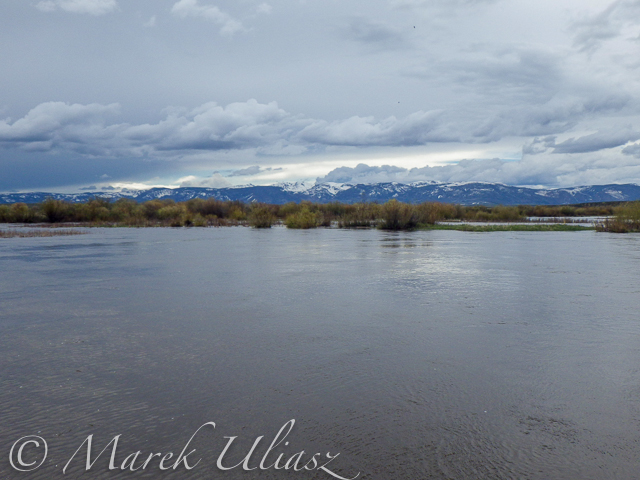
North Platte River at Co Rd 12 W near Walden – the finish of day 1 and the start of day 2
Barbed wire fence across the river
Another fence across the river
And another cattle fence to portage
Lunch break – last minutes of nice weather
Hail storm over diversion dam
The last river section between Cowdrey and Northgate

Finishing in rain at the Northgate

The last look at the river – still raining
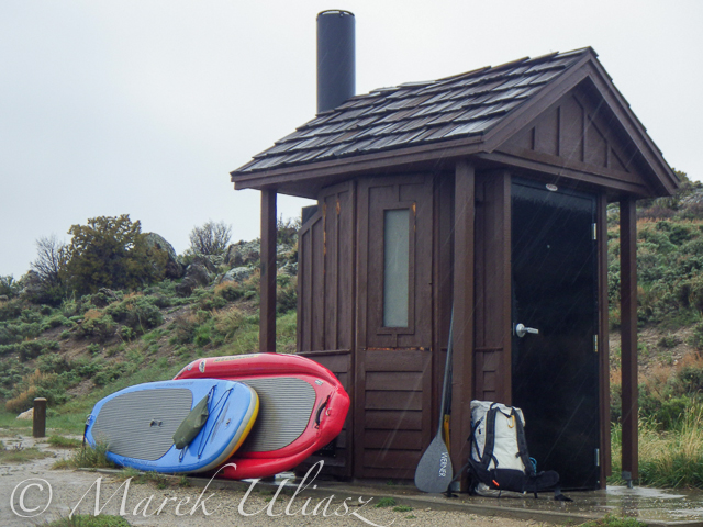
Ready to go home …
All pictures were shot with my current paddling camera on duty – Pentax Optio WG-2. I have been using waterproof Pentax Optio cameras for paddling and other outdoor activities since their first original model was released in 2005. The newest model from that series is available now as Ricoh WG-4.
Your browser does not support iFrame.
Related posts:
– North Platte River in Colorado above Northgate Canyon
– Sun, Snow and Wind on the North Platte River in Wyoming
– Bennett Peak to Pick Bridge on the North Platte River, Wyoming

paddling with a camera


You must be logged in to post a comment.