RSS
 

Posts Tagged ‘Miles’

Wet plate photographer shoots portrait of subject 4000 miles away via Zoom

08 Apr

Life is difficult when you are a portrait photographer and social distancing restrictions prevent face-to-face meetings with anyone beyond the people you live with. Not one to let a global virus pandemic get in the way of a good picture, Shane Balkowitsch combined modern and ancient technology to create a wet-plate photograph of a friend who was almost 4000 miles away using video-conferencing application Zoom. From his studio in Bismarck, North Dakota, Shane photographed Morgan Barbour in London, England, as she streamed video of herself to his computer screen – which he photographed using a 10x8in large format camera with a wet collodion plate loaded in the back.

Morgan in the Zoom video conference on Shane’s screen

Shane tells DPReview that the idea came about when Morgan asked him to make a wet plate image of her. He was going to copy a previous print he had made of her, but having just been introduced to video conferencing the week before it occurred to him that he could make the picture ‘live’ using the computer screen. He sent instructions to Morgan about how she could set up the lighting in her house to create a silhouette and they had a conference call to make the shot.

‘I’d never shot this way before’ Shane explained ‘and I didn’t know what to expect, so I decided that instead of trying to capture a “well lit” portrait we could go for a silhouette. It would take us back to when photography was first invented and the very simple, honest photographs of 180 years ago when photographers were just trying to get any proof of the photograph.’

‘The two plates we made are rather lovely in their simplicity and mood. Our first attempt, which is now known as “A Distance Exposure In Isolation”, is the better of the two. The light reflecting off her upper body adds just the right degree of femininity for me.

Shane tells us that he would usually expect an exposure of ten seconds for his wet plate portraits but this one needed Morgan to remain still while he counted down a full minute.
‘I wasn’t sure how the image on the screen would come out, or if it would come out at all. The wet plate process relies on ultraviolet light to make the exposure, and I didn’t know whether there would be some sort of UV filter on the monitor to protect users’ eyes. Fortunately, however, that turned out not to be the case. It still needed six times the usual exposure to activate the silver on the plate though, and that was for a backlit silhouette. If I’d wanted to get detail in her face I’d probably need two to three minutes.’

Shane says he is stunned by the mixture of technologies that exist 170 years apart, and how the light traveled from Hampstead in London to his Bismarck studio 3961 miles away. ‘There’s no truth in the light I recorded!’ he exclaims. ‘It has been transfigured and translated so many times. It passed through the background in Morgan’s house to reach her phone, where it was converted into zeros and ones to travel across the globe via the internet before reaching my screen. Here it was turned back into light again before passing through my lens and on to the plate. It’s amazing.’

The final image – note the cursor in the top left corner. A sure clue to the mix of technologies

To avoid capturing the texture of the screen Shane says he focused on the outline of Morgan’s lips and nose, and then pulled the focus back a little to blur the pixels of the screen and to create a softer feel to the picture. ‘I didn’t know if I’d get reflections off the screen too, but they don’t seem to show in the picture. There was an odd mark on the plate that I noticed as the image developed. I didn’t know what it was at first, but when I came to remove it I realized it is the arrow cursor from my computer left in the picture area by mistake. Kinda funny!’

Shane’s darkroom, where he sensitizes and develops his plates

Shane will have the chance to practice the process once again this Friday as a model from New York has contacted him since seeing the pictures of Morgan to have her portrait taken. ‘We’ll see what we can come up with. We just got off the phone together, we have never met but she has wanted to have her portrait taken by me for some time.’
Shane says ‘If we ask ourselves, “why would you even attempt this?” the answer is simple – out of necessity. I am usually booked 7-8 months ahead for my Friday sessions in my natural light wet plate studio, but right now I’m having to cancel all those sittings. Now I can shoot remotely. Take that Coronavirus! You think you can stop us from creating? I think not.’

Self-portrait with one of his wet plate cameras

Below you can see the video of the conference call during which Shane made the picture, which also shows the process of sensitising the plate and developing it after the exposure. You can see more of Shane’s wet plate work on Instagram and on his website.

Shane may be the first to shoot a wet plate image directly from a live subject on computer screen, but Robert Matheson used a similar process to record portraits from a live image projected onto a wet plate during the interview below.

Articles: Digital Photography Review (dpreview.com)

 
Comments Off on Wet plate photographer shoots portrait of subject 4000 miles away via Zoom

Posted in Uncategorized


Chinese camera cuts through smog to record details almost 30 miles away

15 May
In this illustration (a) shows the distance between the camera and the target on a map of Shanghai, and (b) shows what the target building actually looks like. Image (c) is the view of the target through the smog of the city, while (d), (e) and (f) show earlier technologies attempting to record the target. Image (g) is the result of the researcher’s improvements

Researchers in China have created a camera that can record through the atmospheric pollutants of Shanghai to pick out objects just 60cm (2ft) high at a distance of 45 kilometers (28 miles). The ‘camera’ uses laser technology to fire light of a specific wavelength at a distant object and then uses a sensor to record the light when it returns so it can produce a picture that shows shapes with some distance information.

The project is being carried out by scientists at the University of Science and Technology of China in Shanghai, who have so far been able to record the form of a distant building with enough resolution to show the windows. The picture is technically a photograph, but not quite as we would expect to record with a normal visible light camera. The idea of the research is to produce an instrument that can ‘see’ further than is possible using visible light, and to be able to see in conditions visible light can’t get through.

At top left you can see the actual set-up of the LiDAR camera mounted inside the telescope, while the diagram top right shows what’s going on inside.

The scientists mounted a LiDAR (Light Detection And Ranging) camera inside a Cassegrain mirrored telescope and fired a near-infared (1550nm) beam from the top of a building on Chongming Island in Shanghai towards the K11 skyscraper 45km away in the centre of the city. As the scientists knew the distance and the speed of the light they were using they were able to calculate when it would return and thus isolate the image forming light from any other stray light in the scene.

An illustration showing how different methods of image extraction can be used to yield a more detailed image.

The quality of the image recorded is hardly going to serve for holiday pictures, but outlines, shapes and forms can easily be seen even when the atmosphere was too thick for visible light. The technology will be useful for seeing when we can’t see – through clouds, atmospheric haze and smog and for security surveillance.

This shows how the researchers are using distance information from the LiDAR to create depth maps of scenes that can hardly be seen with the naked eye

The researchers say they can improve the resolution and the range of their invention, and that they will be able to create 3D images in the future. Already with the range defining abilities of the LiDAR system they can incorporate depth and distance information into their images.

You can read the research paper as a PDF online.

Articles: Digital Photography Review (dpreview.com)

 
Comments Off on Chinese camera cuts through smog to record details almost 30 miles away

Posted in Uncategorized


NASA’s OSIRIS-REx spacecraft captures image of Earth from 71 million miles away

18 Jan

NASA’s OSIRIS-REx spacecraft, which achieved a record orbit at asteroid Bennu earlier this month, has returned an image that, at first glance, is unremarkable. The photo, below, features two bright dots — the larger one on the right is Bennu, and the smaller one on the left is Earth and the moon as seen from a distance of 114 million kilometers / 71 million miles.

The image was captured by OSIRIS-REx’s black and white NavCam1 camera on December 19, 2018, according to the Bennu mission website. The asteroid’s brightness is due to the image’s five second exposure time, which was long enough to make both the Earth and moon visible.

Photo provided by NASA

The OSIRIS-REx probe has been tasked with exploring Bennu, a large asteroid located around 70 million miles from Earth. On December 31, OSIRIS-REx became the first spacecraft to successfully orbit an object as small as Bennu, where it will remain before briefly touching down in 2020 to acquire a small sample.

The spacecraft has returned a number of images to its team on Earth, including close-up shots of the asteroid’s rocky surface. The latest image joins the iconic Pale Blue Dot photo as a rare example of space photography that puts Earth’s tiny place in the universe into perspective. Future images from OSIRIS-REx will be shared in the mission’s Gallery.

Articles: Digital Photography Review (dpreview.com)

 
Comments Off on NASA’s OSIRIS-REx spacecraft captures image of Earth from 71 million miles away

Posted in Uncategorized


East Coast Greenway: Longest Bike Trail in US to Span 2,900 Miles

30 Dec

[ By WebUrbanist in Destinations & Sights & Travel. ]

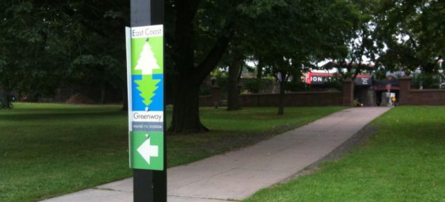
east coast greenway

The East Coast Greenway is already a third of the way to completion, and when finished will stretch from Calais, Maine, to Key West, Florida, passing through 16 states and 25 cities along the way.

ecg

Developed by the non-profit East Coast Greenway Alliance, the aim is to provide a continuous and ever-changing set of views and experiences to travelers on foot or in non-motorized vehicles.

east coast trail

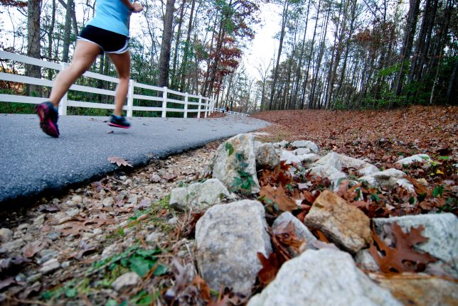
Its creators note that the “route has been chosen to provide the traveler with an ever-changing, interesting and scenic landscape, whether urban, suburban, small town, industrial or rural,” accessible to cyclists, walkers, joggers and runners. Along the way, the Greenway also syncs up with public transportation at key spots, allowing easy access and egress for people seeking to pursue one stretch of it or another.

“It’s about seeing America at the right speed, where you can take in all of the culture around you. And you don’t have a windshield between yourself and the community.” While the project has been in the works for years, new funding and permissions gained in the last year have propelled it forward more quickly, helping its facilitators connect the dots along the nearly 3,000-mile route.

Share on Facebook


[ By WebUrbanist in Destinations & Sights & Travel. ]

[ WebUrbanist | Archives | Galleries | Privacy | TOS ]


WebUrbanist

 
Comments Off on East Coast Greenway: Longest Bike Trail in US to Span 2,900 Miles

Posted in Creativity


10 Winter Miles of Stand Up Paddling on South Platte River

09 Jan

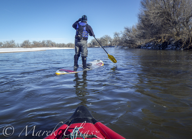
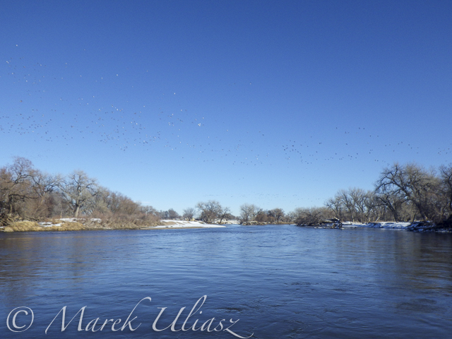
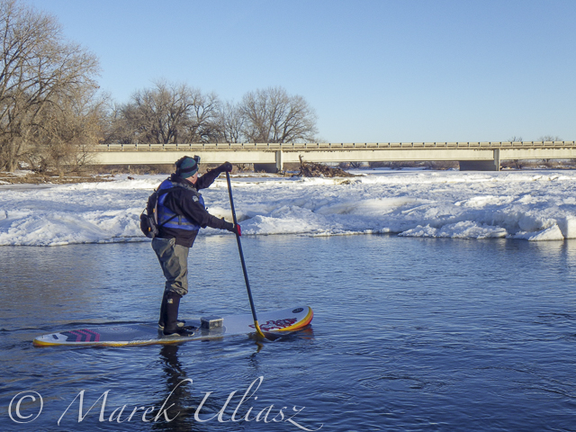
January 3, 2016. First SUP paddle of the year with Rob Bean. We paddled 10 miles on the South Platte River from highway 58 to Kuner. Great weather, river flow ~900 cfs at Kersey, several bald eagles and hundreds of ducks. There are no portages on this river section since we started just below the Plumb Ditch Dam (the second diversion dam if you paddle from Evans).

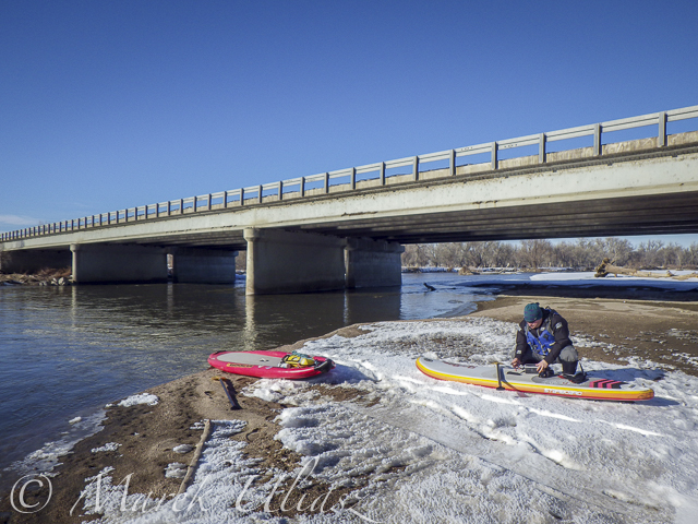
We started from a gravel bar under the new bridge on highway 58 – a right river shore with parking on a wide shoulder, a shorter, steeper route with barbed wire fence on the upstream bridge site. Downstream bridge site may be more convenient without the fence, but with a little longer walk. You can reach the bridge by turning into the new highway 49 at traffic lights from Colorado highway 34 between Evans and Kersey.

Rob posted his pictures on facebook. They actually show much better our launching site.

Start at gravel bar under the new highway 58 bridge

Start at gravel bar under the new highway 58 bridge

Somewhere on the river around Kersey

Somewhere on the river around Kersey

Ducks, ducks, and more ducks. Hundreds of them.

Ducks, ducks, and more ducks. Hundreds of them.

winter SUP paddling on South Platte River

Finishing 10 mile trip at Kuner

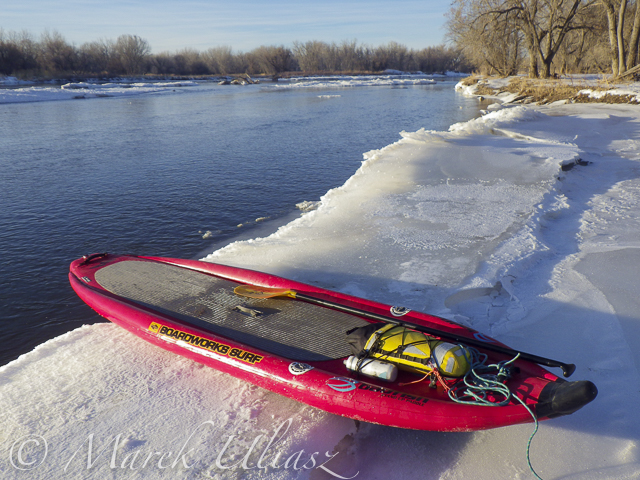
A little bit icy  landing at landing (left shore upstream of the bridge)
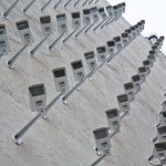
A little bit icy landing at Kuner (left shore upstream of the bridge)

Related posts:
South Platte River below Denver – river guide
Starting 2015/16 Winter Paddling Season on South Platte River
Paddling SUP on South Platte River from Kersey to Kuner
South Platte River from Wildcat to Evans by SUP


paddling with a camera

 
Comments Off on 10 Winter Miles of Stand Up Paddling on South Platte River

Posted in Photography


City Lab: World’s Largest Urban Simulator Spans 26 Square Miles

28 Aug

[ By WebUrbanist in Architecture & Cities & Urbanism. ]

city lab new mexico

It will be a brand-new, from-scratch American city like any other, with urban, suburban, exurban and rural zones dotted with houses, malls, power plants, police and fire stations, missing only one key ingredient: inhabitants. Currently under construction in the New Mexico desert, the Center for Innovation, Testing, and Evaluation (CITE) is a sort of real-life Sim City, the “first of its kind, in scale and scope,” a unique “fully integrated test, evaluation and certification facility dedicated to enabling and facilitating the commercialization of new and emerging technologies.”

city lab deserted complex

Known informally as City Lab (click to enlarge the diagram above), the 26-square-mile urban laboratory complex has a billion-dollar budget and will host all kinds of tests, including but not limited to: intelligent transportation systems, smart grid technologies and green energy strategies. Wired for data collection and replete with tunnels, system-wide scenarios can be monitored in the minutest detail, a dystopian twist on what might otherwise seem an idyllic mid-sized city capable of supporting 35,000 citizens.

citylabmasterplan

Complete with all the infrastructure of a ‘real’ city, the developer’s target clients include university researchers, federal agencies and commercial enterprises. The facility aims to combine elements of private and governmental test environments like Gravesend, a military and police complex in the UK, Liberty City, a drone-oriented cityscape in the US and Mcity, a newly-built autonomous vehicle testing site in Detroit.

city lab simulation space

If you have one in your town it is a safe bet CITE has one as well, from churches and highways to a city hall and even an airport. While this place contains all a community could ever hope for, the only ‘residents’ of the place will be a staff of over 300 that maintain its infrastructure and supervise experiments. Imagine the reaction of some archeologist from the distant future, seeing a sort of dystopian settlement wired for full surveillance and connected by a vast array of underground tunnels (The Cabin in the Woods comes to mind, poster below), but at the same time oddly unoccupied and devoid of art, brands or billboards.

cabin in the woods movie

Noting the lack of these quintessential hallmarks of modern civilization, a professor at the University of New Mexico decided to ask what kind of public art would fit such a strange and made-to-be-deserted city. Her students solicited proposals from around the country and selected a set of winners. Ingenious ideas included: sculptural mounds made from the dirt displaced during excavation, testing paint colors around the complex for durability and weather resistance and a farcical strategy to sell lots and gentrify the faux city.

city lab public art

More from Pegasus Global Holdings: “As a privately-owned, privately-operated test and evaluation center, CITE is open and accessible to a wide array of public and private customer segments – domestic and international. The structure and policies in place at CITE are specifically designed to remove legal, cultural and budgetary impediments as are currently prevalent in the process of moving beyond basic research and development activities.”

Share on Facebook


[ By WebUrbanist in Architecture & Cities & Urbanism. ]

[ WebUrbanist | Archives | Galleries | Privacy | TOS ]


WebUrbanist

 
Comments Off on City Lab: World’s Largest Urban Simulator Spans 26 Square Miles

Posted in Creativity


Ghosts of the Berlin Wall: 8,000 Glowing Orbs Span 10 Miles

31 Oct

[ By WebUrbanist in Art & Installation & Sound. ]

berlin wall art project

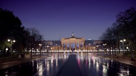
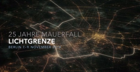
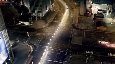
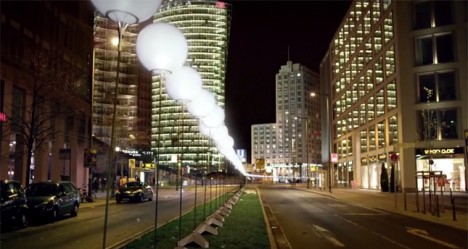
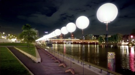
For the 25th anniversary of its fall, this Berlin Wall installation project will illuminate the historical divide between East and West, temporarily recreating the infamous border with balloons on tethers in place of concrete with barbed wire.

light border animated

The work, titled Lichtgrenze by creators Christopher and Marc Bauder, will go live over the weekend of November 9th for just three days, inviting residents and visitors alike to retrace a path that in many places has been obfuscated by time and intentional attempts to bury the past.

light border installation aerial

berlin wall anniversary installation

The biodegradable light-filled balloons will then be released in unison at the end of the weekend, floating away with messages attached by those who choose to contribute.

berlin wall installation art

Every 500 feet along the path of the lights there will be historical footage and imagery of what each area was like when the wall was still intact, leading up to its world-watched destruction in 1989.

berlin wall night lights

While there were walls, mines and no-mans-land zones outside of Berlin as well, there is something particularly powerful about the way the boundary impacted Germany’s capital, slicing it brutally through its center, often cutting streets and even buildings in half.

Share on Facebook


[ By WebUrbanist in Art & Installation & Sound. ]

[ WebUrbanist | Archives | Galleries | Privacy | TOS ]


WebUrbanist

 
Comments Off on Ghosts of the Berlin Wall: 8,000 Glowing Orbs Span 10 Miles

Posted in Creativity


Facing Destruction: Entire City to Be Relocated 2 Miles Away

21 Mar

[ By WebUrbanist in Architecture & Cities & Urbanism. ]

relocated mining city kiruna

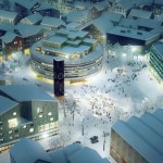
No hoax, it is happening  – 20,000 occupants of Kiruna, Sweden, are being forced to pull up stakes and relocate their entire urban center to avoid having it fall off the face of the Earth.

relocated city aerial view

relocated city google maps

The existing settlement is situated alongside a vast mine that fuels the local economy, but which also responsible for the huge fissures snaking their way toward the heart of the city. As the miners dig deeper, an increasing area of ground is threatened with collapse – at least 3,000 buildings are not expected to survive. Starting immediately, a multi-year effort is underway to shift everything away from the danger zone.

relocating entire city sweden

relocated city mining town

Relocating a whole urban populace is no small feat. As reported by the BBC, “The number of people involved in a project of this scale exceeds the thousands and includes city planners, architects, landscape designers, biologists, urban designers, civil engineers, demolition and construction experts and builders, as well as social anthropologists.” In some cases, whole buildings (like a century-old church) will be deconstructed, moved and reassembled on new sites.

relocated town center deisgn

The pressure has been building for some time with citizens having to make difficult decisions about buying real estate and building businesses with this growing threat looming in the backs of their minds. In a way, the definitive decision to break ground on a new town center is a relief to the population, who can now plan their lives around a new known reality. In some ways, too, it is a chance to start over – to build a city from scratch with lessons learned from the existing layout.

relocated cities art rendering

relocated city night rendering

Still, there are many questions without clear answers, including: how does the city evaluate the parcels held by existing landowners who have to move, be they residents or business owners? “The Stockholm-based architects White Arkitekter AB, which won the contract to design the new Kiruna, envisages a denser city centre with a greater focus on sustainability, pedestrians and public transport than automobiles.” With a freshly-constructed center, one thing is certain: everything will change – the focal point for the entire built environment of the region is shifting and the future of the city remains uncertain.

Share on Facebook


[ By WebUrbanist in Architecture & Cities & Urbanism. ]

[ WebUrbanist | Archives | Galleries | Privacy | TOS ]


WebUrbanist

 
Comments Off on Facing Destruction: Entire City to Be Relocated 2 Miles Away

Posted in Creativity


26 November, 2013 – Miles Flint – My Photographic Journey

27 Nov

One of the benefits of leading workshops to various worldwide locations is you get a chance to meet exceptional people and photographers.  Miles Flint and I met in the fall of 2009 and over the last few years I have had the opportunity to see Miles at several PODAS workshops.  I had the chance to sit down with Miles on the Kimberley, Australia PODAS workshop and talk about his photographic growth over the years and to take a peek at his gear bag.  Luminous-Landscape will be doing more interviews and articles like this in the future.  Article and Video . . .


The Luminous Landscape – What’s New

 
Comments Off on 26 November, 2013 – Miles Flint – My Photographic Journey

Posted in News


Across the Country in 12 Images: 6,000 Wild Miles of America

17 Oct

[ By WebUrbanist in Global & Travel & Places. ]

cross country new mexico

It can be hard to explain to someone from Europe or elsewhere just how vast and variegated the United States really is, but this short epic photo series is a great start. It depicts a series of surreal landscapes, carefully chosen to show the amazing range of environments found across the American West.

cross country grand canyon

cross country indiana dunes

cross country devils peak

cross country nevada

Photographer Reuben Wu came originally from the United Kingdom and was awed by what he found traveling cross-country in America. On his latest trip from his home in Chicago, he looped through the northern and southern Midwest on his way to the West Coast and back, taking incredible images along the way, dubbing the series Cross Country.

travel photography map spots

cross country south dakota badlands

cross country badlands

cross country yellowstone

He traveled this route with a plan: capture scenes at night when natural marvels were devoid of human activity and using technology to calculate when peak moonlight would allow for stunning visibility. The result is this set of vivid images that make familiar places seem alien, and speak both to beautiful variety and carefully found settings.

cross country smith mansion

cross country lake michigan

cross country giant prismatic spring

cross country death valley

Subjects of the series span from Illinois and Indiana through North Dakota and Nevada, California, New Mexico and Kansas, and featured sites (or sights) include: Yellowstone, Badlands, Death Valley, the Grand Canyon and the Grand Prismatic Spring, the Devil’s Tower and the Smith Mansion.

Share on Facebook


[ By WebUrbanist in Global & Travel & Places. ]

[ WebUrbanist | Archives | Galleries | Privacy | TOS ]


WebUrbanist

 
Comments Off on Across the Country in 12 Images: 6,000 Wild Miles of America

Posted in Creativity