RSS
 

Posts Tagged ‘Elevated’

Cones on Poles: Field Guide to Elevated Traffic Cones in Everyday Contexts

11 Aug

[ By WebUrbanist in Art & Installation & Sound. ]

Like some many things in the built environment, once you start noticing cones on poles you will see them everywhere — Cones on Poles, an “unofficial sequel” to The Subconscious Art of Graffiti Removal by Matt McCormick, explores “the strange phenomena of people placing cones on poles and other elevated places.”

What started out as a joke has become a study of adaptive patterns — per Matt, some are “predictable, like a cone being placed atop a bollard that keeps people from backing up into an oil tank,” while “others that are more geo-locative, like a cone on a mailbox or telephone pole in a rural area, set in place to create a sort of landmark.”

Over time, he has started noting and naming different configurations — a cluster of three or more is a “congress” (above) and then, of course, there is the self-evident “triple stack” (below).

“Traffic cones are symbols within a larger semiotic system we’ve created around the driving of automobiles (signifier: traffic cone / signified: hazard),” he explains, “but with cones on poles we see instances of people individualizing that system; the practice of everyday life, as Michel de Certeau puts it.”

Cones, in essence, signal us to be on guard, whether by indicating the presence of a fire hydrant, acting as a beacon for a home or simply (much like street art) making us wonder: what is that there for?

“Like so many of my projects,” says Matt, “this is both tongue-and-cheek yet also serious. It’s fun and goofy, but also part of my larger effort to simply encourage people to pay attention to the natural and built environments around them.” Follow this semi-serious documentary project on Instagram, and check out a trailer for Matt’s latest documentary film below.

Share on Facebook


[ By WebUrbanist in Art & Installation & Sound. ]

[ WebUrbanist | Archives | Galleries | Privacy | TOS ]

WebUrbanist

 
Comments Off on Cones on Poles: Field Guide to Elevated Traffic Cones in Everyday Contexts

Posted in Creativity


Seoul Skygarden: Elevated Park on an Abandoned Highway Officially Opens

23 May

[ By SA Rogers in Drawing & Digital. ]

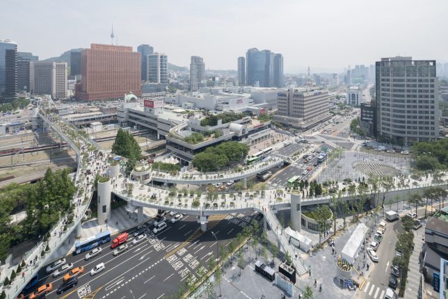
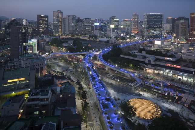
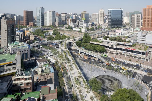
A formerly abandoned 1970s highway in South Korea’s capital city now hosts 24,000 plants as the Seoullo Skygarden, an elevated public park open to all citizens 24 hours a day. That’s a big deal in a city where so much architecture and infrastructure tends to be corporate-sponsored, with special perks for paying customers of companies like Hyundai. Mayor Park Won-soon, a former human rights and anti-corruption activist, wanted to balance all those logos with public spaces that are more accessible to all.

Dutch architecture firm MVRDV was tasked with designing the park back in 2015, and in just two years, they’ve created a successful public space revitalizing and connecting public spaces near the main railway station that were previously fragmented by roads and rail tracks. Its base, a 1970 motorway flyover, sat empty for a long time after being deemed unsafe for its original purpose.

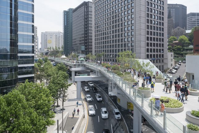
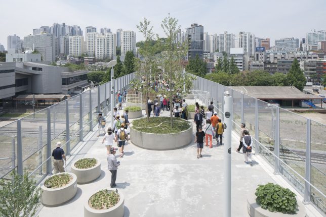
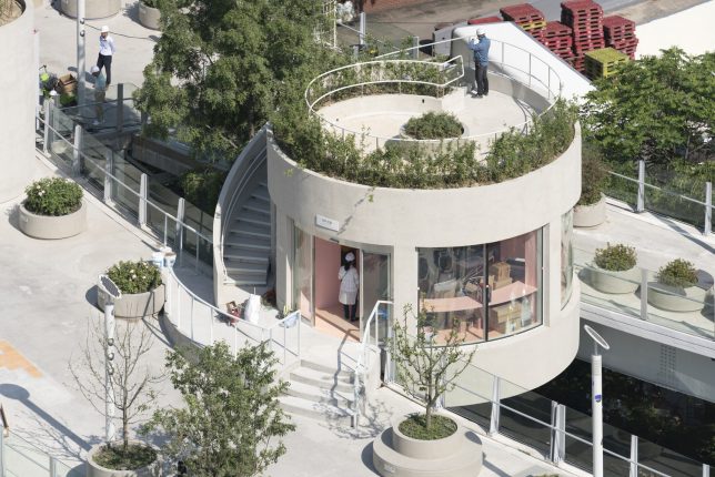
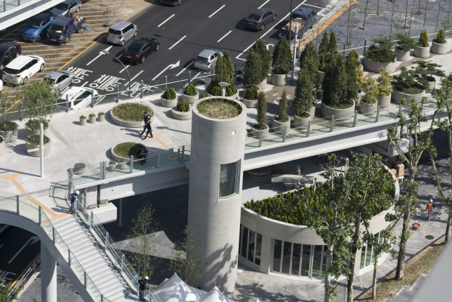
The Skygarden is packed with 645 potted trees and around 228 species and sub-species of plants, adding a significant amount of greenery to a highly paved area of the city – not to mention encouraging foot traffic, recreation, interaction and physical activity. The route is set up to create a network of hotels, shops, gardens and other attractions, enlivening the center of the city. It’s not just a walkway – it’s an educational experience.

“The linear park was designed as a collection of small gardens, each one with its very own composition, perfume, color and identity,” says MVRDV. “The landscape will change according to the seasons: the bright colors of leaves in autumn of the Aceraceae family (maples), the blossom of cherry trees and rhododendron in spring, the evergreen conifer trees ink inter and shrubs and trees bearing fruit in summer.”

“In the future, the overpass will evolve with new plants and new activators so as to become an ‘urban nursery,’ rearing trees for the surrounding districts. Additional structures of stairs, lifts and escalators as well as new ‘satellite’ gardens can connect to the Skygarden, sprouting like branches from the existing structural piers. These extensions can inspire further additions to the area’s greenery and public spaces, and will connect the Skygarden to its surroundings both physicallyl and visually through plant species related to each of the neighborhoods.”

Share on Facebook


[ By SA Rogers in Drawing & Digital. ]

[ WebUrbanist | Archives | Galleries | Privacy | TOS ]

WebUrbanist

 
Comments Off on Seoul Skygarden: Elevated Park on an Abandoned Highway Officially Opens

Posted in Creativity


End of Elevated Parks? UK Garden Bridge & US Pier 55 Projects in Doubt

28 Apr

[ By WebUrbanist in Architecture & Cities & Urbanism. ]

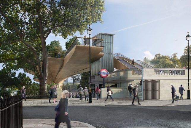
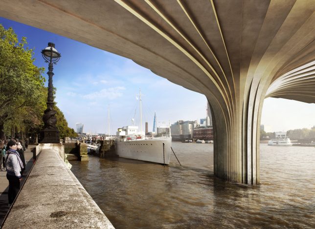
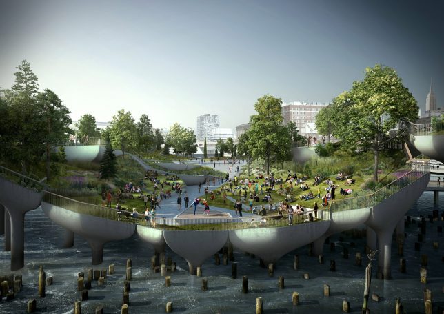
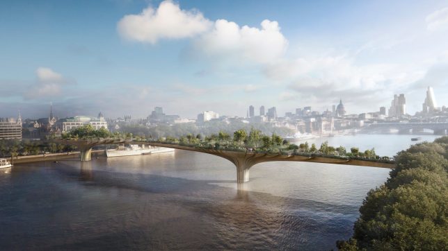
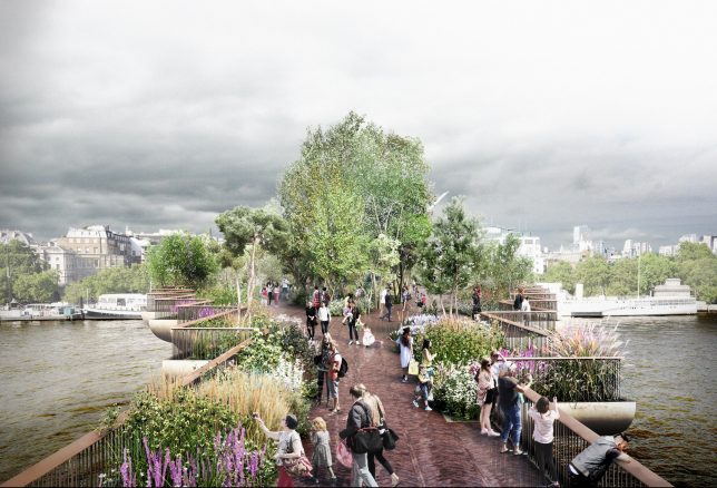
It has been a challenging few weeks for architect Thomas Heatherwick, whose proposals for elevated green urban spaces in both London and New York City face uncertain futures. While the specifics vary, there may be lessons for elevated parks that spans both cases — and if these fail to move forward, it could spell the end of a decade-long trend for lofted public parks.

The Garden Bridge project in London has long been criticized based on its cost and officials are getting serious about making sure the investment (especially tax dollars) will pay off. The design has been touted as a kind of High Line Park for England’s capital, but unlike the High Line it is a brand new construction project (not adaptive reuse) and not positioned to revitalize areas of its city.

At the heart of the issue, unsurprisingly, is money: an initial projection of £60,000,000 has blossomed into an estimated cost of around £200,000,000. Shockingly, even cancelling the project now would result in a bill of over £40,000,000, despite the fact that construction has not even started. While £70,000,000 in private funding was secured at the outset, the rest would have to be covered by taxpayer money, which is less than popular with the public. As of now, the mayor’s financial inquiry has resulted in a recommendation to scrap the project.

According to a governmental report on the project, “Decisions on the Garden Bridge were driven by electoral cycles rather than value for money,. From its inception when there was confusion as to its purpose, through a weak business case that was constructed after contracts had been let and money had been spent, little regard has been had to value for money.” It is unclear whether the project is stalled or slated for abandonment, but it looks unlikely to proceed at this point.

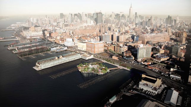
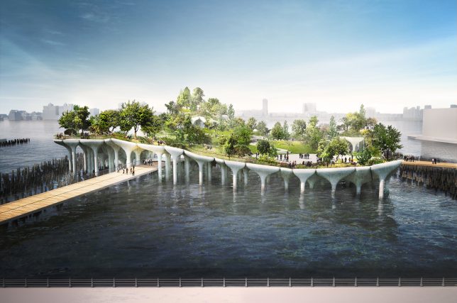
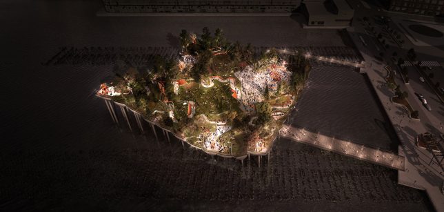
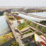
Meanwhile, across the pond, Heatherwick’s proposed Pier 55 project (images by Luxigon), an elevated park stretching out over the water next to Manhattan, is also stalled out, at least for now. Its permit was recently revoked in part based on environmental studies that concluded it would disrupt local marine habitats. There are also concerns that it will block views along the waterfront.

The 10,000-square-foot, $ 200,000,000 park was designed to replace a disused pier in the heart of New York City, but once again it lacks some of the conditions that made the High Line a viable solution, particularly its lack of reuse. Perhaps the elevated parks trend is coming to an end, or (more likely): it is too often pitched as a solution, even in cases where there is no obvious problem to be solved.

Share on Facebook


[ By WebUrbanist in Architecture & Cities & Urbanism. ]

[ WebUrbanist | Archives | Galleries | Privacy | TOS ]

WebUrbanist

 
Comments Off on End of Elevated Parks? UK Garden Bridge & US Pier 55 Projects in Doubt

Posted in Creativity


Bike Over Traffic: World’s Longest Elevated Cycling Path Opens in China

11 Feb

[ By WebUrbanist in Architecture & Cities & Urbanism. ]

first cycleway china

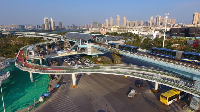
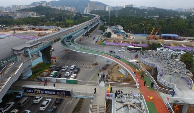
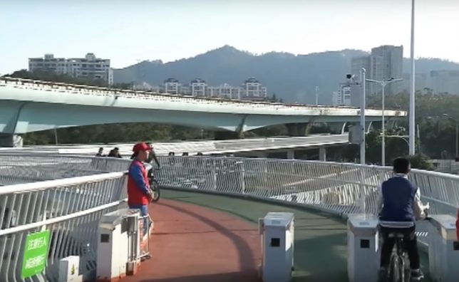
China’s first aerial bike path spans nearly five miles, raised over streets and highways and connecting six public transit hubs in the heart of Xiamen. If the new route is even close to as successful as its designers and planners expect, it could help usher in a new cycle-centric transport paradigm across the country.

Sixteen feet wide, the bike-and-pedestrian pathway network can accommodate 2,000 or more bicycles per hour. At night, 30,000 lights allow travelers to continue using the paths safely. Its planners anticipate an influx of ridership and have a system in place to actually close down the on ramps if too many bikers are already on the path.

raised bike track

Some sections of the cycleway are positioned under overhead mass-transit express lanes, offering some shelter from the elements (and less noise than riding alongside). Along the route, riders access the system via a variety of ramps tied into the city bus and subway system, aiming to bridge the gap between various forms of transportation.

elevated cycle path

Would-be bikers can also pick up bicycles via a ride share system positioned at entry and exit points. If the system does reach full utilization, city officials may extend the network further in the near future. Other cities in China (and around the world) can also look to this integrated system for inspiration for similar bike-oriented urban design strategies.

Share on Facebook


[ By WebUrbanist in Architecture & Cities & Urbanism. ]

[ WebUrbanist | Archives | Galleries | Privacy | TOS ]

WebUrbanist

 
Comments Off on Bike Over Traffic: World’s Longest Elevated Cycling Path Opens in China

Posted in Creativity


Hovering Homes: 12 Cantilevered & Elevated Residences Maximize Views

24 Jan

[ By SA Rogers in Architecture & Houses & Residential. ]

elevated-snohetta-cabin-1

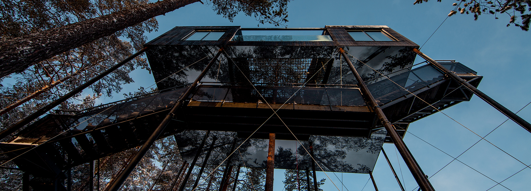
Supported by nothing but skinny poles, delicately balancing or tethered as if they might float away, these precarious-seeming houses laugh in the face of gravity. Cantilevering architectural volumes off cliffsides or elevating them well above ground level gives modern residences incredible views of their surroundings, whether they’re located on a mountain overlooking the sea or in the middle of a busy Japanese city.

Snohetta Treehotel, Sweden

elevated-snohetta-cabin-2

elevated-snohetta-cabin-3

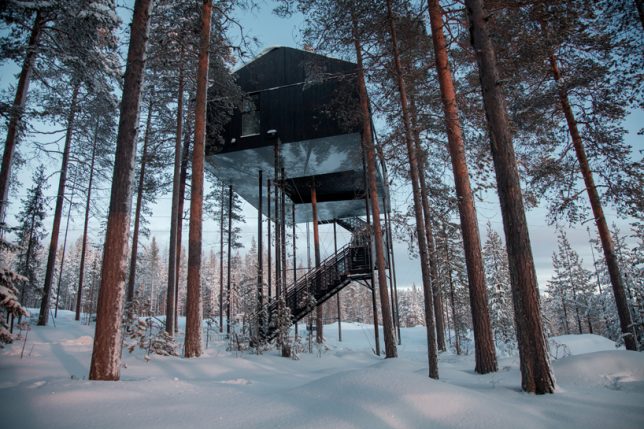
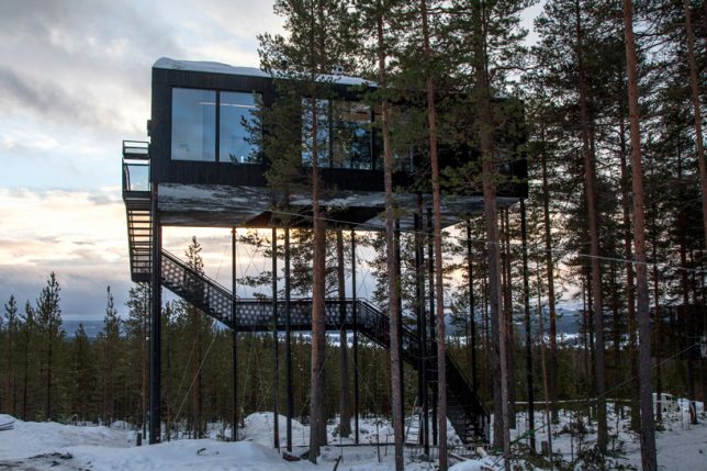
Architecture firm Snøhetta has completed their addition to Sweden’s Treehotel, a hovering cabin that appears at first glance to be supported by no more than the staircase leading up to it. The design is based on a traditional Nordic cabin with a wood facade clad in charred boards of pine for a look that contrasts with the snow below, making the structure look heavy and solid to enhance its gravity-defying properties.

Tower House Inspired by Observatories

tower-house-5

tower-house-3

tower-house-1

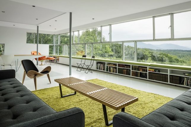
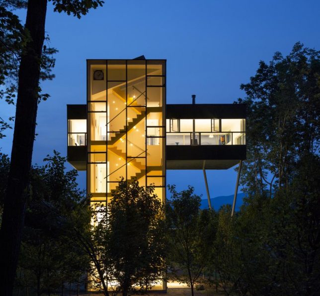
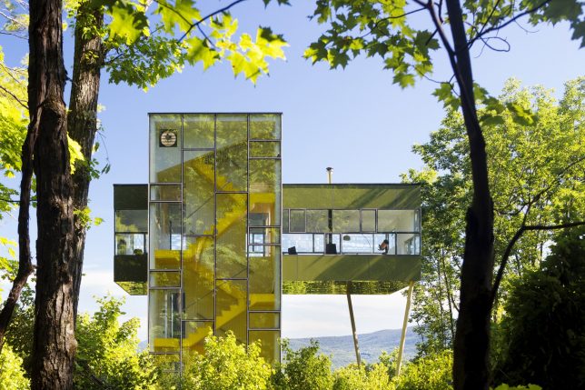
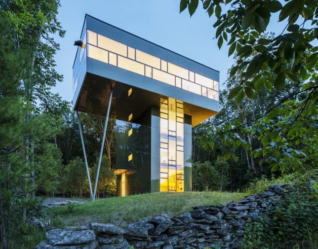
Tucked into the woods of upstate New York, GLUCK+’s Tower House takes inspiration from observatories for its mostly-vertical form. A bright yellow staircase is visible from outside through the glass envelope of the supporting tower, and the upper volume is topped with a terrace.

House in Yatsugatake Mountains by Kidosaki Architects, Japan

elevated-house-kidosaki-1

elevated-house-kidosaki-2

elevated-house-kidosaki-3

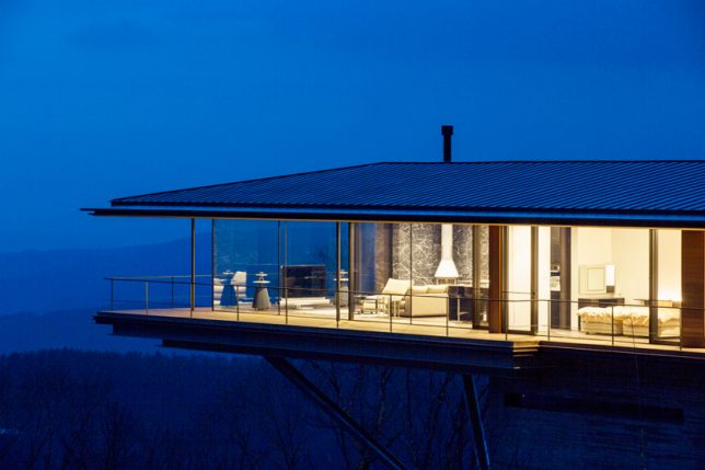
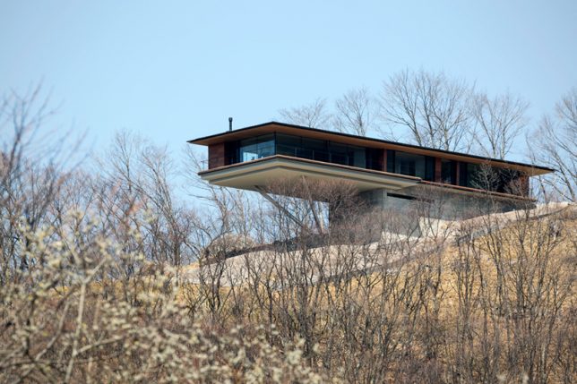
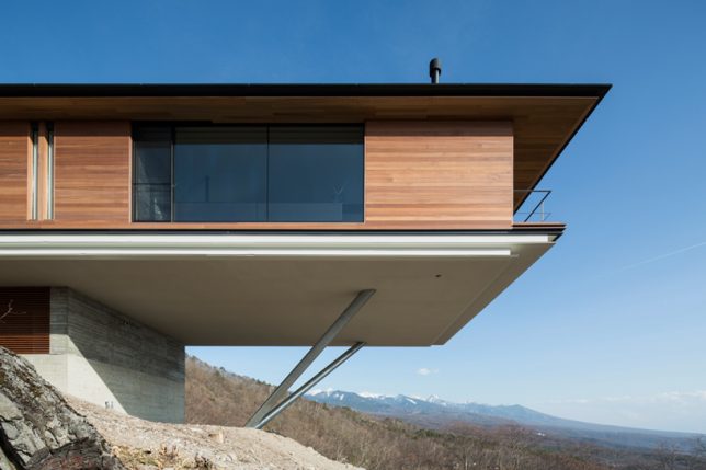
Jutting out over a cliff at the foot of Japan’s Yatsugatake Mountains, this home by Kidosaki Architects Studio expands horizontally out into midair to enhance views of the natural landscape through floor-to-ceiling glazing on three sides. The cantilevered portion of the home is supported by two diagonal steel cylinders.

Cargo Container Office Sticks Out Beyond Edge of Hill

cantilevered-shipping-container-office

cantilevered-shipping-container-office-2

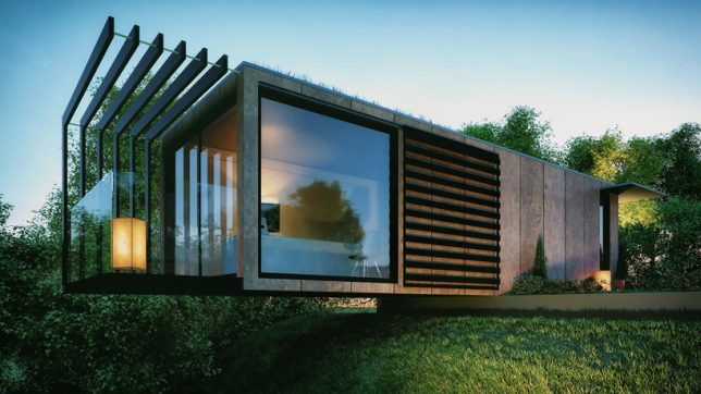
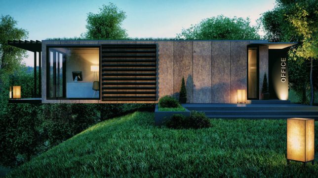
Architect Patrick Bradley repurposed a 45-foot cargo container into an office for himself, allowing a third of it to hang out over the edge of the hilly plot as a sort of floating balcony encased in glass. The project makes very few structural changes in the container itself, staying true to its original form while modernizing its exterior.

Next Page – Click Below to Read More:
Hovering Homes 12 Cantilevered Elevated Residences Maximize Views

Share on Facebook


[ By SA Rogers in Architecture & Houses & Residential. ]

[ WebUrbanist | Archives | Galleries | Privacy | TOS ]

WebUrbanist

 
Comments Off on Hovering Homes: 12 Cantilevered & Elevated Residences Maximize Views

Posted in Creativity


Reconnecting Atlanta: Elevated Park to Bridge a City Divided by Highways

17 Oct

[ By WebUrbanist in Architecture & Cities & Urbanism. ]

downtown-atlanta-elevated-park

Connecting fragmented sections of a divided metropolis, this new elevated park will help stitch together downtown Atlanta while providing fresh public green space in the heart of the city. The raised park will ultimately span nearly a half mile across the center of the city, tying into existing parks, paths and trails.

urban-park-plan

Like many American cities, a mid-century rush to facilitate car traffic ended up leaving a legacy of disconnection in Atlanta. The downtown core is wrapped in high-speed roadways and bisected by busy streets, which the Buckhead Park seeks to overcome with a strategy similar to that of Freeway Park in Seattle.

downtown-atlanta-greenway

The park is divided into a series of different areas with varying amenities, which in turn will also help with staging the construction (much like the segmented Highline in New York City, built in iterative steps).

sky-park-atlanta

atlanta-elevated-park

The northern portion features a commons with an amphitheater. The southern section boasts a lush garden space. In the middle, a plaza is designed to serve area retail and restaurants. Native plants will be irrigated with collected storm water reclamation systems, helping provide shelter from the hot Georgia sun.

atlanta-park

buckbeak-park

Designers from Rogers Partners and Nelson Byrd Waltz aim to bring coherence to the disparate areas of downtown, allowing safe and easy options for pedestrians. Their project will also connect to Park 400, a cycling and jogging trail currently in the works. The project’s creators also hope their work will inspire other cities to think about ways to reconnect divided downtowns.

Share on Facebook


[ By WebUrbanist in Architecture & Cities & Urbanism. ]

[ WebUrbanist | Archives | Galleries | Privacy | TOS ]

WebUrbanist

 
Comments Off on Reconnecting Atlanta: Elevated Park to Bridge a City Divided by Highways

Posted in Creativity


Underline: 10-Mile Park to Trace Path of Elevated Rail in Miami

24 Feb

[ By WebUrbanist in Architecture & Cities & Urbanism. ]

underline

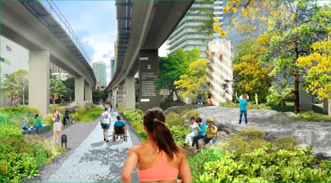
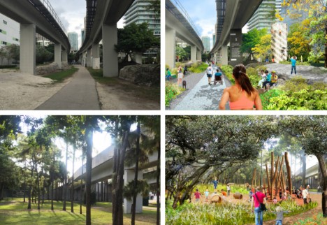
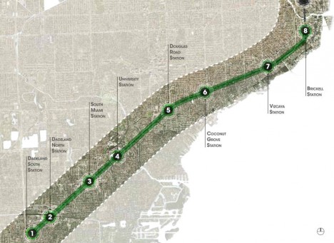
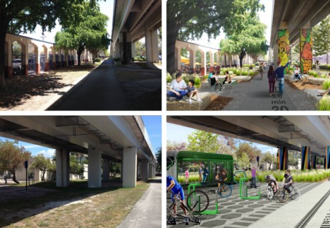
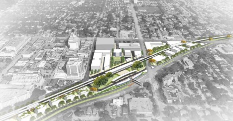
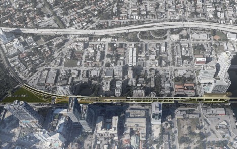
Following in the footsteps of the High Line (and Low Line) of New York City, the Underline project aims to take the underutilized space below Miami’s elevated MetroRail and transform it into a connected park-and-pathway system spanning ten miles and hundreds of acres.

miami underline project

The undertaking is ambitious, but it has solid precedents around the country: “The Underline will connect communities, improve pedestrian and bicyclist safety, create over a hundred acres of open space with restored natural habitats.”

underline system map

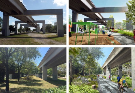
Before-and-after concept images, shown above and below, highlight key points along the trail, including expanded park space, bicycle repair stations and play areas.

miami before after park

Connecting Miami, Coral Gables and South Miami, the design further aims to “encourage a healthy lifestyle, provide an easily accessible place to exercise, create a mobility corridor that integrates transit, car, biking and walking, provide a 10-mile canvas for artistic expression, attract development along US1, and generate significant economic impact.”

underline master plan

Beyond its immediate and direct effects, the trail would also connect out to a system of existing bike paths as well as ones under development, serving as a nexus between a total of 250 miles of extant and proposed trails across southern Florida.

miami park project

James Corner Field Operations of New York City was selected to create the master plan for The Underline, with input collected from surveys and six public meetings.

underline miami design

Their master plan provides “standards and requirements for the urban trails including trail widths and proposed materials. It also includes recommendations for lighting and wayfinding, seating, amenities, etc. The plan proposes improvements to crosswalks, intersections. Landscape recommendations include a plant palette and placement. There are also proposals for destination parks.”

Share on Facebook


[ By WebUrbanist in Architecture & Cities & Urbanism. ]

[ WebUrbanist | Archives | Galleries | Privacy | TOS ]

WebUrbanist

 
Comments Off on Underline: 10-Mile Park to Trace Path of Elevated Rail in Miami

Posted in Creativity


Lookout Below: 1-Mile Toronto Park to Run Under Elevated Highway

29 Nov

[ By WebUrbanist in Architecture & Cities & Urbanism. ]

under park at night

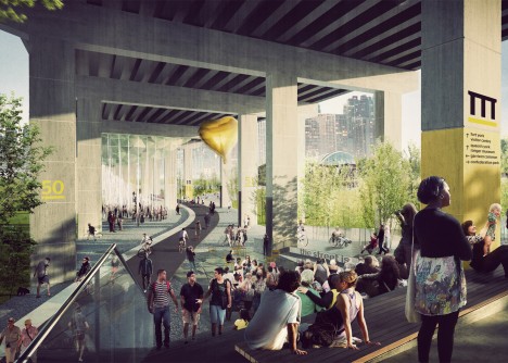
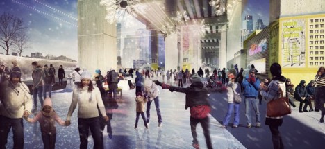
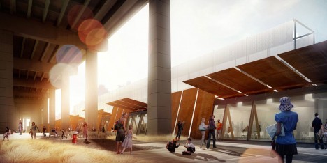
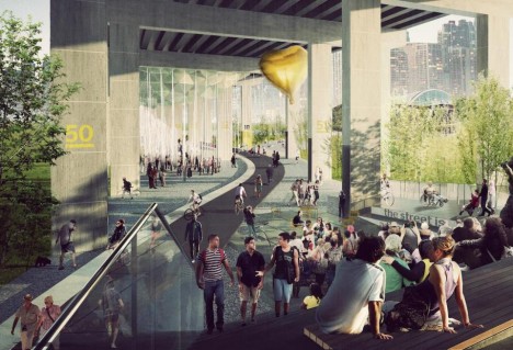
A new urban park in Ontario will take sheltered but unused space below a raised roadway and turn it into a place for walking, cycling and outdoor performances.

toronto under highway park

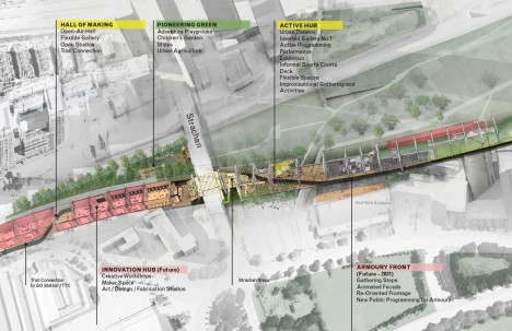
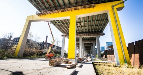
A project of urban designer Ken Greenberg as well as Marc Ryan and Adam Nicklin of Public Work, the Under Gardiner design approach treats the area as a covered streetscape, taking advantage of rain and sun shade provided by the vehicular thoroughfare above.

under park skating

Its surface programming also bridges institutional uses on either side, including aquariums, museums and other cultural buildings.

under highway elevated park

From architectural thesis research into reusing spaces under viaducts, this article’s author can attest to the advantages of using these sub-street spaces – noise and air pollution levels are actually lower directly below than they are adjacent to raised roads.

elevated highway underneath park

The biggest concerns are seismic, which in turn are tied to regional risk factors, and still problematic for any kind of enclosed or sheltered space, architectural or otherwise.

under park construction

Existing columns and beams of the surrounding infrastructure will naturally divide the spaces into sections that act as exterior rooms while also providing ways to hang signage, wayfinding mechanisms and announcement billboards.

under park visual language

The project is being launched with the help of a sizable $ 25,000,000  donation from Toronto philanthropists Judy and Wil Matthews.

street park project

park

“The passion and financial assistance of a major donor is joining with the City and Waterfront Toronto to plan and build new infrastructure, and to showcase a new model of city building for Toronto,” said Waterfront Toronto.

Share on Facebook


[ By WebUrbanist in Architecture & Cities & Urbanism. ]

[ WebUrbanist | Archives | Galleries | Privacy | TOS ]

WebUrbanist

 
Comments Off on Lookout Below: 1-Mile Toronto Park to Run Under Elevated Highway

Posted in Creativity


Abandoned Highway to Seoul Sky Garden: New Elevated Park

16 May

[ By Steph in Architecture & Cities & Urbanism. ]

seoul skygarden 1

Deemed unsafe and left to rot, a stretch of highway in a prime location beside a train station in Seoul, South Korea will soon get a new life as an elevated park. Built in the ’70s, the structure provided access to and from a local market that served as a crucial point of trade in the region for decades, but vehicles were banned after failed inspections in 2006. For years it has sat unused while pedestrians are forced to take a long route around it to get to the station.

seoul skygarden 2

seoul skygarden 3

It was supposed to be demolished, but officials consulted residents and experts to see if there was another option. Pedestrian walkways can be hard to come by in any city, and the dozens of elevated parks that are popping up around the world prove that reclaiming and rehabilitating abandoned infrastructure can be an economic boon as they bring new green space to urban settings and create new connections between neighborhoods.

seoul skygarden 4

Dutch architecture firm MVRDV won a contest to design the park, filling it with massive circular plant pots filled with 254 different species of flowers, shrubs and trees to create a “living dictionary of the natural heritage of Korea.” A greenhouse will grow new plants to populate the pots, and pedestrians can stop at a number of cafes, street markets, flower shops and other vendors.

seoul skygarden 5

Once completed, the 55-foot-high structure will cut the walk around the railway station from 25 minutes to 11, and is expected to generate 1.83 times its cost in economic benefits.

Share on Facebook


[ By Steph in Architecture & Cities & Urbanism. ]

[ WebUrbanist | Archives | Galleries | Privacy | TOS ]

WebUrbanist

 
Comments Off on Abandoned Highway to Seoul Sky Garden: New Elevated Park

Posted in Creativity


Hut Above the Rest: Elevated Cabin for the Athens Skyline

10 Jan

[ By Steph in Architecture & Cities & Urbanism. ]

athens rooftop hut 1

Far from its typical location in the woods and other remote places, an archetypal cabin looms over the bustling city of Athens from its rooftop perch two meters above the top of most high-rises. Proposed by Panos Dragonas and Varvara Christopoulo, the elevated urban hut brings a structure with a rural connotation representing quiet and solitude into an environment that’s nearly the exact opposite.

athens elevated cabin 2

Instead of hills and trees, the hut looks out onto a landscape of man-made design. But the designers posit that these urban spaces, busy as they may be, can still provide a space for meditation and peace – as long as you go to extremes.

athens elevated cabin 3

Urbanization has made isolated spaces hard to come by, so the dream of escaping to a cabin in the woods is not as achievable or even idyllic as it once was. This project emphasizes how much the world has changed as our cities have grown, replacing nature with streets, skyscrapers and antennas.

athens elevated cabin 4

The hut is a mere nine square meters (96 square feet) and lacks any modern amenities, offering only a few platforms for sleeping and sitting, much like a camping shelter in the wilderness.

athens elevated cabin 5

“The urban hut creates a voluntary isolation cell over the ruins of the new Great Depression. The hut returns to the city both as a primary form and as a standard of minimum living, and establishes a heterotopia in the stepped skyline of Athens.,” say the architects.

Share on Facebook


[ By Steph in Architecture & Cities & Urbanism. ]

[ WebUrbanist | Archives | Galleries | Privacy | TOS ]

WebUrbanist

 
Comments Off on Hut Above the Rest: Elevated Cabin for the Athens Skyline

Posted in Creativity