RSS
 

Posts Tagged ‘Earth’

This photograph illustrates how quickly the International Space Station orbits Earth

15 Jun

The International Space Station (ISS) moves fast. Very fast. The modular space station has an orbital speed of 7.66 kilometers per second, which is roughly 17,100 mph. It takes the ISS a mere 92.68 minutes to orbit Earth, meaning it goes around Earth nearly 16 times per day. It’s hard to conceptualize that amount of speed, but French astronaut Thomas Pesquet is aboard the ISS now and wanted to help those of us on terra firma understand the speed at which the ISS moves.

Pesquet has been experimenting with different photographic techniques to show the ISS’s speed. He recently shared an image shot with a 30-second exposure that shows ISS stationary in the frame while the Earth’s surface streaks behind in the background.

During the 30 second exposure, the ISS traveled about 235km. Despite the speed of the space station, Pesquet says that the crew doesn’t have the impression of moving that quickly due to the orbital path’s distance from Earth. The ISS perigee altitude is 418km (259.7mi) and its apogee altitude is 422km (262.2mi).

With the ISS orbiting Earth so many times during the day, there are numerous opportunities to spot the station as it orbits Earth. NASA has set up a dedicated alert system (https://spotthestation.nasa.gov) to let you know when the ISS is passing overhead. You can view the ISS with the naked eye, no need for a telescope.

Pesquet is very active aboard the ISS and regularly posts new photos on Twitter. You can also stay to date with all the activities on the ISS on Twitter. NASA regularly posts videos from the ISS on YouTube.

Articles: Digital Photography Review (dpreview.com)

 
Comments Off on This photograph illustrates how quickly the International Space Station orbits Earth

Posted in Uncategorized


Earth from 100,000 feet: Sigma sent the fp mirrorless camera into near space

03 Oct

Sigma UK recently collaborated with the company Sent Into Space to send a pair of Sigma fp full frame mirrorless cameras into the upper atmosphere. Sigma 14mm F1.8 lenses were used on each camera. It’s a notable kit because it combines the world’s smallest and lightest full frame mirrorless camera with the brightest full frame 14mm prime lens available.

The Sigma fp cameras and 14mm F1.8 lenses were attached to weather balloons and sent up to an altitude of roughly 19 mi. (about 30.5km). At altitude, the cameras captured high-resolution photos and 4K RAW video of Earth.

No good marketing operation is complete without stunning media to share with prospective customers. Sigma UK published a video to document the process of sending Sigma fp cameras into near space and show off the amazing results of the project.

The launches took place in Sheffield and the first Sigma fp to gain altitude was dedicated to recording 12-bit 4K UHD Raw video and the second camera was dedicated to capturing 24.6MP still images. Each camera was part of a kit that includes on-board equipment to provide data and telemetry back to the Sent Into Space team back on the ground.

The balloons, filled with hydrogen, expand considerably during the ascent. As the atmosphere gets thinner, the gas inside the balloon tries to escape to fill the vacuum. At a certain altitude, the balloon will fail and burst, and the equipment will return to the surface aided by onboard parachutes. As Chris Rose of Sent Into Space points out in the video above, the payload will actually descend at up to 250 mph before the atmosphere gets thick enough to act against the parachute.

Each camera was sent into space with an attached 2TB SSD drive. Even with that much storage capacity, the fp couldn’t record 4K UHD RAW video for the entire flight. The stills camera was set up with an interval timer to capture a still image every five seconds for the entire journey.

To learn more about the Sigma fp, head to our First Impressions. For more on the Sigma 14mm F1.8 DG HSM Art lens and its applications for space photography, check out Jose Francisco Salgado’s ‘Astrophotography with the Sigma 14mm F1.8 Art lens’ article.

(DIY Photography)

Articles: Digital Photography Review (dpreview.com)

 
Comments Off on Earth from 100,000 feet: Sigma sent the fp mirrorless camera into near space

Posted in Uncategorized


Video: Astronaut Doug Hurley on what it’s like to photograph Earth from the International Space Station

13 Jul
Photo via NASA: view of the SpaceX Crew Dragon and Japan’s HTV-9 resupply ship

The Twitter account of the International Space Station (ISS) recently shared a short video wherein NASA astronaut Doug Hurley talks about what it’s like to photograph Earth from low Earth orbit.

The video, embedded below, is just 75-seconds long, but in it, Col. Hurley explains how incredible it is to take in the beauty of Earth from a distance and points out a few of the more recognizable landmarks visible from 410 km (254.8 mi) above Earth’s surface.

You can keep up with Col. Hurley on Instagram and Twitter, and follow the ISS Twitter account for future videos and photos.

Articles: Digital Photography Review (dpreview.com)

 
Comments Off on Video: Astronaut Doug Hurley on what it’s like to photograph Earth from the International Space Station

Posted in Uncategorized


Florian Ledoux’s ‘I Am Vital’ is a short film fit for Earth Day

23 Apr

Florian Ledoux is an award-winning photographer and filmmaker. His work documents the effects of climate change. DPReview featured some of his images, captured while traveling with the Arctic Arts Project, earlier this year. 2 months ago, his second short film ‘I Am Vital’ was released. It presents a timely message for today’s 50th annual Earth Day celebration.

‘Like all my work, and my previous documentary, ‘I Am Fragile,’ the beauty, power, and fragility of these polar regions inspire me,’ Ledoux explains to DPReview when asked about his inspiration behind the film. ‘I feel so many emotions when I find myself in the remote Arctic, co-existing in harmony with the wildlife that calls it home.’

‘I Am Vital’ was filmed across Greenland, Antarctica, Nunavut, Svalbard and Iceland over the course of 3 years. Its purpose is to remind viewers of the important role water plays in our ecosystems. Preventing glaciers and ice sheets, which hold almost 70% of the world’s water supply, from melting away is crucial for maintaining sea levels. 2019 was the second-hottest year in recorded history. Antarctica hit a peak temperature of 18ºC (64.9F), according to a reading from an Argentinian research station thermometer.

‘The main body of my work is still photography but over the last few years I have developed video skills. This allows me to use footage that creates an emotional atmosphere in my films. My aim is to connect people a little bit more with this part (Arctic) of the world,’ explains Ledoux about his choice to start filming up close, from an aerial perspective, with a combination of DJI Inspire, Phantom 4 Pro and Mavic 2 Pro drones. ‘The choice of an ultra short documentary is to keep people focused on the message that is clear and direct for a very short time mixed with powerful images,’ he tells us.

‘I believe in and aspire to share a new perspective of our incredibly resilient, yet fragile planet beyond what we’ve already seen through traditional photography. I hope my work allows viewers to observe our Mother Earth and wildlife from new angles and approaches never before possible,’ he concludes. ‘It is my goal to present a new way of learning about the great white North. It is more than time to act and I want my work to positively impact conservation and result in new and expanded Marine Conservation Areas.’

Articles: Digital Photography Review (dpreview.com)

 
Comments Off on Florian Ledoux’s ‘I Am Vital’ is a short film fit for Earth Day

Posted in Uncategorized


Chinese satellite captures image showing both Earth and the Moon’s far side

07 Feb

China’s Longjiang-2 satellite has captured an incredible image featuring both the far side of the Moon and Earth in the background. The data was received by the Netherlands’ Dwingeloo Radio Telescope from an amateur radio transceiver built by a team at China’s Harbin University of Technology.

The satellite first provided the team with partial images of the Moon and Earth back in October, but then was inactive to avoid interfering with China’s Chang’e 4 Lunar mission. The satellite resumed activity on January 19 and captured a time-lapse, including one featuring the Moon’s far side and Earth, on February 3.

According to the team’s initial report, the images have been color corrected by radio amateurs. A team shared an uncorrected version of the image on Twitter, seen above.

Articles: Digital Photography Review (dpreview.com)

 
Comments Off on Chinese satellite captures image showing both Earth and the Moon’s far side

Posted in Uncategorized


NASA’s OSIRIS-REx spacecraft captures image of Earth from 71 million miles away

18 Jan

NASA’s OSIRIS-REx spacecraft, which achieved a record orbit at asteroid Bennu earlier this month, has returned an image that, at first glance, is unremarkable. The photo, below, features two bright dots — the larger one on the right is Bennu, and the smaller one on the left is Earth and the moon as seen from a distance of 114 million kilometers / 71 million miles.

The image was captured by OSIRIS-REx’s black and white NavCam1 camera on December 19, 2018, according to the Bennu mission website. The asteroid’s brightness is due to the image’s five second exposure time, which was long enough to make both the Earth and moon visible.

Photo provided by NASA

The OSIRIS-REx probe has been tasked with exploring Bennu, a large asteroid located around 70 million miles from Earth. On December 31, OSIRIS-REx became the first spacecraft to successfully orbit an object as small as Bennu, where it will remain before briefly touching down in 2020 to acquire a small sample.

The spacecraft has returned a number of images to its team on Earth, including close-up shots of the asteroid’s rocky surface. The latest image joins the iconic Pale Blue Dot photo as a rare example of space photography that puts Earth’s tiny place in the universe into perspective. Future images from OSIRIS-REx will be shared in the mission’s Gallery.

Articles: Digital Photography Review (dpreview.com)

 
Comments Off on NASA’s OSIRIS-REx spacecraft captures image of Earth from 71 million miles away

Posted in Uncategorized


Sony a7S II sends 4K video from the International Space Station to Earth

28 Jul

Last December a Japanese rocket brought cargo 249 miles above the Earth to the International Space Station. On that rocket was none other than a Sony Alpha a7S II, which was soon mounted on the outside of Japan’s KIBO module to take photos and videos of the mothership, so to speak.

Mounting a camera to a space station isn’t like putting a GoPro on your handlebars – the a7S II is enclosed in a specially designed aluminum housing with a radiator to keep it at a comfortable temperature in the vacuum of space. It’s mounted on a two-axis gimbal so, unlike prior cameras on the ISS, it’s not constantly looking straight down. The camera itself is basically the same as what you could buy off the shelf, and has an FE 28-135 F4 G OSS power zoom lens attached.

Head on over to Sony’s website to learn more about why the company’s high-sensitivity full-frame camera was chosen and how it all works. You can also find additional 4K videos to enjoy.

Articles: Digital Photography Review (dpreview.com)

 
Comments Off on Sony a7S II sends 4K video from the International Space Station to Earth

Posted in Uncategorized


The Earth as a Canvas: 25 Monumental Works of Land-Based Art

27 Jun

[ By SA Rogers in Art & Installation & Sound. ]

Treating the Earth like a canvas and natural objects like rocks, sticks, sand and ice as art materials, we alter the natural environment to reflect ourselves and our own artistic impulses – even if only temporarily, until these works of land-based art are erased by nature itself.

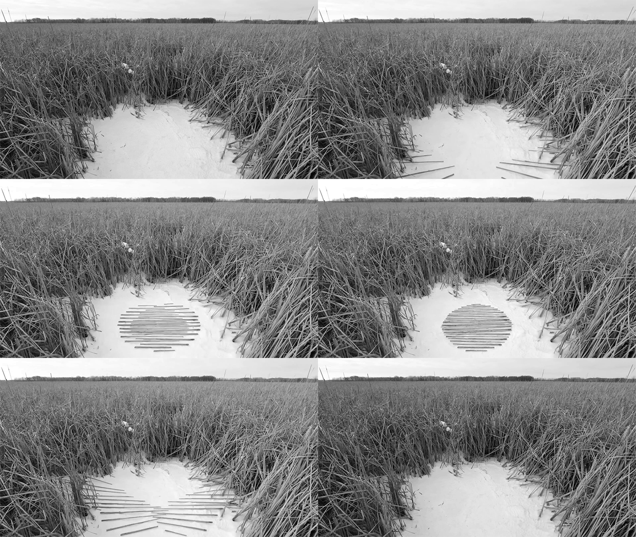
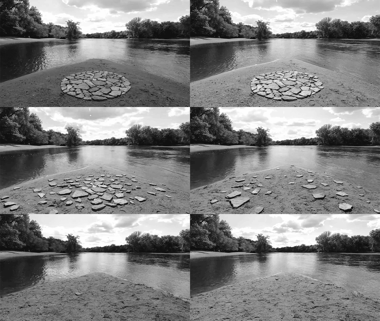
Animated Land Art by Paul Johnson

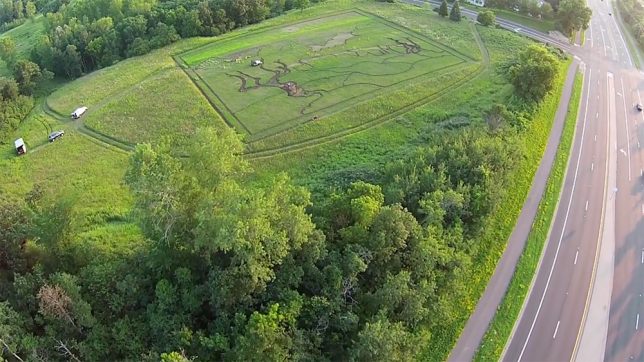
For his ‘Earthworks in Motion’ series, artist Paul Johnson takes inspiration from such legendary land artists as Andy Goldsworthy and Jim Denevan, using some of the same techniques but crafting them into stop-motion animations filmed in parks and nature preserves around Minneapolis/St. Paul, Minnesota.

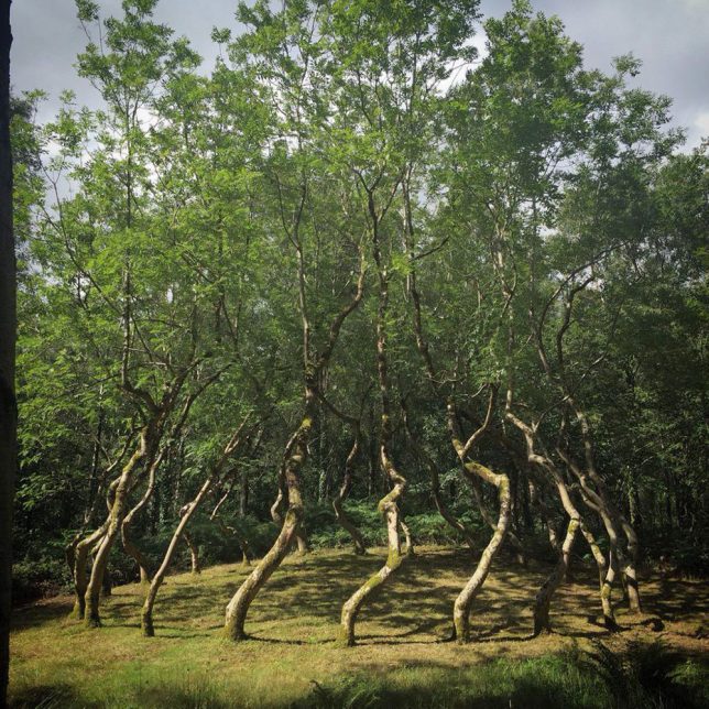
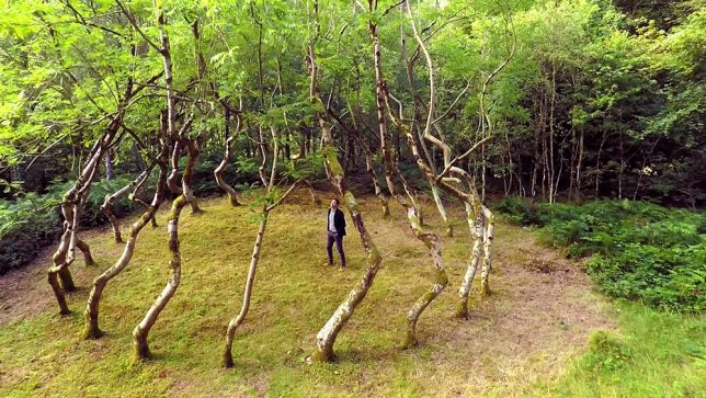
Ash Dome by David Nash

In 1977, sculptor David Nash secretly planted and trained a circle of 22 ash trees to grow into a shape resembling a vortex on an area of land in Wales. 40 years later, they’ve grown enough for the shape to be discernible. Nash says that at the time, during the Cold War and other unrest, planting something that couldn’t be properly enjoyed until the 21st century seemed like a leap of faith.

Van Gogh’s ‘Olive Trees’ Planted in a Field

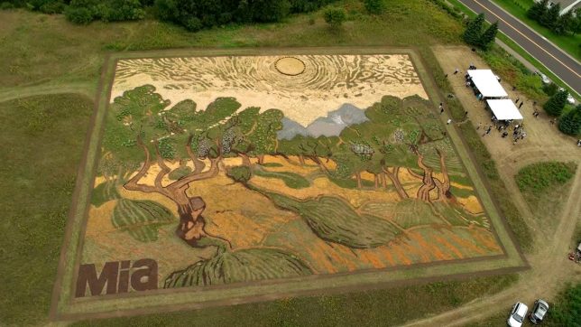
Vincent Van Goh’s masterpiece painting ‘Olive Trees,’ completed in 1889, comes to life – literally – in a Minneapolis field as artist Stan Herd uses nature as his canvas and paints. The piece was viewable from the air during autumn 2015 and then mowed down in concentric circles reminiscent of Van Gogh’s painting strokes.

Seven Magic Mountains by Ugo Rondinone

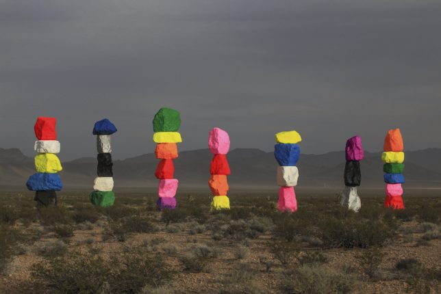
Each of Swiss artist Ugo Rondinone’s ‘Seven Magic Mountains’ made of stacked limestone stands between 30 and 35 feet tall painting in dayglo yellow, red, pink, silver and other colors. They’re set just south of Las Vegas as a monumental work of land art, installed in May 2016 and due to remain in place until May 2018, so there’s still time to see it in person.

Snow Murals by Simon Beck

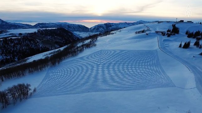
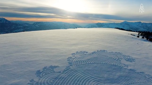
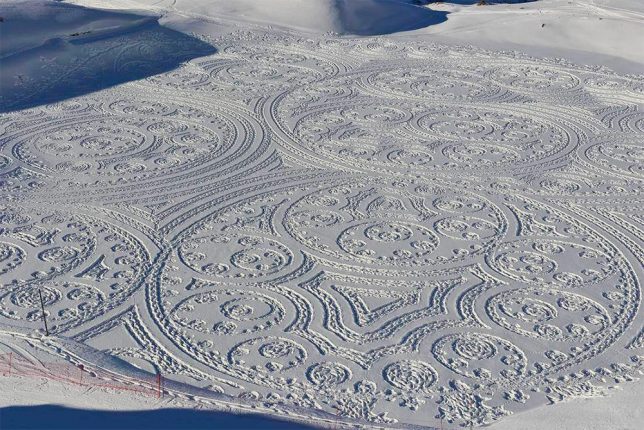
Simon Beck uses snowshoes to manually imprint dazzling patterns and shapes into snowy fields, photographs them from above and then allows them to be blown away, covered by more snow or trampled. It can take up to 5,000 steps an hour for 10 hours at a time to complete an average piece.

Next Page – Click Below to Read More:
The Earth As A Canvas 25 Monumental Works Of Land Based Art

Share on Facebook


[ By SA Rogers in Art & Installation & Sound. ]

[ WebUrbanist | Archives | Galleries | Privacy | TOS ]


WebUrbanist

 
Comments Off on The Earth as a Canvas: 25 Monumental Works of Land-Based Art

Posted in Creativity


Photos from the edge of the earth: World Photography Organization interviews Kiliii Yuyan

18 Jun
An Iñupiaq whaling crew cleans the hide of a polar bear that attacked their camp the previous day. Many Iñupiaq believe that declining sea ice has lead to these animals starving.
Photo by Kiliii Yüyan

Seattle-based photographer and traditional kayak-maker Kiliii Yüyan has spent years documenting the lives of people who live at the edges of the world. We’ve had the pleasure of working alongside him in Seattle and Alaska, but his work has also taken him as far as central Australia and Scandinavia.

In an interview with the World Photography Organization, Kiliii goes into detail about his current project, featuring the Iñupiaq whaling community of Utqiagviq (formerly known as Barrow, AK) and explains what motivates him as a photographer.

A humpback whale and calf feed on anchovies in the waters of Monterey Bay.
Photo by Kiliii Yüyan
California Condors feed on a stillborn calf. Photo by Kiliii Yüyan

Read the full article at worldphoto.org

Watch Kiliii’s talk at PIX 2015

Articles: Digital Photography Review (dpreview.com)
 
Comments Off on Photos from the edge of the earth: World Photography Organization interviews Kiliii Yuyan

Posted in Uncategorized


Industrial Scars: Aerial Photos of Humankind’s Harrowing Impact on Earth

30 May

[ By SA Rogers in Art & Photography & Video. ]

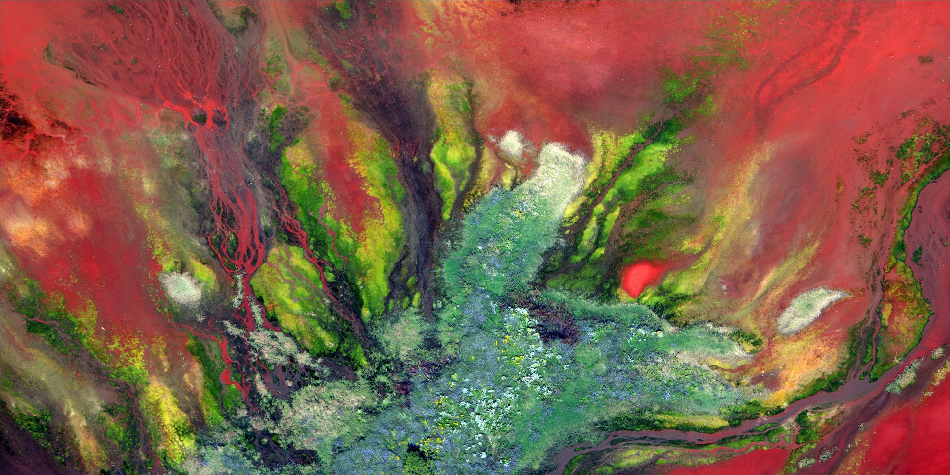
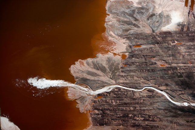
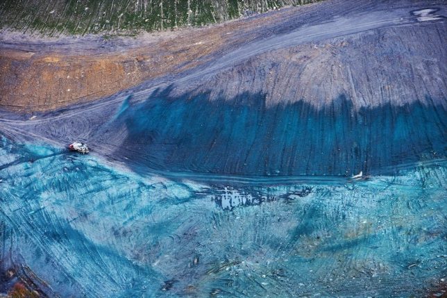
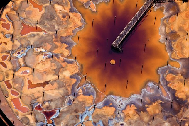
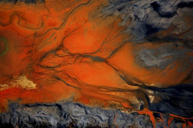
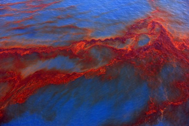
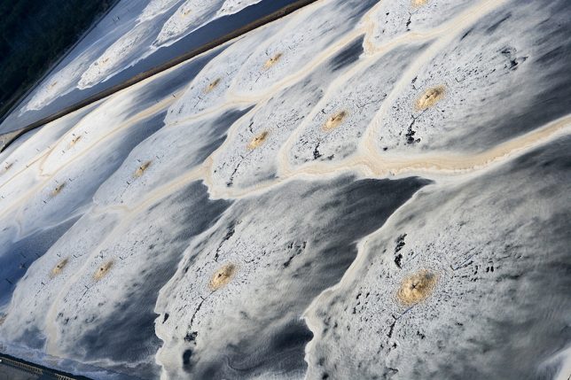
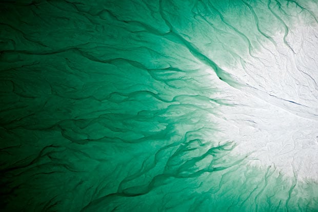
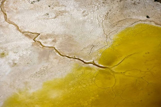
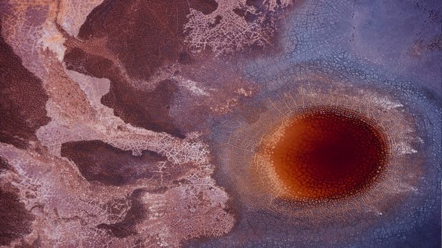
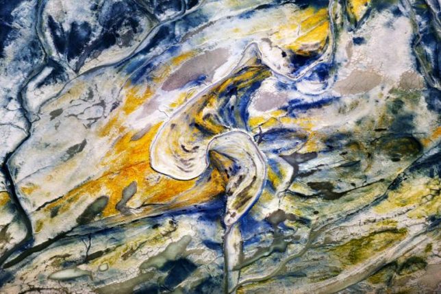
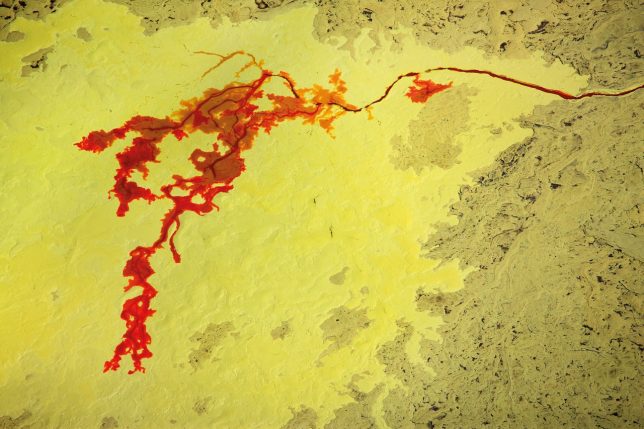
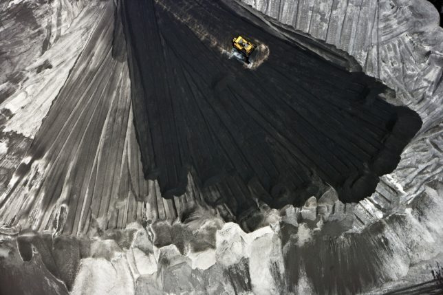
In strikingly well-composed, vividly colored scenes resembling abstract paintings, J. Henry Fair’s aerial photographs of toxic waste and industrial activity on Earth give us an uncomfortable look at the cost of human progress. In fact, the images seem unreal: how could the damage caused by industrial pollution be so strangely beautiful? Tar sands, mountaintop removal mining, fertilizer runoff, coal ash, factory farming and devastating oil spills aren’t exactly the stuff that stunning art is usually made of, but Fair is no ordinary artist, forcing us to face the duality of what we’ve created.

Shooting these scenes from the air gives us a perspective we don’t normally have, as if we’re flying over them in person, reckoning with the damage that comes with our consumption of fossil fuels, large-scale farmed meat, chemicals and other commodities that do significant harm to the environment in their sourcing and manufacturing.

Coal combustion waste may not be pretty, but its splashes of rust and bronze against its black and white surroundings are undeniably striking. Some heavy metals, like ‘red mud’ bauxite waste from aluminum production, are almost floral in their contrast to green.  Oil from the BP Deepwater Horizon spill is mesmerizing in its flowing red ribbons against the cobalt blue of the Gulf of Mexico waters. Phospho-gypsum fertilizer waste is a brilliant blue-green, like a gemstone; it contains both uranium and radium, piled dangerously close to drinking water aquifers.

“What interests me about this series is its essential irony and hope,” he says. “The thinking person participating in the modern world understands that all of us are living unsustainably, the impending consequences on our economy are real and significant. But in fact, with a little effort and luck, these limitations could be overcome, ensuring a secure future. And so we must hope, as we are all invested. My goal is to produce beautiful images that stimulate an aesthetic response, and thus dialog. If the pictures are not beautiful, the viewer will not stop to consider them.”

These images and many more are available in the form of a hardcover book set to be released on July 6th, ‘Industrial Scars: The Hidden Costs of Consumption.’

Share on Facebook


[ By SA Rogers in Art & Photography & Video. ]

[ WebUrbanist | Archives | Galleries | Privacy | TOS ]


WebUrbanist

 
Comments Off on Industrial Scars: Aerial Photos of Humankind’s Harrowing Impact on Earth

Posted in Creativity