New Year Day afternoon. I started the 2021 paddling on Horsetooth Reservoir with Sea Wind, my expedition canoe. No drysuit or wetsuit needed, but loading this boat on Toyota 4Runner and carrying to water was a good crossfit training in […]
paddling with a camera
Posts Tagged ‘Colorado’
Starting 2021 Paddling Season with Kruger Canoe in Colorado
Scouting the South Platte River near Greeley, Colorado
I haven’t paddled the South Platte since the last winter, so I decided to do some scouting around Greeley. There some changes … Riverside Park at Evans The park was rebuilt after flooding damages and reopened in October of 2018. […]
paddling with a camera
Colorado Tripod Company introduces ‘world’s first titanium tripod system’
 |
The Colorado Tripod Company has introduced what it claims is the world’s first titanium tripod system, with a crowdfunding campaign on Kickstarter. Not only does the use of titanium make the ball heads lightweight and strong, but the design of the heads also allows the camera to drop to the side below the usual 90 degrees seen in other heads.
 |
The Highline ballhead will be available in either titanium or aluminum. The titanium model will feature a hollow ball to reduce weight. Both versions will have a locking force of 54lb and will offer left-handed controls that allow users to hold the camera and shoot with the right hand. The titanium model will weigh less than 340g (12oz), while in aluminium the same unit weighs 510g (18oz).
 |
To accompany these heads a new line of titanium and carbon fibre legs have also been introduced. The company says that by CNC machining from a solid block of titanium it can make its metal parts stronger than manufacturers that use metal casting. Milling also means the company can make its parts more precisely, and it says it can cut the amount of material used to help reduce weight. The carbon fibre used in the Centennial legs is ten-layered, and comes from Japan.
An additional ball head called the Aspen comes only in aluminium but offers a much wider range of camera positions, as it has no housing around the ball. This allows the camera to drop well below 90 degrees, while making the head quite lightweight at only 454g (16oz).
The Highline ball head in aluminium starts at $ 79 on Kickstarter, while the titanium version can be had for $ 399. The Aspen head costs $ 179 and the Centennial tripod is $ 249 in aluminium and $ 399 in titanium. Various kits combing these products are also available. Shipping is planned to start in March.
For more information see the Colorado Tripod Company’s Kickstarter campaign page.
Disclaimer: Remember to do your research with any crowdfunding project. DPReview does its best to share only the projects that look legitimate and come from reliable creators, but as with any crowdfunded campaign, there’s always the risk of the product or service never coming to fruition.
Articles: Digital Photography Review (dpreview.com)
10 pictures from Fat Bike Riding in Northern Colorado
I enjoy a variety of outdoor activities. Of course, paddling in different flavors (SUP, kayak, canoe, packraft) comes first. It includes long distance racing. But, there is also biking, hiking, inline skating, drone flying and 4WD driving. The common theme […]
paddling with a camera
Searching for Paddling Water in Southern Colorado – Part 2
I started my February trip to southern Colorado with visiting Paint Mine Interpretive Park at Calhan east of Colorado Springs. I spent there evening and next morning photographing fantastic clay and sandstone erosion formations. I added some pictures to my […]
paddling with a camera
Searching for Paddling Water in Southern Colorado – Part 1
I paddled all winter in Fort Collins and northern Colorado: Horsetooth Reservoir, South Platte River, St Vrain Creek. One day in late February I decided to check some paddling waters in southern Colorado for a change. Paint Mine Interpretive Park […]
paddling with a camera
Colorado proposes bill supporting photographers who record police
Colorado, U.S. state legislatures have introduced a new bill that, if signed into law, will prevent law enforcement officers from interfering with citizens who are photographing or recording police activity. It is House Bill 15-1290, and it comes at a time when Texas has proposed its own bill on the topic, but with a draconian slant: it penalizes citizens that film or photograph police actions within 15 feet of the incident. Read more
Articles: Digital Photography Review (dpreview.com)
Exploring the Upper North Platte River in Colorado by SUP
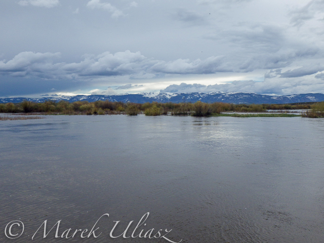
Confluence of two Grizzly Creeks 10 miles SW of Walden, CO – the beginning of the North Platte River
After some fall and winter scouting and a lot of time spent on Google maps, the exploration of the upper North Platte River finally took place during the Memorial Day weekend. Rob Bean joined me to paddle our inflatable Bordwarks SUPs: Shubu and Badfish.
Upper North Platte River on Google maps with some waypoints for access points and diversion dams.
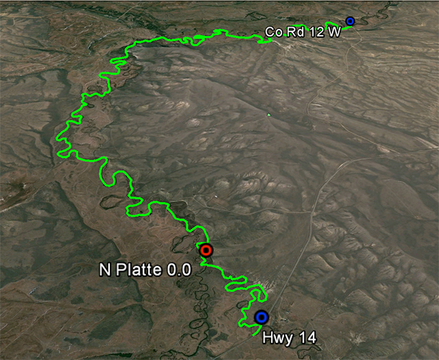
14 miles of the upper North Platte River near Walden with the river beginning
as a confluence of Grizzly Creek and Little Grizzly Creek
Put-in: Grizzly Creek at highway 14, 10 miles south of Walden (not much room for off road parking)
Take-off: Co road 12 W, 8 miles west of Walden (official fishing access, parking near bridge, another fishing access with parking ~0.5 mile below the bridge).
GPS milege: 13.8 miles, time: 2:50 hours.
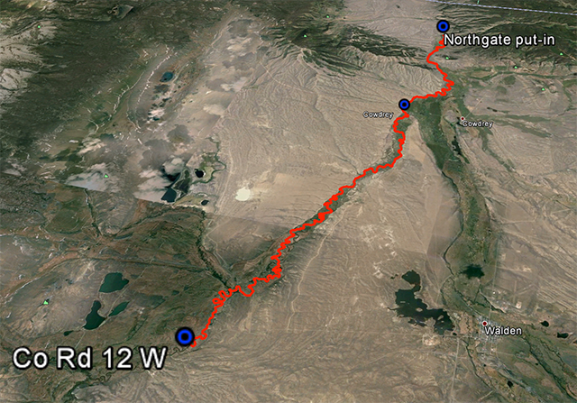
31 miles of the North Platte River from Walden to the Northgate Canyon put-in
Put-in: Co road 12 W
Take-off: put-in for the Northgate Canyon run, 9 miles north of Cowdrey
Alternative put-in for a short 6 miles run: Co Rd 6, 2 miles west of Cowdrey (that run is described in Paddling Colorado book by Dunbar Hardy).
GPS milege: 31 miles, time: 6:49 hours.
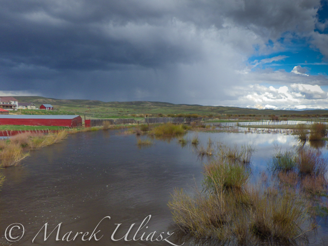
River flow was rising from 3000 to 4000 cfs at Northgate during our two days of paddling. A lot of meadows in the river valley were flooded. Paddling speed: up to 9 mph.
The weather was challenging. We had a lot of thunderstorms around us during the first day followed by ~8 hours of heavy rain. We were lucky to finished our paddling before the rain. A beautiful weather on second day lasted till noon, then we experienced a storm with a small hail followed by heavy rain for the rest of the day. Strong afternoon headwinds put us on our knees, especially, during the second day.
Obstacles: diversion dams, fences across the river, low bridges depending a water level. No trees. No rapids (except dams). The river is wide and open, so you can see or hear all incoming obstacles well in advance. We never run into any troubles.
Most of the dams can be seen on satellite pictures. The dam a few miles below Co road 12 W is pretty big and always requires portaging (not comfortable on right). Other dams are primitive rock dams and often can be run. We portaged most of them to avoid big waves, but I would run more of them in a canoe. We managed to paddle around a few of them. It is easier to select a correct river arm on a map than in practice on the river.
We had to portage numerous barbed wire fences crossing the river. Some were in water and could be safely run over in a canoe, but we played safe in out inflatable SUPs. A few fences had only a single wire across the river and was possible to paddle under them. Always watch for these fences! You can notice stronger and taller posts on the shores and, sometimes, stairs over them, before seeing the actual wires over the river.
One or two low farm bridges in the upper section required portaging. All bridges in the lower section have a high clearance.
Wildlife: moose, bighorn, deer, elk (a herd was swimming across the river several times just in front of us), bald and gold eagles, pelicans, geese and other waterfowl, numerous smaller birds, curious cows.
Scenery: a wide valley surrounded by snowy mountains, crazy river meanders in the upper section, cliffs and rock outcroppings, just a few trees (often with eagle nest), higher hills with some forest in the lower section, a lot of water flowing around and flooding meadows, but, usually, not difficult to find a dry place to land.
Grizzly Creek looking upstream from highway 14
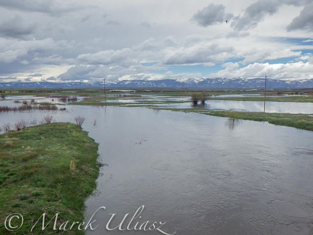
Grizzly Creek looking downstream from highway 14 – start of our adventure
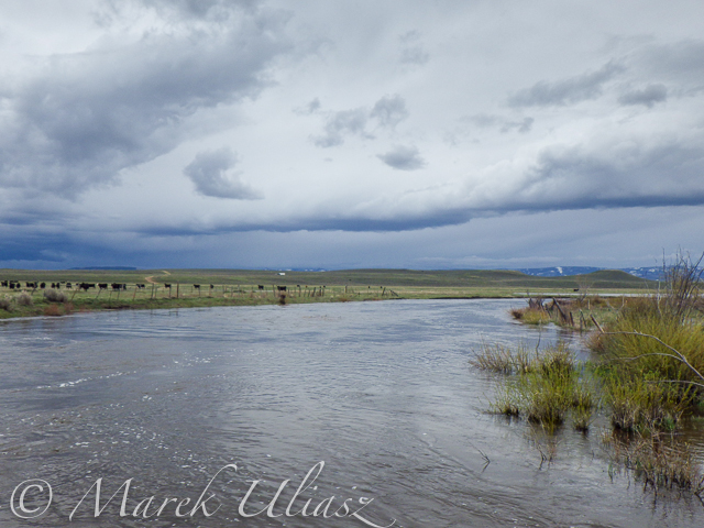
North Platte River meandering near Walden
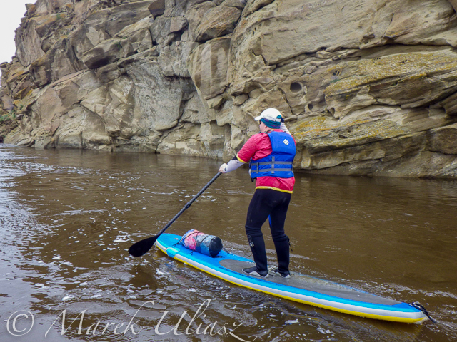
One of high cliffs
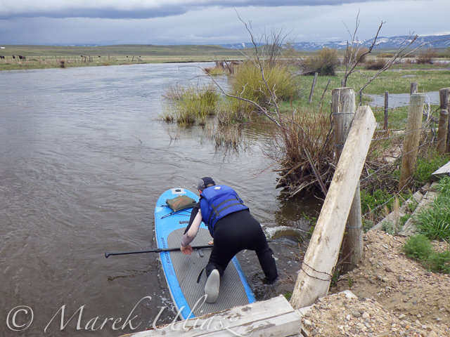
Going over a low farm bridge
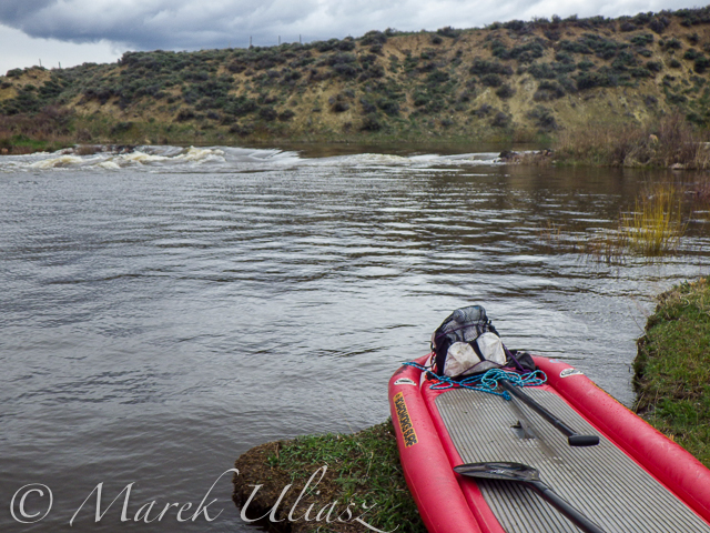
One of diversion dams
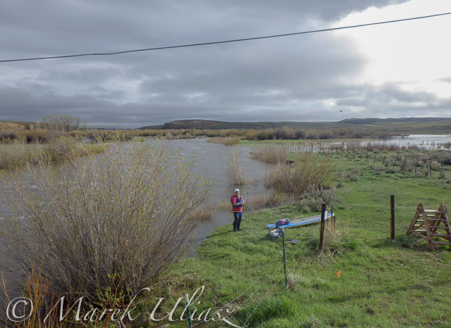
North Platte River at Co Rd 12 W near Walden – the finish of day 1 and the start of day 2
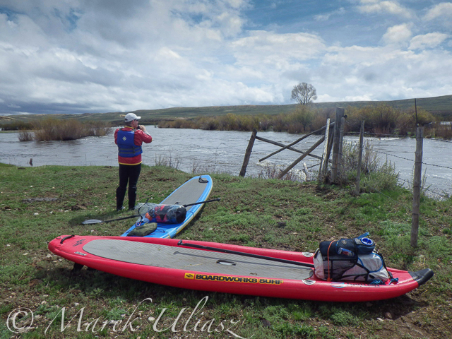
Barbed wire fence across the river
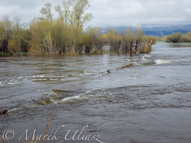
Another fence across the river
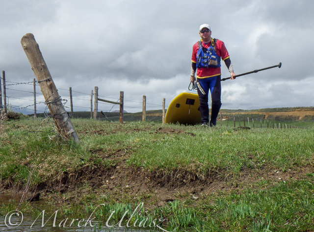
And another cattle fence to portage
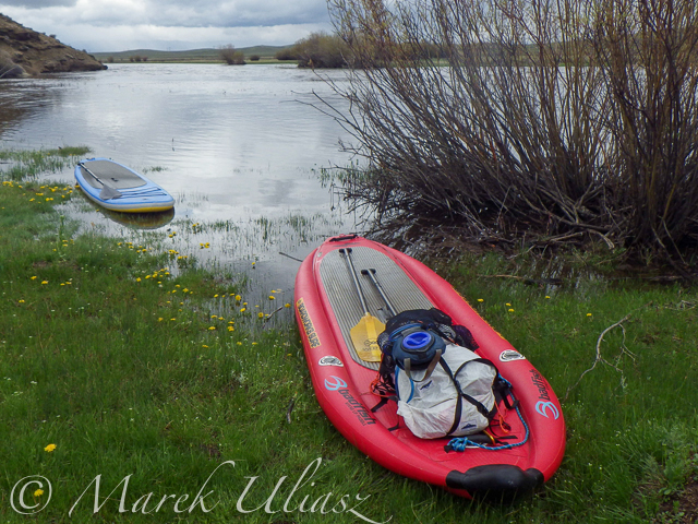
Lunch break – last minutes of nice weather
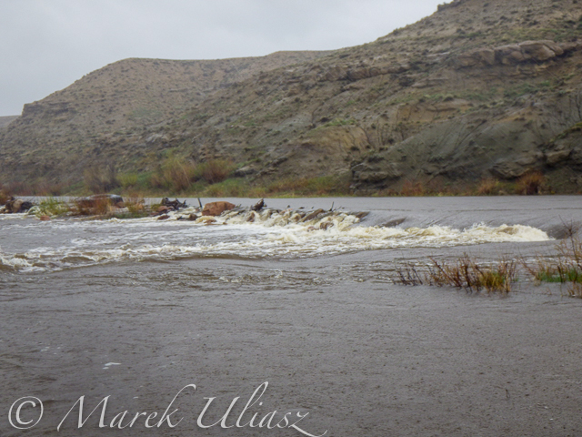
Hail storm over diversion dam
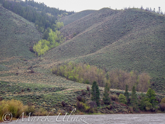
The last river section between Cowdrey and Northgate

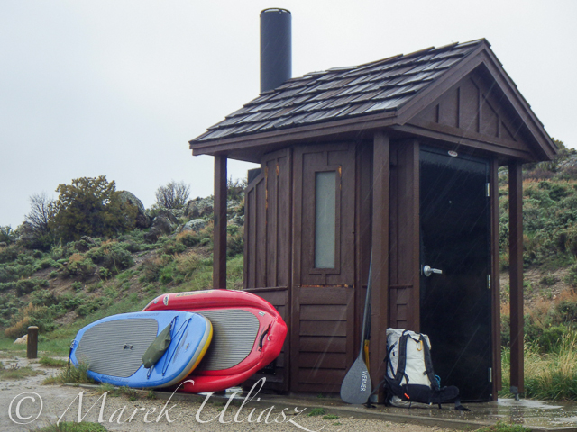
Finishing in rain at the Northgate

The last look at the river – still raining
Ready to go home …
Your browser does not support iFrame.
Related posts:
– North Platte River in Colorado above Northgate Canyon
– Sun, Snow and Wind on the North Platte River in Wyoming
– Bennett Peak to Pick Bridge on the North Platte River, Wyoming
Exploring the Upper North Platte River in Colorado by SUP

Confluence of two Grizzly Creeks 10 miles SW of Walden, CO – the beginning of the North Platte River
After some fall and winter scouting and a lot of time spent on Google maps, the exploration of the upper North Platte River finally took place during the Memorial Day weekend. Rob Bean joined me to paddle our inflatable Bordwarks SUPs: Shubu and Badfish.
Upper North Platte River on Google maps with some waypoints for access points and diversion dams.

14 miles of the upper North Platte River near Walden with the river beginning
as a confluence of Grizzly Creek and Little Grizzly Creek
Put-in: Grizzly Creek at highway 14, 10 miles south of Walden (not much room for off road parking)
Take-off: Co road 12 W, 8 miles west of Walden (official fishing access, parking near bridge, another fishing access with parking ~0.5 mile below the bridge).
GPS milege: 13.8 miles, time: 2:50 hours.

31 miles of the North Platte River from Walden to the Northgate Canyon put-in
Put-in: Co road 12 W
Take-off: put-in for the Northgate Canyon run, 9 miles north of Cowdrey
Alternative put-in for a short 6 miles run: Co Rd 6, 2 miles west of Cowdrey (that run is described in Paddling Colorado book by Dunbar Hardy).
GPS milege: 31 miles, time: 6:49 hours.
River flow was rising from 3000 to 4000 cfs at Northgate during our two days of paddling. A lot of meadows in the river valley were flooded. Paddling speed: up to 9 mph.
The weather was challenging. We had a lot of thunderstorms around us during the first day followed by ~8 hours of heavy rain. We were lucky to finished our paddling before the rain. A beautiful weather on second day lasted till noon, then we experienced a storm with a small hail followed by heavy rain for the rest of the day. Strong afternoon headwinds put us on our knees, especially, during the second day.
Obstacles: diversion dams, fences across the river, low bridges depending a water level. No trees. No rapids (except dams). The river is wide and open, so you can see or hear all incoming obstacles well in advance. We never run into any troubles.
Most of the dams can be seen on satellite pictures. The dam a few miles below Co road 12 W is pretty big and always requires portaging (not comfortable on right). Other dams are primitive rock dams and often can be run. We portaged most of them to avoid big waves, but I would run more of them in a canoe. We managed to paddle around a few of them. It is easier to select a correct river arm on a map than in practice on the river.
We had to portage numerous barbed wire fences crossing the river. Some were in water and could be safely run over in a canoe, but we played safe in out inflatable SUPs. A few fences had only a single wire across the river and was possible to paddle under them. Always watch for these fences! You can notice stronger and taller posts on the shores and, sometimes, stairs over them, before seeing the actual wires over the river.
One or two low farm bridges in the upper section required portaging. All bridges in the lower section have a high clearance.
Wildlife: moose, bighorn, deer, elk (a herd was swimming across the river several times just in front of us), bald and gold eagles, pelicans, geese and other waterfowl, numerous smaller birds, curious cows.
Scenery: a wide valley surrounded by snowy mountains, crazy river meanders in the upper section, cliffs and rock outcroppings, just a few trees (often with eagle nest), higher hills with some forest in the lower section, a lot of water flowing around and flooding meadows, but, usually, not difficult to find a dry place to land.

Grizzly Creek looking upstream from highway 14

Grizzly Creek looking downstream from highway 14 – start of our adventure

North Platte River meandering near Walden

One of high cliffs

Going over a low farm bridge

One of diversion dams

North Platte River at Co Rd 12 W near Walden – the finish of day 1 and the start of day 2

Barbed wire fence across the river

Another fence across the river

And another cattle fence to portage

Lunch break – last minutes of nice weather

Hail storm over diversion dam

The last river section between Cowdrey and Northgate

Finishing in rain at the Northgate

The last look at the river – still raining

Ready to go home …
All pictures were shot with my current paddling camera on duty – Pentax Optio WG-2. I have been using waterproof Pentax Optio cameras for paddling and other outdoor activities since their first original model was released in 2005. The newest model from that series is available now as Ricoh WG-4.
Your browser does not support iFrame.
Related posts:
– North Platte River in Colorado above Northgate Canyon
– Sun, Snow and Wind on the North Platte River in Wyoming
– Bennett Peak to Pick Bridge on the North Platte River, Wyoming
North Platte River in Colorado above Northgate Canyon
North Platte River is one of my favorite paddling destinations. Usually, I paddle various flatwater river sections in Wyoming, but, recently, I scouted access points to the upper North Platte River in Colorado above Northgate Canyon.
That river section in mentioned as “Upper Valley” in Paddling Colorado book by Dunbar Hardy. It is just 6 miles starting from put-in on county road 6 west of Cowdrey and ends in the Routt launch site (put-in for the Northgate Canyon run). The river is meandering in a wide valley with some beaver swamps.


I took these three pictures from the Routt launch site looking upstream on October 16, 2003 with the river flow about 250 cfs which is much higher than usual for autumn. Recommended flow for paddling is 500-1500 cfs. I believe that 250 cfs may be sufficient for downriver run, perhaps, with some occasional shallow spots. A packraft trip with a bike shuttle? A bike leg would include some hill climbing and would be longer than a river one.
I added North Platte River pictures to my stock photography portfolio. There are available for download and licensing as royalty free pictures starting from $ 2 for a small size perfect for blogging or web publication.
Related posts:
Sun, Snow and Wind on the North Platte River in Wyoming
Bennett Peak to Pick Bridge on the North Platte River, Wyoming
44 Miles of the North Platte River in 2 Minutes
57 Miles of Paddling on North Platte River from Treasure Island to Fort Steele, Wyoming
You must be logged in to post a comment.