RSS
 

Posts Tagged ‘10Mile’

Underline: 10-Mile Park to Trace Path of Elevated Rail in Miami

24 Feb

[ By WebUrbanist in Architecture & Cities & Urbanism. ]
underline

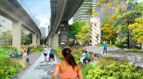
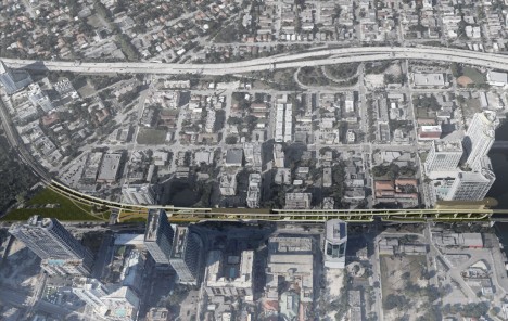
Following in the footsteps of the High Line (and Low Line) of New York City, the Underline project aims to take the underutilized space below Miami’s elevated MetroRail and transform it into a connected park-and-pathway system spanning ten miles and hundreds of acres.
miami underline project

The undertaking is ambitious, but it has solid precedents around the country: “The Underline will connect communities, improve pedestrian and bicyclist safety, create over a hundred acres of open space with restored natural habitats.”
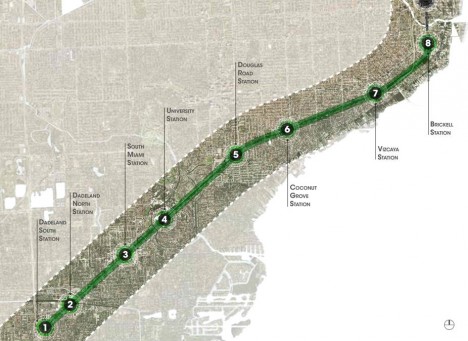
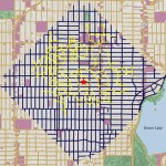
underline system map

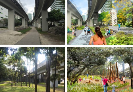
Before-and-after concept images, shown above and below, highlight key points along the trail, including expanded park space, bicycle repair stations and play areas.
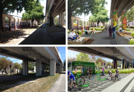
miami before after park

Connecting Miami, Coral Gables and South Miami, the design further aims to “encourage a healthy lifestyle, provide an easily accessible place to exercise, create a mobility corridor that integrates transit, car, biking and walking, provide a 10-mile canvas for artistic expression, attract development along US1, and generate significant economic impact.”
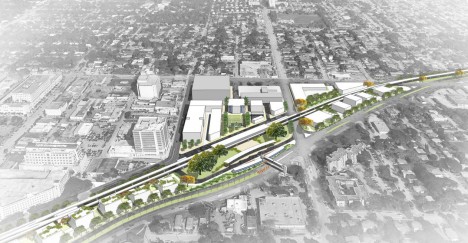
underline master plan

Beyond its immediate and direct effects, the trail would also connect out to a system of existing bike paths as well as ones under development, serving as a nexus between a total of 250 miles of extant and proposed trails across southern Florida.
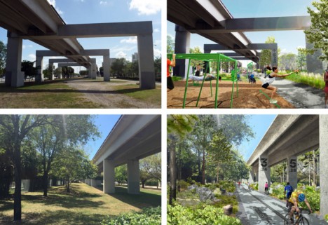
miami park project

James Corner Field Operations of New York City was selected to create the master plan for The Underline, with input collected from surveys and six public meetings.
underline miami design

Their master plan provides “standards and requirements for the urban trails including trail widths and proposed materials. It also includes recommendations for lighting and wayfinding, seating, amenities, etc. The plan proposes improvements to crosswalks, intersections. Landscape recommendations include a plant palette and placement. There are also proposals for destination parks.”

Share on Facebook


[ By WebUrbanist in Architecture & Cities & Urbanism. ]

[ WebUrbanist | Archives | Galleries | Privacy | TOS ]


WebUrbanist

 
Comments Off on Underline: 10-Mile Park to Trace Path of Elevated Rail in Miami

Posted in Creativity


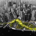
Turning Tides: 10-Mile Park to Protect NYC from Flooding

30 May

[ By WebUrbanist in Architecture & Cities & Urbanism. ]

green park ring manhattan

Designed to shield the exposed edges of Lower Manhattan from increasingly-disastrous storms, this impressive system of parks and other public spaces is also designed to serve the everyday needs of New York citizens.

green city edge view

green ocean level indicator

green park swimming pools

Rising sea levels and increased flood frequencies may eventually are the driving threat behind this competition entry. Big U, an urban design scheme authored by Bjarke Ingels Group (BIG) and others, is one of a set of submissions to Rebuild by Design, a competition from the U.S. Department of Housing and Urban Development (HUD). This plan calls for a series of discrete interventions that together form a protective buffer.

Jeremy Siegel, one of the project leads, elaborates: “Because they all work individually, you end up with a system that’s resilient. If you have a breach in one area, it’s localized and you can organize evacuation into neighboring compartments. It’s a little bit like the hull of a ship, where you’ve got different segments, and breaching one area doesn’t necessarily mean that the whole system fails.”

green park section diagram

One of the advantages of this segmentation is the ability to build in sections, breaking a massive construction project down into discrete steps that can be implemented sequentially for budgeting and other pragmatic reasons. Each area features its own personality and amenities, including aquariums, swimming pools, walking paths and seasonal markets.

Learning local lessons from Hurricane Sandy (and national ones from the likes of Katrina), the architecture teams participating in the competition sought to address social as well as engineering needs. Located anywhere else and their ambitious plans might sound far fetched, but New York City is already home to Central Park and The High Line.

green park fall leaves

green park swimming pool

green area under rails

Siegel notes that, particularly in a place like NYC, “If you’re going to be investing so much money into an infrastructure for resiliency–that’s going to be sitting along one of the most spectacular coastlines in the world–there’s a huge opportunity there to also improve civic infrastructure, so it can protect the city, but also become a platform for civic life.” As for other proposed schemes, you can see and read more about the finalists and (eventual) winners at Rebuild by Design.

Share on Facebook


[ By WebUrbanist in Architecture & Cities & Urbanism. ]

[ WebUrbanist | Archives | Galleries | Privacy | TOS ]

WebUrbanist

 
Comments Off on Turning Tides: 10-Mile Park to Protect NYC from Flooding

Posted in Creativity