RSS
 

Posts Tagged ‘River’

North Platte River in Colorado above Northgate Canyon

19 Oct

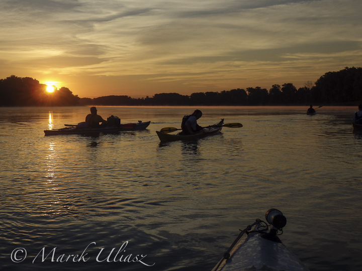
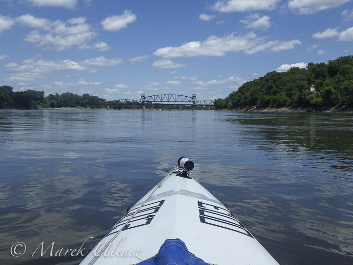
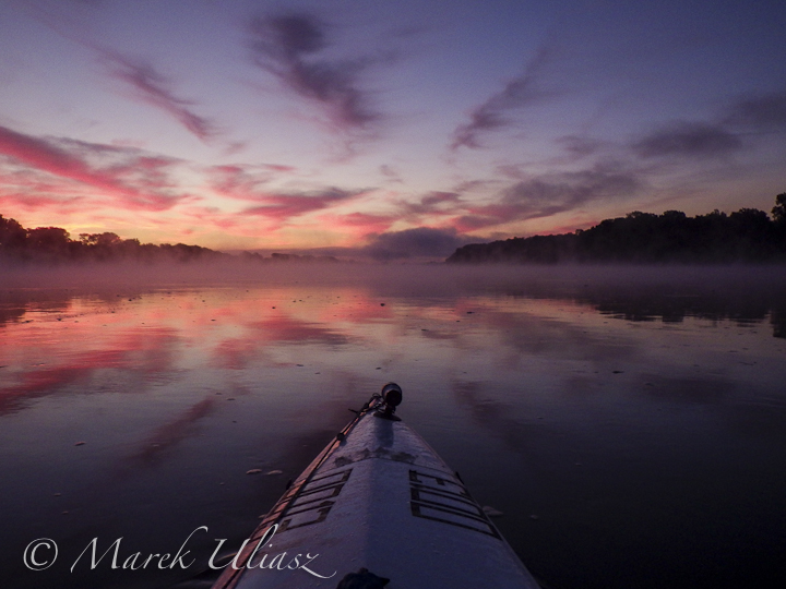
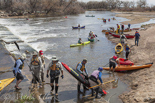
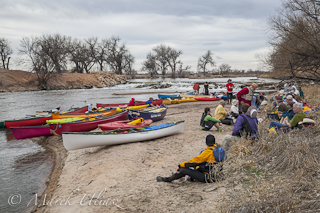
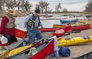
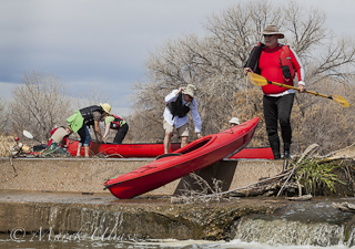
North Platte River is one of my favorite paddling destinations. Usually, I paddle various flatwater river sections in Wyoming, but, recently, I scouted access points to the upper North Platte River in Colorado above Northgate Canyon.

That river section in mentioned as “Upper Valley” in Paddling Colorado book by Dunbar Hardy. It is just 6 miles starting from put-in on county road 6 west of Cowdrey and ends in the Routt launch site (put-in for the Northgate Canyon run). The river is meandering in a wide valley with some beaver swamps.

North Platte River above North Gate Canyon

North Platte River in Colorado

beaver dam on North Platte River near Cowdrey - Colorado

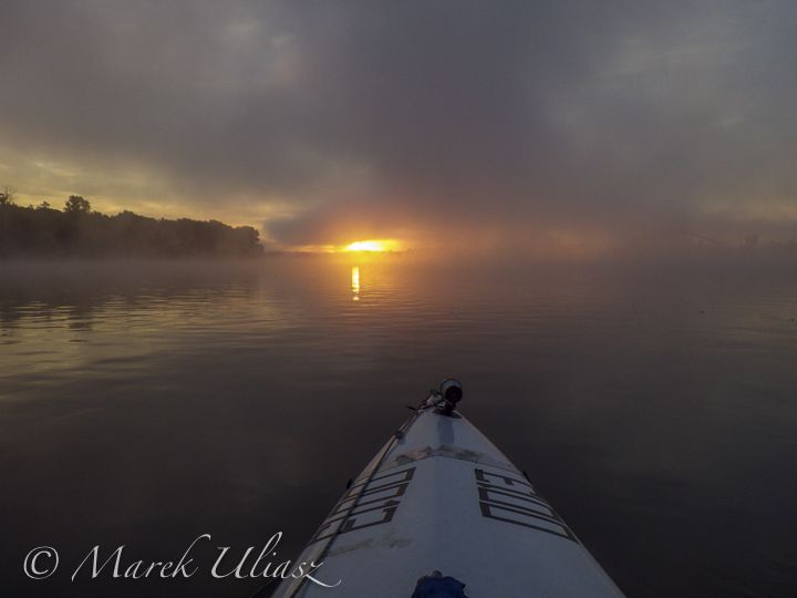
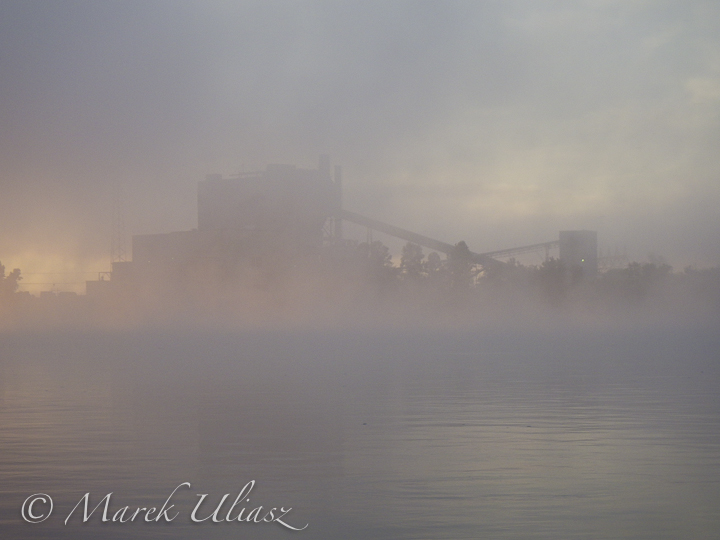
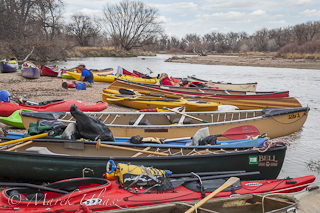
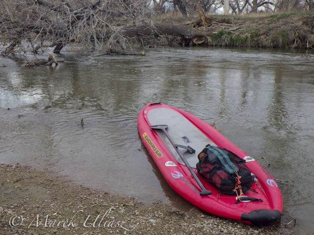
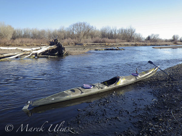
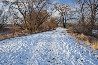
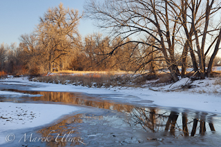
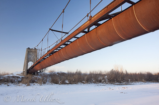
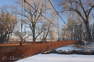
I took these three pictures from the Routt launch site looking upstream on October 16, 2003 with the river flow about 250 cfs which is much higher than usual for autumn. Recommended flow for paddling is 500-1500 cfs. I believe that 250 cfs may be sufficient for downriver run, perhaps, with some occasional shallow spots. A packraft trip with a bike shuttle? A bike leg would include some hill climbing and would be longer than a river one.

I added North Platte River pictures to my stock photography portfolio. There are available for download and licensing as royalty free pictures starting from $ 2 for a small size perfect for blogging or web publication.

Related posts:
Sun, Snow and Wind on the North Platte River in Wyoming
Bennett Peak to Pick Bridge on the North Platte River, Wyoming
44 Miles of the North Platte River in 2 Minutes
57 Miles of Paddling on North Platte River from Treasure Island to Fort Steele, Wyoming


paddling with a camera

 
Comments Off on North Platte River in Colorado above Northgate Canyon

Posted in Photography


10 Pictures from 2013 Missouri River 340 Race

14 Aug

Sea Wind canoe on Kaw River
My Sea Wind canoe on the shore of Kaw River 20 minutes before the race start.

Missouri American Water MR340 is a paddling race across the entire state of Missouri – 340 miles nonstop in less than 88 hours from Kansas City to St Charles. The 8th edition of the race took place July 23-26, 2013.

It was my 7th MR340 race, and the third one paddled self supported in Sea Wind canoe designed by Verlen Kruger. This year it took me 62:21 hours to finish – 38th place overall and 19th place in men’s solo division (142 boats), see race results. I had a pretty good race. Sea Wind allowed me to to run long river sections up to 12 hours of paddling without any stops.

Here is a selection of 10 pictures from the race, all shot with Pentax Optio WG2 camera. I will be writing more technical reports and commentary in my Fitness Paddling blog where you can find a lot of information on previous MR340 races starting from the very first one in 2006.


solo boats start of 2013 Missouri River 340 Race
A few minutes before the start of solo boats at 7am on the Kaw River with a cityscape of Kansas City.

solo boats start of 2013 Missouri River 340 Race
Tandems and all other boats are starting at 8am.

solo boats start of 2013 Missouri River 340 Race
One of 3 SUP paddlers is standing up above kayaks and canoes.

sunrise on Missouri River
First sunrise on the river (Wednesday morning) a few miles above Glasgow.+

Old Katy railroad bridge at Boonsville1
Old Katy railroad bridge at Boonsville. 170 miles. Already half of the race or only half …

Old Katy railroad bridge at Boonsville
Approaching Boonsville bridge. Traditionally, I am shooting some pictures here.

foggy sunrise on Missouri River

foggy sunrise on Missouri River

foggy


paddling with a camera

 
Comments Off on 10 Pictures from 2013 Missouri River 340 Race

Posted in Photography


French River, Northern ON Canada

06 Aug


Bridge over French River on the Trans Canada Highway

. : LIGHT and SHADOW : .

 
Comments Off on French River, Northern ON Canada

Posted in Equipment


French River, Northern ON Canada

03 Aug


Granite rock faces on the French River

. : LIGHT and SHADOW : .

 
Comments Off on French River, Northern ON Canada

Posted in Equipment


French River ON, Canada: Fishing

02 Aug


What a great summer time Canadian scene!

. : LIGHT and SHADOW : .

 
Comments Off on French River ON, Canada: Fishing

Posted in Equipment


Snowmobile Bridge French River, ON Canada

01 Aug


The longest snowmobile bridge in the world.

. : LIGHT and SHADOW : .

 
Comments Off on Snowmobile Bridge French River, ON Canada

Posted in Equipment


24 June, 2013 – The Wind River Range

24 Jun

Miles Hecker’s Geotagged location for this month is The Wind River Range.

"Michael’s and Jeff’s tutorial videos are absolutely awesome, not only because of the information transmitted but also because of the casual, conversational style which somehow really makes things stick in your memory."


The Luminous Landscape – What’s New

 
Comments Off on 24 June, 2013 – The Wind River Range

Posted in News


12th Annual South Platte River All Club Paddle

16 Apr

The annual spring kickoff paddling trip on the South Platte River took place this year with two weeks delay on April 6, 2013, due to a winter weather. Typically, this trip is organized on the third Saturday of March. It starts in Evans Riverside Park and goes 9 miles downriver to Kersey or 14 miles to Kuner wuth a lunch break at the second dam portage. Several Colorado paddling clubs participate (Rocky Mountain Canoe Club, Poudre Paddlers Club, Rocky Mountain Sea Kayak Club, High Country River Rafters, and Colorado White Water Association), but no membership is required to paddle.

Kayaks and canoes on South Platte River portaging kayaks and canoes over diversion dam on South Platte River
Kayaks and canoes on South Platte River Kayaks and canoes on South Platte River
lunch break on South Platte River portaging kayaks and canoes on South Platte River

We had a good weather this year with some signs of spring, but pretty low water, ~550 cfs at Kersey. I took the pictures above with my Canon 5D Mark II DSLR camera. They can be licensed for editorial use from my stock photography portfolio

This year I paddled Badfish inflatable SUP in a longer version of this trip to Kuner. It was not a first time of this paddleboard on the South Platte since I started my SUP season in early February this year with upstream and downstream paddling at Kersey.

I had a nice paddling with some problems on several shallow spots. I paddled a couple of miles without the center 10″ fin, but tracking of Badfish was pretty bad. I will try a shorter fin in my next paddling.

Badfish SUP on South Platte River

Related posts:
Opening 2013 Paddling Season with Badfish SUP on the South Platte River
SUP on the South Platte River – Opening Winter Paddling Season
South Platte River below Denver, Colorado – GPS/photo river guide. Links to flow data.


paddling with a camera

 
Comments Off on 12th Annual South Platte River All Club Paddle

Posted in Photography


South Platte River at Fort Lupton – Northern Colorado Paddling

12 Mar
Subaru Outback and JKK Supernova kayak><br />
I haven’t paddled my JKK Supernova kayak since 2012 Missouri River 340 race. I decided that to rinse some Missouri mud off.</p>
<p><img decoding=

Paddling upstream with GoPro camera mounted in the front deck.

paddling South Platte River

About 2 miles upstream of Fort Lupton. The river was shallow, fast, twisty, stinky … Near perfect! I had a great workout.

South Platte River at Fort Lupton
Back to Fort Lupton.

I have paddled JKK Supernova starting at Fort Lupton several times this winter. It seems that my driving time from Fort Collins is about 45 minutes and is not longer than driving to Kersey below Greeley. I didn’t try to paddle my SUP since some spots were too shallow for a fin.


This is a diversion dam just below Fort Lupton. I’ve paddled the river between Fort Lupton and the confluence wit St Vrain Creek. There are 7 dams in this short section. Maybe, it’s a time to run it just for documentary purposes, certainly, not for recreation. It feels like a packrafting project.

Related posts:
South Platte River below Denver, Colorado – GPS/photo river guide


paddling with a camera

 
Comments Off on South Platte River at Fort Lupton – Northern Colorado Paddling

Posted in Photography


Winter Walk Along the Poudre River in Fort Collins

11 Jan

All my local paddling waters are covered by ice. Even the Horsetooth Reservoir is partially frozen as seen in this recent picture of the Inlet Bay. So, it’s time for more hiking, biking and inline skating or driving to the South Platte River which is open and flowing.

Here is a little gallery of pictures shot during winter time along the Cache la Poudre River in Fort Collins. They came from favorite natural areas, Arapaho Bend and Riverbend Ponds or just from the Poudre biking trail.

Cache la Poudre River, Fort Collins winter river in Colorado
winter road - Riverbend Ponds Natural Area Cache la Poudre River in winter
rusty flume suspended over a river old rusty aqueduct across a river

These images are available for licensing as royalty free digital downloads starting with $ 2 directly from my stock photography portfolio. Recently, I started to sort my Colorado portfolio into several galleries. It should not be surprising that three of them are related to water:


Horsetooth

Horsetooth

Horsetooth Reservoir and Horsetooth Mountain Open Space near Fort Colorado – a great area for water sports, hiking, climbing, trail running, and mountain biking. It is my favorite local destination for kayak, canoe and SUP paddling.


Cache la Poudre River

Cache la Poudre River

Pictures from the Poudre Canyon as well as pictures of the river as seen from biking trails in Fort Collins and downriver all the way to Greeley and confluence with the South Platte River.

water

Water

Water issues mostly in Colorado – river diversion, irrigation, ditches, water pollution. Many pictures in this gallery are shot from a kayaker perspective.

Related posts:
Fort Collins and Northern Colorado Pictures in My Stock Photography Portfolio
Fort Collins from Winter Hiking the Horsetooth Rock Trail
Horsetooth Reservoir in Winter Scenery
Riverbend Ponds in Late Fall Scenery
Paddling the Poudre River at Nix Natural Area in Fort Collins


paddling with a camera

 
Comments Off on Winter Walk Along the Poudre River in Fort Collins

Posted in Photography