Tag: River

  • Exploring the Upper North Platte River in Colorado by SUP

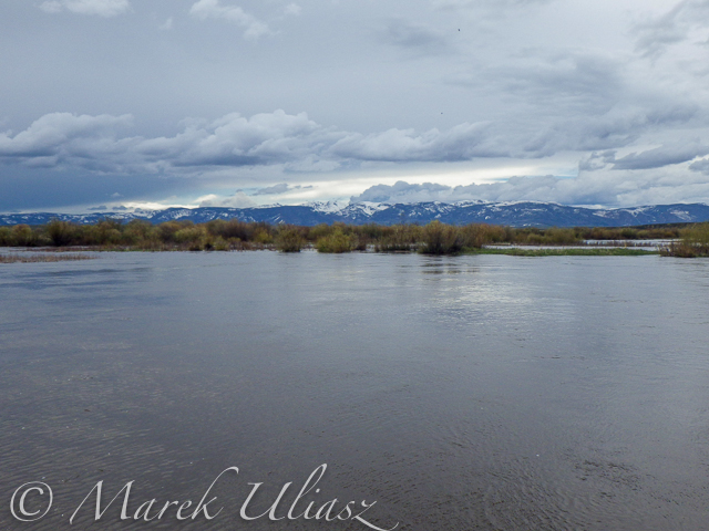
    beginning of the North Platte River

    Confluence of two Grizzly Creeks 10 miles SW of Walden, CO – the beginning of the North Platte River

    North Platte River is one of my favorite paddling destinations. Usually, I paddle various flatwater river sections in Wyoming above and below Saratoga. However, there is a 45 mile long river stretch in Colorado’s North Park before the North Platte enters the Northgate Canyon.

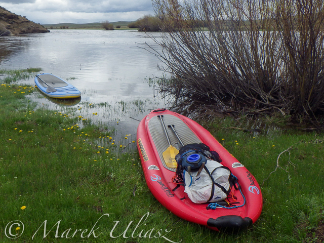
    After some fall and winter scouting and a lot of time spent on Google maps, the exploration of the upper North Platte River finally took place during the Memorial Day weekend. Rob Bean joined me to paddle our inflatable Bordwarks SUPs: Shubu and Badfish.

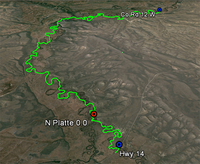
    Upper North Platte River on Google maps with some waypoints for access points and diversion dams.
    North Platte River near Walden, Colorado

    14 miles of the upper North Platte River near Walden with the river beginning
    as a confluence of Grizzly Creek and Little Grizzly Creek

    May 24, 2014
    Put-in: Grizzly Creek at highway 14, 10 miles south of Walden (not much room for off road parking)
    Take-off: Co road 12 W, 8 miles west of Walden (official fishing access, parking near bridge, another fishing access with parking ~0.5 mile below the bridge).
    GPS milege: 13.8 miles, time: 2:50 hours.
    North Platte River in Colorado near Walden

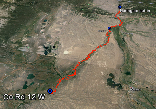
    31 miles of the North Platte River from Walden to the Northgate Canyon put-in

    May 25, 2014
    Put-in: Co road 12 W
    Take-off: put-in for the Northgate Canyon run, 9 miles north of Cowdrey
    Alternative put-in for a short 6 miles run: Co Rd 6, 2 miles west of Cowdrey (that run is described in Paddling Colorado book by Dunbar Hardy).
    GPS milege: 31 miles, time: 6:49 hours.

    River flow was rising from 3000 to 4000 cfs at Northgate during our two days of paddling. A lot of meadows in the river valley were flooded. Paddling speed: up to 9 mph.

    The weather was challenging. We had a lot of thunderstorms around us during the first day followed by ~8 hours of heavy rain. We were lucky to finished our paddling before the rain. A beautiful weather on second day lasted till noon, then we experienced a storm with a small hail followed by heavy rain for the rest of the day. Strong afternoon headwinds put us on our knees, especially, during the second day.

    Obstacles: diversion dams, fences across the river, low bridges depending a water level. No trees. No rapids (except dams). The river is wide and open, so you can see or hear all incoming obstacles well in advance. We never run into any troubles.

    Most of the dams can be seen on satellite pictures. The dam a few miles below Co road 12 W is pretty big and always requires portaging (not comfortable on right). Other dams are primitive rock dams and often can be run. We portaged most of them to avoid big waves, but I would run more of them in a canoe. We managed to paddle around a few of them. It is easier to select a correct river arm on a map than in practice on the river.

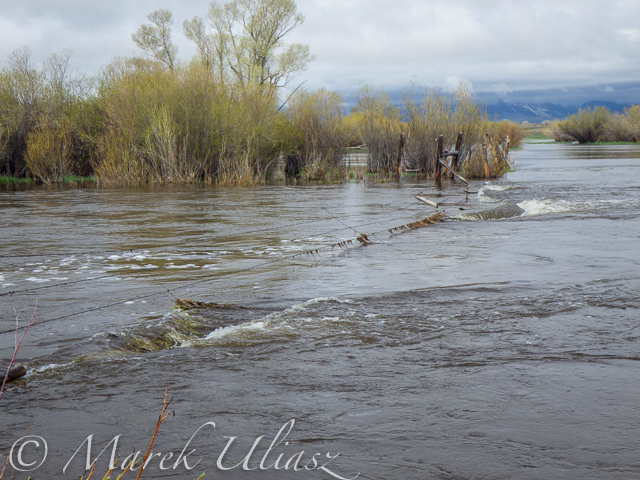
    We had to portage numerous barbed wire fences crossing the river. Some were in water and could be safely run over in a canoe, but we played safe in out inflatable SUPs. A few fences had only a single wire across the river and was possible to paddle under them. Always watch for these fences! You can notice stronger and taller posts on the shores and, sometimes, stairs over them, before seeing the actual wires over the river.

    One or two low farm bridges in the upper section required portaging. All bridges in the lower section have a high clearance.

    Wildlife: moose, bighorn, deer, elk (a herd was swimming across the river several times just in front of us), bald and gold eagles, pelicans, geese and other waterfowl, numerous smaller birds, curious cows.

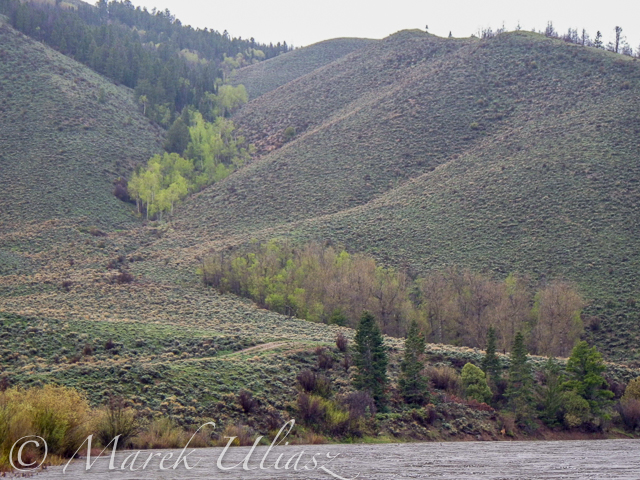
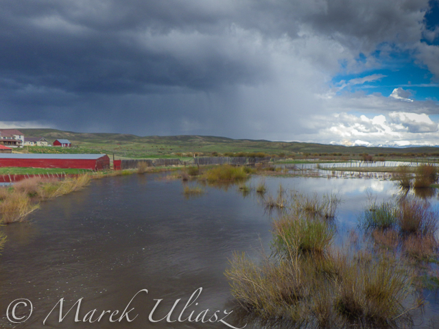
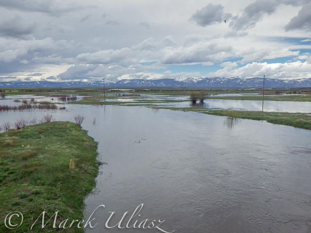
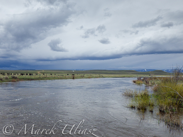
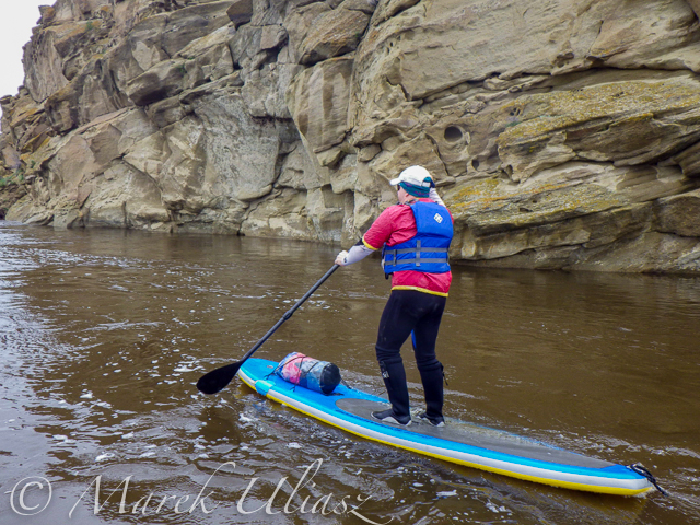
    Scenery: a wide valley surrounded by snowy mountains, crazy river meanders in the upper section, cliffs and rock outcroppings, just a few trees (often with eagle nest), higher hills with some forest in the lower section, a lot of water flowing around and flooding meadows, but, usually, not difficult to find a dry place to land.
    Grizzly Creek near Walden

    Grizzly Creek looking upstream from highway 14
    Grizzly Creek near Walden, CO

    Grizzly Creek looking downstream from highway 14 – start of our adventure
    North Platte River near Walden

    North Platte River meandering near Walden
    North Platte River

    One of high cliffs

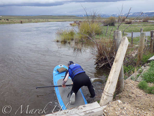
    North Platte River - portage

    Going over a low farm bridge

    North Platte RIver near Walden

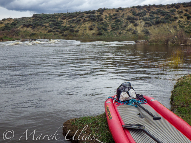
    One of diversion dams

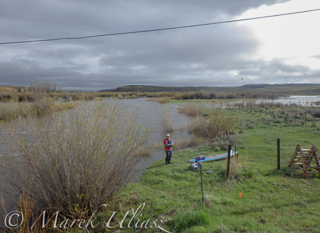
    North Platte River at Co Rd 12 W near Walden

    North Platte River at Co Rd 12 W near Walden – the finish of day 1 and the start of day 2
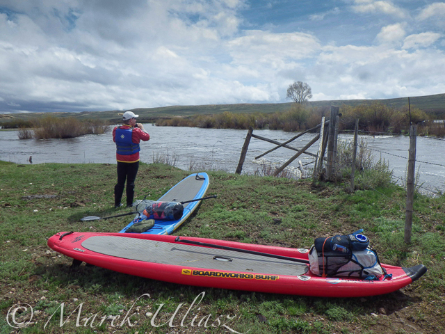
    North Platte River below Walden

    Barbed wire fence across the river

    Another fence across the  river
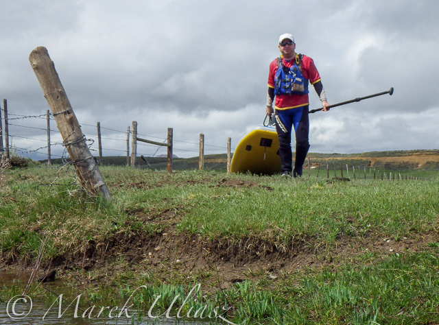
    Another fence across the river

    North Platte River below Walden

    And another cattle fence to portage

    SUPs on North Platte River

    Lunch break – last minutes of nice weather
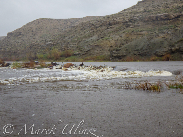
    North Platte River diversion dam

    Hail storm over diversion dam

    North Platte RIver above Northgate

    The last river section between Cowdrey and Northgate

    North Platte River - Northgate Canyon

    Finishing in rain at the Northgate

    North Platte River - Northgate Canyon

    The last look at the river – still raining
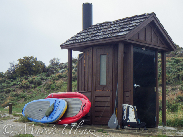
    North Platte River - Northgate Canyon

    Ready to go home …

    All pictures were shot with my current paddling camera on duty – Pentax Optio WG-2. I have been using waterproof Pentax Optio cameras for paddling and other outdoor activities since their first original model was released in 2005. The newest model from that series is available now as Ricoh WG-4.

    Your browser does not support iFrame.

    Related posts:
    – North Platte River in Colorado above Northgate Canyon
    – Sun, Snow and Wind on the North Platte River in Wyoming
    – Bennett Peak to Pick Bridge on the North Platte River, Wyoming

    paddling with a camera

  • Floating Beach: Recreational River Barge Campaign for NYC

    [ By Steph in Architecture & Cities & Urbanism. ]

    Manhattan City Beach 1

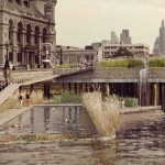
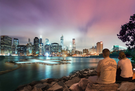
    Manhattan is packed full of world-class restaurants, a vast array of shops, a beautiful nature preserve and virtually everything else required to satisfy the modern urbanite – except for a beach. That might seem obvious; it’s an island built up from swampland, cut off from the sea. But that doesn’t mean beach-craving creative thinkers can’t come up with a way to incorporate one into America’s most densely populated city. City Beach NYC is a project seeking to build a floating beach park on a barge in the Hudson River.

    Manhattan City Beach 2

    Starting with a reclaimed barge, the project would create a two-level destination with shops and restaurants tucked beneath a curving, sand-covered platform overlooking the water. You can’t exactly swim in the Hudson, but the park would have misters for cooling off, as well as a large water feature that mimics the sound of the sea, drowning out the city cacophony.

    Manhattan City Beach 3

    Changing rooms, a surf shop and a marine science lab would also be incorporated into the 260-foot park. The plan is to permanently moor it on the west side of Manhattan, with the possibility of renting small personal watercraft like kayaks and paddle boards.

    Manhattan City Beach 4

    The creators of City Beach NYC are currently raising the first round of funding on Indiegogo to hire a team to develop the operational plan; additional milestones will build scaled 3D models, fund the services of architects and engineers, and gain permits. They’re hoping that the people of Manhattan want a beach badly enough to come together and donate. Sure, you could just cross a bridge and go to Coney Island or Brighton or Rockaway, with access to the actual ocean, but a floating beach with views of the city would certainly be a novelty.

    Share on Facebook


    [ By Steph in Architecture & Cities & Urbanism. ]

    [ WebUrbanist | Archives | Galleries | Privacy | TOS ]


    WebUrbanist

  • LA River Rehab: Dramatic Urban Revitalization Planned

    [ By Steph in Architecture & Cities & Urbanism. ]

    LA River Rehab 1

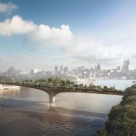
    Currently a concrete wasteland along most of its urban length, the Los Angeles River is set to get a dramatic billion-dollar makeover with the backing of the Army Corps of Engineers. The Corps has revealed support for the most comprehensive plan, which transforms two segments of the river stretching 11 miles in length into green space for humans and natural habitats for wildlife.

    LA River Rehab 3

    Curbed LA has interactive sliding before-and-after images of various parts of the river, showing what they look like now and how much they’ll change after the rehabilitation. Among the planned changes are restoring wetlands that have been lost to urban expansion.

    LA River Rehab 2

    LA River Rehab 7

    The LA River acted as a flood control channel until January 1st of this year, getting a new use as a navigable waterway, meaning the county has to make it accessible to the public. New public events along the river have already begun, like bike-in movie nights.

    LA River Rehab 5

    Aside from the obvious positives for residents of Los Angeles, the $ 1 billion transformation is expected to bring in over $ 5 million over the next 10 to 15 years alone, and generate tens of thousands of jobs.

    Share on Facebook


    [ By Steph in Architecture & Cities & Urbanism. ]

    [ WebUrbanist | Archives | Galleries | Privacy | TOS ]


    WebUrbanist

  • Exploring the Upper North Platte River in Colorado by SUP

    beginning of the North Platte River

    Confluence of two Grizzly Creeks 10 miles SW of Walden, CO – the beginning of the North Platte River

    North Platte River is one of my favorite paddling destinations. Usually, I paddle various flatwater river sections in Wyoming above and below Saratoga. However, there is a 45 mile long river stretch in Colorado’s North Park before the North Platte enters the Northgate Canyon.

    After some fall and winter scouting and a lot of time spent on Google maps, the exploration of the upper North Platte River finally took place during the Memorial Day weekend. Rob Bean joined me to paddle our inflatable Bordwarks SUPs: Shubu and Badfish.

    Upper North Platte River on Google maps with some waypoints for access points and diversion dams.

    North Platte River near Walden, Colorado

    14 miles of the upper North Platte River near Walden with the river beginning
    as a confluence of Grizzly Creek and Little Grizzly Creek

    May 24, 2014
    Put-in: Grizzly Creek at highway 14, 10 miles south of Walden (not much room for off road parking)
    Take-off: Co road 12 W, 8 miles west of Walden (official fishing access, parking near bridge, another fishing access with parking ~0.5 mile below the bridge).
    GPS milege: 13.8 miles, time: 2:50 hours.
    North Platte River in Colorado near Walden

    31 miles of the North Platte River from Walden to the Northgate Canyon put-in

    May 25, 2014
    Put-in: Co road 12 W
    Take-off: put-in for the Northgate Canyon run, 9 miles north of Cowdrey
    Alternative put-in for a short 6 miles run: Co Rd 6, 2 miles west of Cowdrey (that run is described in Paddling Colorado book by Dunbar Hardy).
    GPS milege: 31 miles, time: 6:49 hours.

    River flow was rising from 3000 to 4000 cfs at Northgate during our two days of paddling. A lot of meadows in the river valley were flooded. Paddling speed: up to 9 mph.

    The weather was challenging. We had a lot of thunderstorms around us during the first day followed by ~8 hours of heavy rain. We were lucky to finished our paddling before the rain. A beautiful weather on second day lasted till noon, then we experienced a storm with a small hail followed by heavy rain for the rest of the day. Strong afternoon headwinds put us on our knees, especially, during the second day.

    Obstacles: diversion dams, fences across the river, low bridges depending a water level. No trees. No rapids (except dams). The river is wide and open, so you can see or hear all incoming obstacles well in advance. We never run into any troubles.

    Most of the dams can be seen on satellite pictures. The dam a few miles below Co road 12 W is pretty big and always requires portaging (not comfortable on right). Other dams are primitive rock dams and often can be run. We portaged most of them to avoid big waves, but I would run more of them in a canoe. We managed to paddle around a few of them. It is easier to select a correct river arm on a map than in practice on the river.

    We had to portage numerous barbed wire fences crossing the river. Some were in water and could be safely run over in a canoe, but we played safe in out inflatable SUPs. A few fences had only a single wire across the river and was possible to paddle under them. Always watch for these fences! You can notice stronger and taller posts on the shores and, sometimes, stairs over them, before seeing the actual wires over the river.

    One or two low farm bridges in the upper section required portaging. All bridges in the lower section have a high clearance.

    Wildlife: moose, bighorn, deer, elk (a herd was swimming across the river several times just in front of us), bald and gold eagles, pelicans, geese and other waterfowl, numerous smaller birds, curious cows.

    Scenery: a wide valley surrounded by snowy mountains, crazy river meanders in the upper section, cliffs and rock outcroppings, just a few trees (often with eagle nest), higher hills with some forest in the lower section, a lot of water flowing around and flooding meadows, but, usually, not difficult to find a dry place to land.

    Grizzly Creek near Walden

    Grizzly Creek looking upstream from highway 14

    Grizzly Creek near Walden, CO

    Grizzly Creek looking downstream from highway 14 – start of our adventure

    North Platte River near Walden

    North Platte River meandering near Walden

    North Platte River

    One of high cliffs

    North Platte River - portage

    Going over a low farm bridge

    North Platte RIver near Walden

    One of diversion dams

    North Platte River at Co Rd 12 W near Walden

    North Platte River at Co Rd 12 W near Walden – the finish of day 1 and the start of day 2

    North Platte River below Walden

    Barbed wire fence across the river

    Another fence across the  river

    Another fence across the river

    North Platte River below Walden

    And another cattle fence to portage

    SUPs on North Platte River

    Lunch break – last minutes of nice weather

    North Platte River diversion dam

    Hail storm over diversion dam

    North Platte RIver above Northgate

    The last river section between Cowdrey and Northgate

    North Platte River - Northgate Canyon

    Finishing in rain at the Northgate

    North Platte River - Northgate Canyon

    The last look at the river – still raining

    North Platte River - Northgate Canyon

    Ready to go home …

    All pictures were shot with my current paddling camera on duty – Pentax Optio WG-2. I have been using waterproof Pentax Optio cameras for paddling and other outdoor activities since their first original model was released in 2005. The newest model from that series is available now as Ricoh WG-4.

    Your browser does not support iFrame.

    Related posts:
    – North Platte River in Colorado above Northgate Canyon
    – Sun, Snow and Wind on the North Platte River in Wyoming
    – Bennett Peak to Pick Bridge on the North Platte River, Wyoming


    paddling with a camera

  • Alpacka Yukon Packraft on the Poudre River

    packraft poudre river

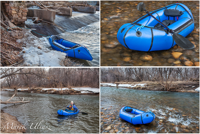
    Packraft on the Poudre River in Fort Collins, Colorado – February 2014

    I had two paddling photo sessions with my Alpacka Yukon packraft on the Poudre River in February. Both times I started at Kingfisher Point Natural Area. There is about half mile of slow water behind the diversion dam there. My cruising speed in a packraft is about 2.5 mph. So, paddling against even a slow current provided a pretty good workout.

    I added pictures of a packraft to my stock photography portfolio.

    Related posts:
    Wintertime Canoe, Packraft and SUP Paddling in northern Colorado
    Wildcat Mound Run – the South Platte River by Bike and Packraft
    Biking and Packrafting – A Selfsupported Classic Run on the South Platte River near Greeley
    Inline Skating and Packrafting – Road and River Test on the South Platte


    paddling with a camera

  • Alpacka Yukon Packraft on the Poudre River

    packraft on Poudre River

    Packraft on the Poudre River in Fort Collins, Colorado – February 2014

    I had two paddling photo sessions with my Alpacka Yukon packraft on the Poudre River in February. Both times I started at Kingfisher Point Natural Area. There is about half mile of slow water behind the diversion dam there. My cruising speed in a packraft is about 2.5 mph. So, paddling against even a slow current provided a pretty good workout.

    Related posts:
    Wintertime Canoe, Packraft and SUP Paddling in northern Colorado
    Wildcat Mound Run – the South Platte River by Bike and Packraft
    Biking and Packrafting – A Selfsupported Classic Run on the South Platte River near Greeley
    Inline Skating and Packrafting – Road and River Test on the South Platte


    paddling with a camera

  • Confluence of Wildlife and Man – A Story from the South Platte River

    I was looking at paintings by Nancy Rynes, a Colorado artist. I like her texture series and, especially, the picture called “Confluence”. Two red hawks sitting on a wall covered by graffiti. For me the confluence means here the coming together of wildlife and man made objects. It reminds me an old story from the South Platte River paddling – encounter of a young eagle sitting on old trashed car.
    I really hated those cars from 1950s and 1960s when I started to paddle the South Platte River years ago. Then, having no choice, I accepted them and started to photograph them. At least they were put into the river for a reason – to protect river banks. It seems that wildlife is accepting them too.

    Car Photography Session on the South Platte River
    South Platte River – Another View or How to Photograph the River?

    Here is my eagle story originally posted in 2007.

    October 15 was my first day on the South Platte River in the fall/winter paddling season of 2007. I paddled upstream from Kersey in the Thunderbolt kayak. After exploring the Lone Tree Creek I paddled back down river to Kersey. It was just before sunset when I decided to shoot some pictures of old cars dumped there to protect river banks.

    I squeezed my kayak into some standing backwater and started shooting. I didn’t notice anything unusual, but I did sense somebody’s presence …


    bald eagle South Platte River

    eaglet bald eagle south platte river kayak Colorado

    Not farther from me than a length of my kayak there was an old truck and a young eagle was sitting on the top of it. I kept shooting my pictures. However, looking at a beak and powerful talons, I didn’t feel very comfortable balancing my tippy kayak in the front of that chick. Judging from the time stamps in my pictures I spent 12 minutes there. During that time the eaglet did not make the slightest movement.

    I wished I had a better camera than my Pentax Optio W10. It was getting dark, so I backed up leaving the eagle on his truck.

    I have seen adult bald eagles many times during my paddling on the South Platte, but it was the closest and most exciting encounter. As a first guess I assumed that I saw a juvenile bald eagle. After searching internet it seems that it is quite difficult to distinguish between immature bald and golden eagles. Some comments I got indicate that it was the golden eagle. So, who is that chick?

    Breeding Bald Eagles in Colorado

    … from the Center for Biological Diversity:

    Bald eagles commonly nested in and around Rocky Mountain National Park as late as the 1950s (117). By 1974, just one pair remained in the state (93). The population remained perilously low through the 1970s and 1980s, began growing in 1986 and reached a peak of approximately 65 pairs in 2006 (2, 69, 93, 96). One-third of Colorado’s nesting bald eagles occur east of the Continental Divide in the South Platte River watershed (115). Other breeding concentrations include the Yampa River upstream of Craig, the White River in the vicinity of Meeker, the Colorado River upstream of Kremmling, and La Plata and Montezuma counties.

    Bald Eagle – Nesting & Young from American Bald Eagle Information.

    Other bird stories and pictures:

    Do Wild Turkey Swim? A Photo Story of White Water Turkey Hen for Thanksgiving
    Are My Paddlings Days Over?
    Blue Heron – Bird Photography from a Racing Kayak with Pentax Optio W10 Camera?
    From the Love Life of Canada Goose in My Paddling Pond: Rivals or Mates?


    paddling with a camera

  • Scouting and Paddling the South Platte River after 2013 Flooding

    I paddled the South Platte River twice this year in the upstream/downstream mode covering just a couple of miles above Kersey on January 21 and above Kuner on February 16.

    The river is the same as before 2013 flooding, wide open, without any unusual obstacles. More changes you can see on shores including river access.

    Evans. Riverside Park, a popular launching place, is closed. I am not sure if it is related to the flooding or just temporary closure due to winter/muddy conditions. No information on their website.

    37th street bridge in Evans (left shore, upstream) may be an alternative launching spot with off road parking. It is just below the Riverside Park. Right now, the place is very muddy with a lot of fresh dirt after the bridge repairs. SWA below the bridge is closed.

    Kersey access remains the same (not too easy for larger groups).

    Kuner access remains the same.

    The river flow is good, above 1000cfs, all the way to Fort Morgan. Most dams below Kuner were upgraded with gates during recent years. They may be paddleable if not diverting water. The dam below Kuner (Empire Reservoir inlet) was closed yesterday.

    Only a little bit of snow was left on sandbars. Turkey were very talkative and loud. I saw a whitetail deer crossing the river – it had to swim across the main channel.

    Sea Wind canoe

    Pixel, the “water” Corgi in Sea Wind canoe

    winter paddling on South Platte River

    South Platte River above Kuner, February 2014

    South Platte River above Kuner

    South Platte River above Kuner, February 2014

    South Platte River above Kuner

    South Platte River above Kuner, February 2014

    Related posts:
    South Platte River below Denver – GPS/photo river guide
    12th Annual South Platte River All Club Paddle
    Opening 2014 Paddling Season on the South Platte River


    paddling with a camera

  • Swim the Thames: Pair of Pools for London’s Polluted River

    [ By WebUrbanist in Architecture & Public & Institutional. ]

    london urban swimming design
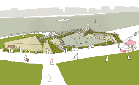
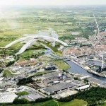
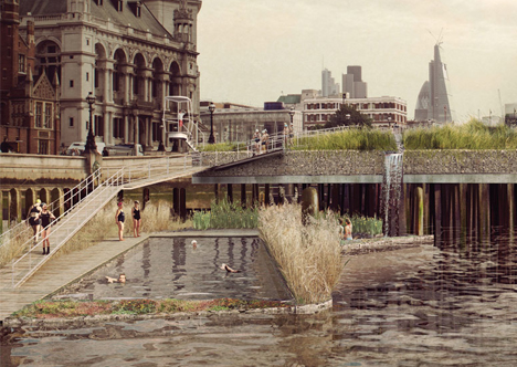
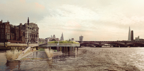
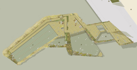
    Inspired by planned Super Sewer that will reduce pollution in London’s central waterway by 96%, this audacious design aims to take advantage of a future in which it is finally safe again to swim in the River Thames. Unlike a similar proposal for New York City’s Hudson River (more on that below), this bold plan proposes to use unfiltered river water to fill its swimming holes.
    london swimming overview image
    london pool site plan

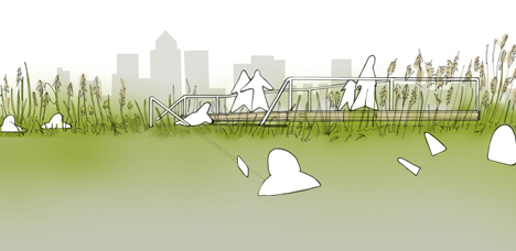
    Studio Octopi and their partners at Civic Engineers and Jonathan Cook Landscape Architects ask doubters to imagine the experience of clean swimming right in the heart of the city, with incredible urban views framed by rich regional plant life.
    london pool structural diagram

    One fixed-in-place pool would be replenished each time the surrounding tides rise over its high water mark (like coastal rock pools). The other would itself lift and lower, floating up and down with the river’s natural highs and lows, thus providing swimmers with a sense of the currents but within a protected space.

    london thames in context

    london pool landscape watercolor

    More on the project’s context: “In 1865, Sir Joseph Bazalgette’s London sewage system was opened. 150 years later the sewers are at the limits of their capacity. In 2012, 57 combined sewer overflows discharged 39 million tonnes of sewage into the River Thames. Thames Water is planning the Thames Tideway Tunnel, or ‘Super Sewer’, for completion in 2023.”

    new york pool rendering

    new york urban swimming

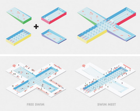
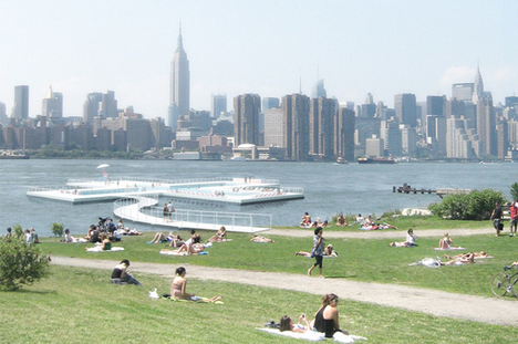
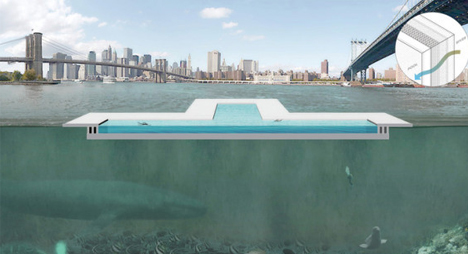
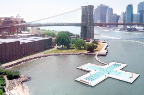
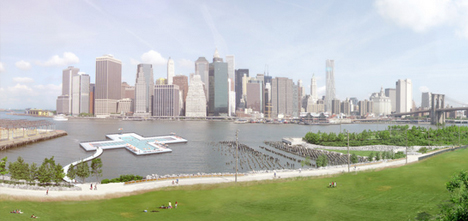
    Meanwhile, across the pond in New York, the Plus Pool reached its crowdfunding goal some time ago but is a long way from completion. Though both propose to use water from the rivers they are set in, this one, unlike its British brethren, assumes filters will be essential.

    new york pool diagram

    new york plus pool

    The design is also somewhat more contemporary – the plus shape is clean, modern and separates the pool into four primary zones for different use cases.

    new york pool section

    new york hudson pool

    Whether either proposal will be realized remains to be seen, but one thing they may have in common: selling the public has already proven easier than pushing their respective cities into accepting the plans and taking action on them.

    Share on Facebook


    [ By WebUrbanist in Architecture & Public & Institutional. ]

    [ WebUrbanist | Archives | Galleries | Privacy | TOS ]


    WebUrbanist

  • Opening 2014 Paddling Season on the South Platte River

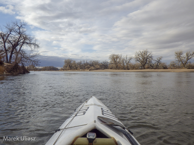
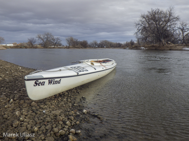
    January 21, 2014. Finally, I started my paddling season for the year 2014. I took the Sea Wind canoe to Kersey and paddled upstream to the confluence with the Poudre River and back. It was my first paddling on the South Platte after last year flooding. There are a lot of signs of that flooding on shores, but the river remains the same – wide open without any new obstacles.

    The river flow was ~950cfs at Kersey. There is a new station near Greeley – PLAGRECO. I don’t know its exact location yet, but it may be pretty useful for planning paddling trips since it shows the river flow not affected by subtraction and addition of water between Greeley and Kersey (2 diversion dams and the Poudre River).

    I will be doing more training runs at different locations on the South Platte during winter time if anybody would like to join me. Most of the time I will paddle the Sea Wind canoe which is my first choice boat for this year Missouri River 340 race. I am hoping also for some downriver SUP runs. You can expect updates to my South Platte River guide.

    south-platte-river-kersey-012114-3

    paddling upstream the South Platte River above Kersey, Colorado

    paddling South Platte River near Kersey, Colorado

    Sea Wind canoe on the South Platte River

    south-platte-river-kersey-012114-2

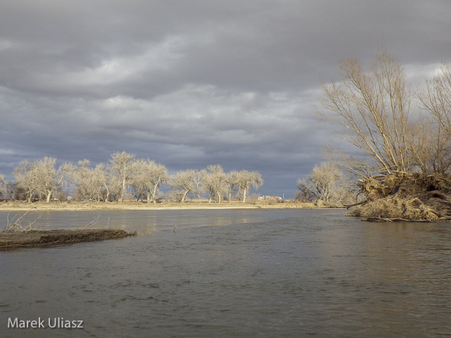
    looking downstream the South Platte River

    south-platte-river-kersey-012114-1

    launching/landing spot on the downstream side of Kersey bridge

    Related posts:
    South Platte River below Denver – GPS/photo river guide
    12th Annual South Platte River All Club Paddle
    Opening 2013 Paddling Season with Badfish SUP on the South Platte River


    paddling with a camera