No location in Canada’s Ocean Playground is more quintessentially Nova Scotian than Peggy’s Cove. It’s all there: a lighthouse, pounding surf on large granite outcroppings and a tranquil working fishing community. And it’s only 50 kilometres from Halifax, the largest city in Atlantic Canada.
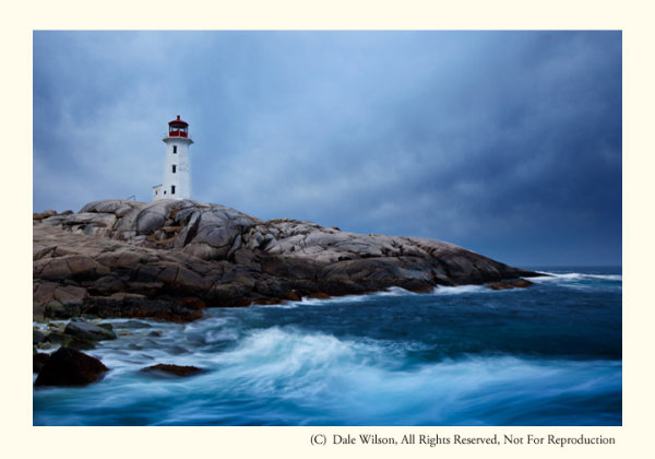
Early spring is a great time to photograph one of the most photographed lighthouses in the world, should you want images without people in the picture
The only land route to Peggy’s Cove is Highway 333, starting at Armdale, and then routes along to coast and eventually joins Highway 103 at Upper Tantallon to the west. You then turn right onto Highway 103 and drive east back to the western reaches of Halifax at Bayers Lake. The coastal drive from Armdale to Peggy’s Cove along Route 333 is by far the most scenic and interesting, offering may little side trips to the not too distant shoreline and coastal communities. You will have no difficulty locating Peggy’s Cove itself: it’s one of the top tourist destinations in all of Canada, so road signage is abundant.
Photographers who desire images of the lighthouse without people milling about will have their patience taxed to the limit. The task will be almost impossible in the peak tourist season of July and August, and just plain difficult at any other time of the year … except maybe the coldest days of winter. I find April is a good time as most of the snow will have melted and it is still too early for people to be thinking about visiting this Atlantic sentinel. Additionally, what little foliage there is will still be brown and this is typically a good month for storm clouds that create interesting and supportive notions of why a lighthouse is there in the first place.
The best approach to photograph the village and the lighthouse is to arrive in early morning and “play tourist,” making pictures as you meander around the harbour. You can easily spend several hours just following your nose, and there is a large restaurant on site for that moment when the light gets too harsh. Make sure to re-visit in the evening –after a noon-day nap, of course—and leave yourself lots of time to find the perfect location to get the classic lighthouse-against-the-sunset photograph. Should you stake out a vantage point on the south side of the lighthouse there is a better chance you will be able to eliminate people from the image with creative camera positioning and sight angles. From a low elevation the camera’s line of sight will be just over the heads of the tourists who sit on the rocks enjoying the last rays of the day. The other classic view is from the water’s edge just to the north of the little cove in front of the lighthouse itself, immediately below the restaurant. Be aware, from here you will almost be guaranteed there will be people in your picture.

By staying to the south of the light, it is possible to keep the camera low and avoid people from creeping into the frame. Challenge yourself to look for creative images as well as portaits of the light.
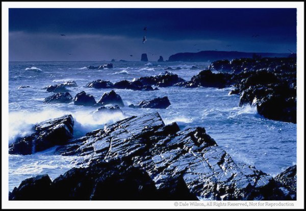
When travelling along the shoreline anywhere in Atlantic Canada, but especially so in Peggy’s Cove, be astutely aware of your surroundings, rogue waves are common and have called unwary visitors to the depths to dwell with King Neptune. So, please, be careful and mindful of the signage; if those rocks are black or wet you are too close to the water’s edge. The Atlantic Ocean is huge and powerful, and its combers deserve, and demand, your respect.
Now get out there and enjoy one of the most photogenic places in all of Nova Scotia, and Canada. You won’t be disappointed.
Post originally from: Digital Photography Tips.
Check out our more Photography Tips at Photography Tips for Beginners, Portrait Photography Tips and Wedding Photography Tips.
Canadian Travelogue – Nova Scotia – Peggy’s Cove

You must be logged in to post a comment.